- Dataset-Verfügbarkeit
- 2018-09-01T00:00:00Z–2018-09-01T00:00:00Z
- Dataset-Produzent
- US Geological Survey
- Tags
Beschreibung
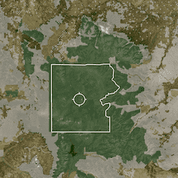
PAD-US ist das offizielle nationale Inventar der USA für terrestrische und marine Schutzgebiete, die der Erhaltung der biologischen Vielfalt und anderen natürlichen, Erholungs- und kulturellen Zwecken dienen und für diese Zwecke durch rechtliche oder andere wirksame Mittel verwaltet werden. Diese Datenbank ist in vier separate Tabellen-Assets unterteilt: designation, easement, fee und proclamation.
Das Asset „Designation“ umfasst Gebiete, die sich voraussichtlich mit gebührenpflichtigen Grundstücken überschneiden, einschließlich Bezeichnungen wie „Wilderness Area“, Pachtverträge, Vereinbarungen und Gebiete, in denen der Schutzmechanismus (Kategorie) „Unknown“ ist.
Die PAD-US-Datenbank soll ein vollständiges Inventar von Gebieten sein, die der Erhaltung der biologischen Vielfalt und anderen natürlichen (einschließlich der Gewinnung), Erholungs- oder kulturellen Zwecken gewidmet sind und für diese Zwecke durch rechtliche oder andere wirksame Mittel verwaltet werden. PAD-US ist eine Zusammenfassung der „besten verfügbaren“ räumlichen Daten, die von Behörden und Organisationen zu einem bestimmten Zeitpunkt bereitgestellt werden. Dazu gehören sowohl das Eigentum an Grundstücken als auch die Verwaltung durch Pachtverträge, Dienstbarkeiten oder andere verbindliche Vereinbarungen. Die Daten enthalten auch Bezeichnungen des Kongresses, der Exekutive und der Verwaltung, die in Managementplänen angegeben sind (z.B. „Area of Environmental Concern“ des Bureau of Land Management). Diese Faktoren sorgen für einen robusten Datensatz, der eine räumliche Darstellung des komplexen Netzwerks der US-amerikanischen Schutzgebiete bietet. Es ist wichtig, eine bestimmte Analysefrage im Hinterkopf zu haben, wenn Sie sich überlegen, wie Sie mit den Daten arbeiten. PAD-US ist ein vollständiges Inventar von Gebieten, die aus autoritativen Quelldaten zusammengefasst wurden. Es enthält sich überschneidende Bezeichnungstypen und kleine Grenzabweichungen zwischen den Datasets der Behörden. Überlappende Bezeichnungen treten hauptsächlich in den Feature-Klassen „Designation“ (Bezeichnung) oder „Combined“ (Kombiniert) auf (z.B. „Wilderness Area“ (Wildnisgebiet) über „Wild and Scenic River“ (Wildfluss) und „National Forest“ (Nationalwald)).
Es ist wichtig, auf Überschneidungen zu achten, insbesondere wenn Sie versuchen, Flächenstatistiken zu berechnen. Bei sich überschneidenden Grenzen wird dieselbe Fläche mehrmals gezählt. Es gibt zwar weiterhin geringfügige Abweichungen bei den Grenzen, die meisten größeren Überschneidungen wurden jedoch aus dem Asset „Gebühr“ entfernt. Dies ist die beste Quelle für die Berechnung der Gesamtfläche des Landes nach Landmanager („Manager Name“) in der PAD-US-Datenbank. Datenlücken schränken die Berechnungen nach Gebührenbesitz oder „Owner Name“ ein. Statistiken, in denen der „Public Access“- oder Schutzstatus („GAP Status Code“) nach Verwaltungsbehörde oder Organisation aus einer Analyse der PAD-US 1.4-Klasse „Combined“ zusammengefasst werden, sind verfügbar und werden mit PAD-US 2.0 aktualisiert. Da die PAD-US-Datenbank eine direkte Aggregation von Quelldaten ist, ändert das PAD-US-Entwicklungsteam die räumlichen Linien nicht. Die Ausnahme besteht darin, Grundstücksdaten entlang von Bundesstaatsgrenzen zu „beschneiden“ (mit der von der US-Volkszählungsbehörde bereitgestellten autoritativen Datei für Bundesstaatsgrenzen) und die durch diesen Prozess erstellten kleinen Grenzsegmente zu entfernen, die mit staatlichen oder lokalen Grundstücken (nicht mit Bundes- oder Nonprofit-Grundstücken) verbunden sind. Im Dataset sind weiterhin einige Grenzabweichungen (oder Splitter) vorhanden. Datenüberschneidungen wurden identifiziert und werden zusammen mit der Datei für die Gerichtsbarkeitsgrenzen der US-Volkszählungsbehörde an die Datenverantwortlichen der Behörde weitergegeben, um Änderungen in Quelldateien zu ermöglichen, die dann im Laufe der Zeit in nachfolgende PAD-US-Versionen aufgenommen werden. Die PAD-US-Datenbank wird in Zusammenarbeit mit vielen Partnern und Datenverantwortlichen erstellt. Informationen zu Data Stewards
Tabellenschema
Tabellenschema
| Name | Typ | Beschreibung |
|---|---|---|
| Agg_Src | STRING | Quelle des Datenaggregators. |
| Kategorie | STRING | Die Art des Schutzes: Bezeichnung, Dienstbarkeit, Gebühr, Meer, Sonstiges, Proklamation oder unbekannt. |
| Kommentare | STRING | Zusätzliche Kommentare. |
| Date_Est | STRING | Jahr, in dem das Schutzgebiet eingerichtet wurde. |
| Des_Tp | STRING | Die detaillierte Art der Bezeichnung, z.B. „Gebiet von kritischer Umweltbedeutung“, „Stadtpark“, „Nationalpark“, „Wildnisgebiet“ usw. |
| EsmtHldr | STRING | Die Organisation, die die Dienstbarkeit besitzt. |
| EHoldTyp | STRING | Der Typ des Dienstbarkeitsinhabers. |
| FeatClass | DOUBLE | Eindeutige ID |
| GAP_Sts | STRING | Das Schutzniveau oder der „Status“:
|
| GAPCdDt | STRING | Datum, an dem der Statuscode ermittelt wurde. |
| GAPCdSrc | STRING | Quelle des Statuscodes. |
| GIS_Acres | DOUBLE | Anzahl der Hektar des berechneten Schutzgebiets. |
| GIS_Src | STRING | Die Quelle der GIS-Daten. |
| Src_Date | STRING | Das Datum, das die GIS-Daten darstellen. |
| IUCN_Cat | STRING | Schutzniveau gemäß IUCN-Schutzstatus:
|
| IUCNCtDt | STRING | Datum der IUCN-Kategorie. |
| IUCNCtSrc | STRING | Quelle des IUCN-Schutzstatus. |
| Loc_Ds | STRING | Bezeichnung des Schutzgebiets auf lokaler Ebene. |
| Loc_Mang | STRING | Der Leiter des Schutzgebiets. |
| Loc_Nm | STRING | Der Name des Schutzgebiets. |
| Loc_Own | STRING | Der Inhaber des Schutzgebiets. |
| Mang_Name | STRING | Der Name der verwaltenden Organisation. |
| Mang_Type | STRING | Der Verwaltungskontotyp. |
| Own_Name | STRING | Der Name des Eigentümers des Schutzgebiets. |
| Own_Type | STRING | Der Typ der Inhaberorganisation. |
| Zugriff | STRING | Zugänglichkeit des Schutzgebiets. |
| Access_Dt | STRING | Das Datum des Zugriffs. |
| Access_Src | STRING | Die Quelle der Zugriffsdaten. |
| ID | STRING | Die ID des Schutzgebiets. |
| State_Nm | STRING | Namen von Bundesstaaten in Abkürzungen mit zwei Buchstaben |
| Unit_Nm | STRING | Name der Einheiten |
| WDPA_Cd | STRING | Der mit dem WDPA-Dataset verknüpfte Standortcode. |
Nutzungsbedingungen
Nutzungsbedingungen
Die Digital Object Identifier doi:10.5066/P955KPLE für PAD-US 2.0 ist die dauerhafte Referenz, die zum Abrufen der Daten verwendet werden sollte. Das U.S. Geological Survey und alle beitragenden Datenpartner haften nicht für eine unsachgemäße oder falsche Verwendung der hier beschriebenen und/oder enthaltenen Daten. Alle Informationen werden für einen bestimmten Zweck erstellt. Dies gilt insbesondere für GIS-Daten, deren Erstellung kostspielig ist und die auf die unmittelbaren Programmanforderungen ausgerichtet sein müssen. Diese Daten wurden in der Erwartung erstellt, dass sie für andere Anwendungen verwendet werden. Im Folgenden sind jedoch unangemessene Verwendungszwecke aufgeführt. Diese Liste ist keineswegs vollständig, soll aber als Leitfaden dienen, um zu beurteilen, ob eine vorgeschlagene Verwendung durch diese Daten unterstützt werden kann oder nicht. Für viele Anwendungen ist es unwahrscheinlich, dass PAD-US die einzigen erforderlichen Daten liefert. Für Anwendungen mit behördlichen Auswirkungen sollten die Ergebnisse durch Daten von zuständigen Behörden und Feldstudien überprüft werden. PAD-US wird Nutzern empfohlen, die grundlegende Informationen zu den Grundstücken mehrerer Behörden oder Organisationen suchen. Nutzer sollten sich direkt an die maßgeblichen Quelldaten wenden, um Fragen zu einer Behörde zu beantworten oder Fragen zu beantworten, die häufigere Aktualisierungen erfordern. Letztendlich liegt es in der Verantwortung jedes Datennutzers, zu entscheiden, ob diese Daten die gestellte Frage beantworten können. Die folgenden Verwendungszwecke sind nicht angemessen: Verwendung von PAD-US für Anwendungen oder Analysen, die mit einer Behörde oder einer bestimmten Einheit in Verbindung stehen (Behörden sind immer die beste und maßgebliche Quelle für ihre Daten zu Grundstücken und viele veröffentlichen Updates häufiger als PAD-US). Verwendung von Daten zur Kartierung kleiner Gebiete (weniger als Tausende von Hektar), die in der Regel eine Kartierungsauflösung im Maßstab 1:24.000 erfordern (da die Grenzqualität je nach Datenquelle variiert), und Verwendung von Luftbildern oder Bodenuntersuchungen in Gebieten, in denen Daten unvollständig sind. Kombination dieser Daten mit anderen Daten, die einen Maßstab von mehr als 1:100.000 haben, um neue Hybridkarten zu erstellen oder Anfragen zu beantworten. Generieren bestimmter Flächenmessungen aus den Daten, die genauer als die nächstgelegenen tausend Hektar sind. Darstellung von Grenzen als rechtliche Darstellung für die Regulierung oder den Erwerb. Das genaue Vorhandensein oder Nichtvorhandensein eines bestimmten Features für ein genaues geografisches Gebiet feststellen. Bestimmung der Häufigkeit, des Gesundheitszustands oder des Zustands eines Merkmals. Die Daten werden verwendet, ohne die Metadaten abzurufen und zu prüfen.
Zitationen
U.S. Geological Survey (USGS) Gap Analysis Project (GAP), 2018, Protected Areas Database of the United States (PAD-US): U.S. Geological Survey data release, doi:10.5066/P955KPLE.
DOIs
Die Earth Engine nutzen
Code-Editor (JavaScript)
var dataset = ee.FeatureCollection('USGS/GAP/PAD-US/v20/designation');

// Encode 'GAP_Sts' (protection level) as a number for visualization.
dataset = dataset.map(function(feature) {
  return feature.set('status', ee.Number.parse(feature.get('GAP_Sts')));
});

// Paint new 'status' value to an image for visualization.
var datasetVis = ee.Image().byte().paint(dataset, 'status');

var visualization = {
  min: 1,
  max: 4,
  palette: ['b1a44e', '4eb173', '4e5bb1', 'b14e8c']
};

Map.setCenter(-93.952, 35.400, 8);
Map.addLayer(datasetVis, visualization, 'Protection status');
Map.addLayer(dataset, null, 'FeatureCollection', false);
Als FeatureView visualisieren
Ein FeatureView ist eine beschleunigte Darstellung eines FeatureCollection, die nur angezeigt werden kann. Weitere Informationen finden Sie in der
Dokumentation zu FeatureView.
Code-Editor (JavaScript)
var fvLayer = ui.Map.FeatureViewLayer(
  'USGS/GAP/PAD-US/v20/designation_FeatureView');

var visParams = {
  opacity: 1,
  color: {
    property: 'GAP_Sts',
    categories: [
      ['1', 'b1a44e'],
      ['2', '4eb173'],
      ['3', '4e5bb1'],
      ['4', 'b14e8c']
    ]
  }
};

fvLayer.setVisParams(visParams);
fvLayer.setName('Protection status');

Map.setCenter(-93.952, 35.400, 8);
Map.add(fvLayer);