- 数据集可用时间
- 2009-08-16T00:00:00Z–2017-03-12T00:00:00Z
- 数据集生产者
- 明尼苏达大学极地地理空间中心 Google Earth Engine
- 标签
说明
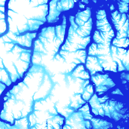
ArcticDEM 是一种数字表面模型 (DSM),可显示首次返回的高程值,其中包括植被、树冠、建筑物和其他人造地表特征。由于条带之间的投影差异,2m 资产是一组条带,而不是单个镶嵌。
条带 DEM 文件对应于输入立体像对条带的重叠区域,这些条带由 DigitalGlobe 的极地轨道卫星星座收集。DEM 条带尺寸会因获取影像的卫星传感器和收集的离轴角度而异。大多数条带的宽度介于 16 公里和 18 公里之间,长度介于 110 公里和 120 公里之间。
频段
像素大小
2 米
波段
| 名称 | 单位 | 像元大小 | 说明 | ||||||||||||||||||||||||||||||||||||||||||||||||||||||||||||||||||||||||||||||||||||||||||||||||
|---|---|---|---|---|---|---|---|---|---|---|---|---|---|---|---|---|---|---|---|---|---|---|---|---|---|---|---|---|---|---|---|---|---|---|---|---|---|---|---|---|---|---|---|---|---|---|---|---|---|---|---|---|---|---|---|---|---|---|---|---|---|---|---|---|---|---|---|---|---|---|---|---|---|---|---|---|---|---|---|---|---|---|---|---|---|---|---|---|---|---|---|---|---|---|---|---|---|---|---|
elevation |
米 | 米 | 海拔 |
||||||||||||||||||||||||||||||||||||||||||||||||||||||||||||||||||||||||||||||||||||||||||||||||
matchtag |
米 | 指示 DEM 像素处理的位掩码光栅 |
|||||||||||||||||||||||||||||||||||||||||||||||||||||||||||||||||||||||||||||||||||||||||||||||||
使用条款
使用条款
美国国家科学基金会(PGC 的主要资金来源)的政策要求研究人员在所有出版物、网页和媒体采访中注明 NSF 的支持。
在 Earth Engine 中使用 PGC 数据即表示用户同意引用 PGC 及其 NSF 赞助。PGC 提供的任何第三方数据的原始来源也必须正确注明。
如需了解详情,请参阅 PGC 的确认政策。
引用
引用:
由 Polar Geospatial Center 基于 DigitalGlobe, Inc. 影像创建的 DEM。
通过 Earth Engine 探索
代码编辑器 (JavaScript)
var dataset = ee.ImageCollection('UMN/PGC/ArcticDEM/V2/2m');
var elevation = dataset.select('elevation');
var elevationVis = {
  min: -50.0,
  max: 1000.0,
  palette: ['0d13d8', '60e1ff', 'ffffff'],
};
Map.setCenter(-63.402, 66.368, 7);
Map.addLayer(elevation, elevationVis, 'Elevation');