Page Summary
-
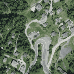
The SWISSIMAGE 10 cm orthophoto mosaic provides digital aerial images of Switzerland with a ground resolution of 10 cm in plains and main alpine valleys, and 25 cm in the Alps.
-
This dataset is updated annually and available from 2017-01-01 to 2021-01-01.
-
The imagery contains three bands: Red, Green, and Blue.
-
The geodata and geoservices can be used, distributed, enriched, processed, and used commercially with mandatory source citation.
-
The dataset is available on Google Earth Engine for scientific analysis and visualization.
- Dataset Availability
- 2017-01-01T00:00:00Z–2021-01-01T00:00:00Z
- Dataset Producer
- Topography swisstopo
- Tags
Description
The SWISSIMAGE 10 cm orthophoto mosaic is an assembly of new color digital aerial images over the whole of Switzerland with a ground resolution of 10 cm in the plains and the main alpine valleys and 25 cm in the Alps. It is updated annually.
For more information, please see the SWISSIMAGE10cm_FR documentation
This RGB collection contains digital aerial images with three bands. Standard deviation for the precision in position: +/- 0.15 m for the ground sample distance of 0.1 m.
Bands
Bands
Pixel size: 0.1 meters (all bands)
| Name | Min | Max | Pixel Size | Wavelength | Description |
|---|---|---|---|---|---|
R |
0 | 255 | 0.1 meters | 619-651nm | Red |
G |
0 | 255 | 0.1 meters | 525-585nm | Green |
B |
0 | 255 | 0.1 meters | 435-495nm | Blue |
Terms of Use
Terms of Use
The free geodata and geoservices of swisstopo may be used, distributed and made accessible. Furthermore, they may be enriched and processed and also used commercially.
A reference to the source is mandatory. please see the Terms of use
Citations
Copyright Federal Office of Topography swisstopo
Explore with Earth Engine
Code Editor (JavaScript)
var dataset = ee.Image('Switzerland/SWISSIMAGE/orthos/10cm/2017');

Map.setCenter(7.75, 46.02, 18);
Map.addLayer(dataset, null, 'Switzerland RGB (10 cm)');