Page Summary
-
This dataset provides monthly precipitation data in millimeters at a 1 km resolution.
-
The data is based on a combination of SM2RAIN-ASCAT, IMERG, CHELSA Climate, and WorldClim datasets, with SM2RAIN-ASCAT given a higher weight.
-
The dataset covers the period from 2007 to 2019, excluding Antarctica.
-
The data is available for use under the Creative Commons Attribution-ShareAlike 4.0 International License.
- Dataset Availability
- 2007-01-01T00:00:00Z–2019-01-01T00:00:00Z
- Dataset Producer
- EnvirometriX Ltd
- Tags
Description
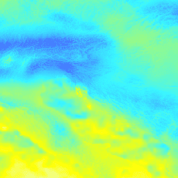
Monthly precipitation in mm at 1 km resolution based on SM2RAIN-ASCAT 2007-2018, IMERG, CHELSA Climate, and WorldClim.
Downscaled to 1 km resolution using gdalwarp (cubic splines) and an average between WorldClim, CHELSA Climate, and IMERG monthly product (see, e.g, "3B-MO-L.GIS.IMERG.20180601.V05B.tif"). 3x higher weight is given to the SM2RAIN-ASCAT data since it assumed to be more accurate. Processing steps are available here. Antarctica is not included.
To access and visualize maps outside of Earth Engine, use this page.
If you discover a bug, artifact or inconsistency in the LandGIS maps or if you have a question please use the following channels:
Bands
Bands
Pixel size: 1000 meters (all bands)
| Name | Units | Min | Max | Pixel Size | Description |
|---|---|---|---|---|---|
jan |
mm | 0* | 380* | 1000 meters | Jan Precipitation monthly |
feb |
mm | 0* | 380* | 1000 meters | Feb Precipitation monthly |
mar |
mm | 0* | 380* | 1000 meters | Mar Precipitation monthly |
apr |
mm | 0* | 380* | 1000 meters | Apr Precipitation monthly |
may |
mm | 0* | 380* | 1000 meters | May Precipitation monthly |
jun |
mm | 0* | 380* | 1000 meters | Jun Precipitation monthly |
jul |
mm | 0* | 380* | 1000 meters | Jul Precipitation monthly |
aug |
mm | 0* | 380* | 1000 meters | Aug Precipitation monthly |
sep |
mm | 0* | 380* | 1000 meters | Sep Precipitation monthly |
oct |
mm | 0* | 380* | 1000 meters | Oct Precipitation monthly |
nov |
mm | 0* | 380* | 1000 meters | Nov Precipitation monthly |
dec |
mm | 0* | 380* | 1000 meters | Dec Precipitation monthly |
Terms of Use
Terms of Use
This is a human-readable summary of (and not a substitute for) the license.
You are free to - Share - copy and redistribute the material in any medium or format Adapt - remix, transform, and build upon the material for any purpose, even commercially.
This license is acceptable for Free Cultural Works. The licensor cannot revoke these freedoms as long as you follow the license terms.
Under the following terms - Attribution - You must give appropriate credit, provide a link to the license, and indicate if changes were made. You may do so in any reasonable manner, but not in any way that suggests the licensor endorses you or your use.
ShareAlike - If you remix, transform, or build upon the material, you must distribute your contributions under the same license as the original.
No additional restrictions - You may not apply legal terms or technological measures that legally restrict others from doing anything the license permits.
Citations
Monthly precipitation in mm at 1 km resolution based on SM2RAIN-ASCAT 2007-2018 and IMERG 2014-2018 10.5281/zenodo.1435912
DOIs
Explore with Earth Engine
Code Editor (JavaScript)
var dataset = ee.Image('OpenLandMap/CLM/CLM_PRECIPITATION_SM2RAIN_M/v01');

var visualization = {
  bands: ['jan'],
  min: 0.0,
  max: 380.0,
  palette: ['ecffbd', 'ffff00', '3af6ff', '467aff', '313eff', '0008ff']
};

Map.centerObject(dataset);

Map.addLayer(dataset, visualization, 'Precipitation monthly in mm');