
- Dataset Availability
- 2023-02-10T00:00:00Z–2026-10-24T00:00:00Z
- Dataset Producer
- NASA LP DAAC at the USGS EROS Center
- Cadence
- 8 Days
- Tags
Description
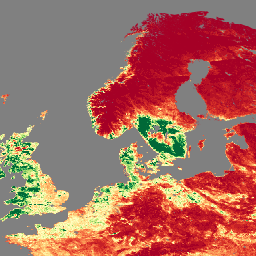
The Visible Infrared Imaging Radiometer Suite (VIIRS) Leaf Area Index (LAI) and Fraction of Photosynthetically Active Radiation (FPAR) Version 2 data product provides information about the vegetative canopy layer at 500 meter resolution (VJ215A2H). The VIIRS sensor is located onboard the NOAA-21 satellite. LAI is an index that quantifies the one-sided leaf area of a canopy, while FPAR is the fraction of incoming solar energy absorbed through photosynthesis at 400 to 700 nanometers. This product is intentionally designed after the Terra and Aqua Moderate Resolution Imaging Spectroradiometer (MODIS) LAI/FPAR operational algorithm to promote the continuity of the Earth Observation System (EOS) mission.
Documentation:
Bands
Bands
Pixel size: 500 meters (all bands)
| Name | Units | Pixel Size | Description | ||||||||||||||||||||||||||||||||||||||||||||||||||||||||||||||||||||||||||||||||||||||||||||||||
|---|---|---|---|---|---|---|---|---|---|---|---|---|---|---|---|---|---|---|---|---|---|---|---|---|---|---|---|---|---|---|---|---|---|---|---|---|---|---|---|---|---|---|---|---|---|---|---|---|---|---|---|---|---|---|---|---|---|---|---|---|---|---|---|---|---|---|---|---|---|---|---|---|---|---|---|---|---|---|---|---|---|---|---|---|---|---|---|---|---|---|---|---|---|---|---|---|---|---|---|
Fpar |
500 meters | Fraction of Photosynthetically Active Radiation. |
|||||||||||||||||||||||||||||||||||||||||||||||||||||||||||||||||||||||||||||||||||||||||||||||||
FparExtra_QC |
500 meters | Pass-through Quality Control (QC) for FPAR |
|||||||||||||||||||||||||||||||||||||||||||||||||||||||||||||||||||||||||||||||||||||||||||||||||
FparLai_QC |
500 meters | Quality for LAI and FPAR |
|||||||||||||||||||||||||||||||||||||||||||||||||||||||||||||||||||||||||||||||||||||||||||||||||
FparStdDev |
500 meters | Standard deviation of FPAR |
|||||||||||||||||||||||||||||||||||||||||||||||||||||||||||||||||||||||||||||||||||||||||||||||||
Lai |
Area fraction | 500 meters | Leaf Area Index |
||||||||||||||||||||||||||||||||||||||||||||||||||||||||||||||||||||||||||||||||||||||||||||||||
LaiStdDev |
Area fraction | 500 meters | Standard deviation for LAI |
||||||||||||||||||||||||||||||||||||||||||||||||||||||||||||||||||||||||||||||||||||||||||||||||
Image Properties
Image Properties
| Name | Type | Description |
|---|---|---|
| num_tiles | INT | The number of source tiles that were mosaicked to create this image. |
Terms of Use
Terms of Use
LP DAAC NASA data are freely accessible; however, when an author publishes these data or works based on the data, it is requested that the author cite the datasets within the text of the publication and include a reference to them in the reference list.
Citations
Please visit LP DAAC 'Citing Our Data' page for information on citing LP DAAC datasets.
DOIs
Explore with Earth Engine
Code Editor (JavaScript)
var dataset = ee.ImageCollection('NASA/VIIRS/002/VJ215A2H')
                  .filter(ee.Filter.date('2023-11-01', '2023-12-01'));

var visualization = {
  bands: ['Lai'],
  min: [0],
  max: [4],
  palette: [
    'a50026',
    'd73027',
    'f46d43',
    'fdae61',
    'fee08b',
    'ffffbf',
    'd9ef8b',
    'a6d96a',
    '66bd63',
    '1a9850',
    '006837',
  ]
};
Map.setCenter(41.2, 38.84, 3);
Map.addLayer(dataset, visualization, 'Leaf Area Index (LAI)');