
- Dataset Availability
- 2023-02-10T00:00:00Z–2026-10-16T00:00:00Z
- Dataset Producer
- NASA LP DAAC at the USGS EROS Center
- Cadence
- 8 Days
- Tags
Description
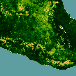
The Joint Polar Satellite System (JPSS-2) / NOAA-21 NASA Visible Infrared Imaging Radiometer Suite (VIIRS) Vegetation Indices (VJ213A1) Version 2 data product provides vegetation indices by a process of selecting the best available pixel over a 16-day acquisition period at 500 meter resolution. The VJ213 data products are designed after the Moderate Resolution Imaging Spectroradiometer (MODIS) Terra and Aqua Vegetation Indices product suite to promote the continuity of the Earth Observation System (EOS) mission.
The VJ213 algorithm process produces three vegetation indices:
- Normalized Difference Vegetation Index (NDVI): One of the longest continual remotely-sensed time series observations, using both the red and near-infrared (NIR) bands.
- Enhanced Vegetation Index (EVI): A slightly different vegetation index that is more sensitive to canopy cover, while NDVI is more sensitive to chlorophyll.
- Enhanced Vegetation Index-2 (EVI2): A reformation of the standard 3-band EVI, using the red band and NIR band. This reformation addresses arising issues when comparing VIIRS EVI to other EVI models that do not include a blue band. EVI2 will eventually become the standard EVI.
Along with the three Vegetation Indices layers, this product also includes layers for near-infrared (NIR) reflectance; three shortwave infrared (SWIR) reflectance; red, blue, and green reflectance; composite day of year; pixel reliability; relative azimuth, view, and sun angles; and a quality layer.
The band scale factors are already applied.
For additional information, visit the VIIRS Land Product Quality Assessment website.
Documentation:
Bands
Bands
Pixel size: 500 meters (all bands)
| Name | Units | Min | Max | Pixel Size | Wavelength | Description | |||||||||||||||||||||||||||||||||||||||||||||||||||||||||||||||||||||||||||||||||||||||||||||
|---|---|---|---|---|---|---|---|---|---|---|---|---|---|---|---|---|---|---|---|---|---|---|---|---|---|---|---|---|---|---|---|---|---|---|---|---|---|---|---|---|---|---|---|---|---|---|---|---|---|---|---|---|---|---|---|---|---|---|---|---|---|---|---|---|---|---|---|---|---|---|---|---|---|---|---|---|---|---|---|---|---|---|---|---|---|---|---|---|---|---|---|---|---|---|---|---|---|---|---|
EVI |
-1 | 1 | 500 meters | None | 3 band Enhanced Vegetation Index |
||||||||||||||||||||||||||||||||||||||||||||||||||||||||||||||||||||||||||||||||||||||||||||||
EVI2 |
-1 | 1 | 500 meters | None | 2 band Enhanced Vegetation Index |
||||||||||||||||||||||||||||||||||||||||||||||||||||||||||||||||||||||||||||||||||||||||||||||
NDVI |
-1 | 1 | 500 meters | None | Normalized Difference Vegetation Index |
||||||||||||||||||||||||||||||||||||||||||||||||||||||||||||||||||||||||||||||||||||||||||||||
NIR_reflectance |
0 | 1 | 500 meters | 846-885nm | Near-infrared Radiation reflectance |
||||||||||||||||||||||||||||||||||||||||||||||||||||||||||||||||||||||||||||||||||||||||||||||
SWIR1_reflectance |
0 | 1 | 500 meters | 1230-1250nm | Shortwave Infrared Radiation reflectance |
||||||||||||||||||||||||||||||||||||||||||||||||||||||||||||||||||||||||||||||||||||||||||||||
SWIR2_reflectance |
0 | 1 | 500 meters | 1580-1640nm | Shortwave Infrared Radiation reflectance |
||||||||||||||||||||||||||||||||||||||||||||||||||||||||||||||||||||||||||||||||||||||||||||||
SWIR3_reflectance |
0 | 1 | 500 meters | 2225-2275nm | Shortwave Infrared Radiation reflectance |
||||||||||||||||||||||||||||||||||||||||||||||||||||||||||||||||||||||||||||||||||||||||||||||
VI_Quality |
500 meters | None | Quality Assessment (QA) bit-field |
||||||||||||||||||||||||||||||||||||||||||||||||||||||||||||||||||||||||||||||||||||||||||||||||
red_reflectance |
0 | 1 | 500 meters | 600-680nm | Red band reflectance |
||||||||||||||||||||||||||||||||||||||||||||||||||||||||||||||||||||||||||||||||||||||||||||||
green_reflectance |
0 | 1 | 500 meters | 545-565nm | Green band reflectance |
||||||||||||||||||||||||||||||||||||||||||||||||||||||||||||||||||||||||||||||||||||||||||||||
blue_reflectance |
0 | 1 | 500 meters | 478-498nm | Blue band reflectance |
||||||||||||||||||||||||||||||||||||||||||||||||||||||||||||||||||||||||||||||||||||||||||||||
composite_day_of_the_year |
d | 1 | 366 | 500 meters | None | Julian day of year |
|||||||||||||||||||||||||||||||||||||||||||||||||||||||||||||||||||||||||||||||||||||||||||||
pixel_reliability |
500 meters | None | Pixel usefulness using a simple rank class |
||||||||||||||||||||||||||||||||||||||||||||||||||||||||||||||||||||||||||||||||||||||||||||||||
relative_azimuth_angle |
deg | -180 | 180 | 500 meters | None | Relative azimuth angle for each pixel |
|||||||||||||||||||||||||||||||||||||||||||||||||||||||||||||||||||||||||||||||||||||||||||||
sun_zenith_angle |
deg | 0 | 180 | 500 meters | None | Sun zenith angle for each pixel |
|||||||||||||||||||||||||||||||||||||||||||||||||||||||||||||||||||||||||||||||||||||||||||||
view_zenith_angle |
deg | 0 | 180 | 500 meters | None | View zenith angle for each pixel |
|||||||||||||||||||||||||||||||||||||||||||||||||||||||||||||||||||||||||||||||||||||||||||||
pixel_reliability Class Table
| Value | Color | Description |
|---|---|---|
| 0 | None | Excellent |
| 1 | None | Good |
| 2 | None | Acceptable |
| 3 | None | Marginal |
| 4 | None | Pass |
| 5 | None | Questionable |
| 6 | None | Poor |
| 7 | None | Cloud Shadow |
| 8 | None | Snow/Ice |
| 9 | None | Cloud |
| 10 | None | Estimated |
| 11 | None | LTAVG (taken from database) |
Image Properties
Image Properties
| Name | Type | Description |
|---|---|---|
| num_tiles | INT | The number of source tiles that were mosaicked to create this image. |
Terms of Use
Terms of Use
LP DAAC NASA data are freely accessible; however, when an author publishes these data or works based on the data, it is requested that the author cite the datasets within the text of the publication and include a reference to them in the reference list.
Citations
Vermote, E. (2023). VIIRS/JPSS2 Vegetation Indices 16-Day L3 Global 500m SIN Grid V002 [Data set]. NASA EOSDIS Land Processes Distributed Active Archive Center. doi:10.5067/VIIRS/VJ213A1.002
DOIs
Explore with Earth Engine
Code Editor (JavaScript)
var dataset = ee.ImageCollection('NASA/VIIRS/002/VJ213A1')
                  .filter(ee.Filter.date('2026-10-08', '2026-10-16'));

var trueColorVis = {
  bands: ['red_reflectance', 'green_reflectance', 'blue_reflectance'],
  min: 0.0,
  max: 0.3,
  gamma: 1.4,
};

var ndviVis = {
  min: 0.0,
  max: 0.9,
  palette: [
    'FFFFFF', 'CE7E45', 'DF923D', 'F1B555', 'FCD163', '99B718', '74A901',
    '66A000', '529400', '3E8601', '207401', '056201', '004C00', '023B01',
    '012E01', '011D01', '011301',
  ],
};

Map.setCenter(-98.0, 17.6, 6);
Map.addLayer(dataset, trueColorVis, 'True Color (RGB)');
Map.addLayer(dataset.select('NDVI'), ndviVis, 'NDVI');