Page Summary
-
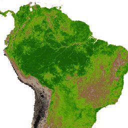
This dataset contains MODIS Normalized Difference Vegetation Index (NDVI) and Enhanced Vegetation Index (EVI) products computed from atmospherically corrected bi-directional surface reflectances.
-
The dataset includes layers such as NDVI, EVI, various surface reflectances, view and solar zenith angles, relative azimuth angle, day of year, and quality assurance information.
-
The data was available from 2002-07-04 to 2017-03-14 and has a 16-day cadence.
-
This dataset is deprecated and has been superseded by MODIS/061/MYD13Q1.
-
MODIS data and products acquired through the LP DAAC have no restrictions on subsequent use, sale, or redistribution.
- Dataset Availability
- 2002-07-04T00:00:00Z–2017-03-14T00:00:00Z
- Dataset Producer
- NASA LP DAAC at the USGS EROS Center
- Cadence
- 16 Days
- Tags
Description
The MODIS Normalized Difference Vegetation Index (NDVI) complements NOAA's Advanced Very High Resolution Radiometer (AVHRR) NDVI products and provides continuity for time series historical applications. MODIS also includes a new Enhanced Vegetation Index (EVI) that minimizes canopy background variations and maintains sensitivity over dense vegetation conditions. The EVI also uses the blue band to remove residual atmosphere contamination caused by smoke and sub-pixel thin cloud clouds. The MODIS NDVI and EVI products are computed from atmospherically corrected bi-directional surface reflectances that have been masked for water, clouds, heavy aerosols, and cloud shadows.
MOD13AQ1 is comprised of the following layers:
- NDVI: Normalized Difference Vegetation Index, Scale 0.0001
- EVI: Enhanced Vegetation Index, Scale 0.0001
- DetailedQA: VI Quality, see MOD13Q1 VI Quality
- sur_refl_b01: Red surface reflectance, scale 0.0001
- sur_refl_b02: NIR surface reflectance, scale 0.0001
- sur_refl_b03: Blue surface reflectance, scale 0.0001
- sur_refl_b07: MIR surface reflectance, scale 0.0001
- ViewZenith: View zenith angle, scale 0.01
- SolarZenith: Solar zenith angle, scale 0.01
- RelativeAzimuth: Relative azimuth angle, scale 0.1
- DayOfYear: Julian day of year
- SummaryQA: Pixel reliability summary QA
- -1 Fill/No data: Not processed
- 0 Good data: Use with confidence
- 1 Marginal data: Useful but look at detailed QA for more information
- 2 Snow/ice: Pixel covered with snow/ice
- 3: Cloudy: Pixel is cloudy
MOD13Q1 IV Quality
- Bits 0-1: MODLAND_QA
- 00 (0): VI produced, good quality
- 01 (1): VI produced, check other QA
- 10 (2): Pixel produced, probably cloudy
- 11 (3): Pixel not produced due to other reason (not clouds)
- Bits 2-5: VI Usefulness
- 0000 (0): Highest quality
- 0001 (1): Lower quality
- 0010 (2): Decreasing quality
- 0100 (4): Decreasing quality
- 1000 (8): Decreasing quality
- 1001 (9): Decreasing quality
- 1010 (10): Decreasing quality
- 1100 (12): Lowest quality
- 1101 (13): Quality so low that it is not useful
- 1110 (14): L1B data faulty
- 1111 (15): Not useful for any other reason/not processed
- Bits 6-7: Aerosol quantity
- 00 (0): Climatology
- 01 (1): Low
- 10 (2): Average
- 11 (3): High
- Bit 8: Adjacent cloud detected
- 0: No
- 1: Yes
- Bit 9: Atmosphere BRDF correction performed
- 0: No
- 1: Yes
- Bit 10: Mixed Clouds
- 0: No
- 1: Yes
- Bits 11-13: Land/Water flag
- 000 (0): Shallow ocean
- 001 (1): Land
- 010 (2): Ocean coastlines and lake shorelines
- 011 (3): Shallow inland water
- 100 (4): Ephemeral water
- 101 (5): Deep inland water
- 110 (6): Moderate or continental ocean
- 111 (7): Deep ocean
- Bit 14: Possible snow/ice
- 0: No
- 1: Yes
- Bit 15: Possible shadow
- 0: No
- 1: Yes
Please visit LP DAAC 'Citing Our Data' page for information on citing LP DAAC datasets.
Terms of Use
Terms of Use
MODIS data and products acquired through the LP DAAC have no restrictions on subsequent use, sale, or redistribution.