Page Summary
-
This dataset provides global MODIS vegetation indices designed for consistent spatial and temporal comparisons of vegetation conditions.
-
The dataset includes both the Normalized Difference Vegetation Index (NDVI) and the Enhanced Vegetation Index (EVI), computed from atmospherically corrected surface reflectances.
-
Global MYD13A1 data is available every 16 days at 500-meter spatial resolution and can be used for global monitoring, modeling biogeochemical and hydrologic processes, and characterizing land surface properties.
-
This version of the dataset has been superseded by MODIS/061/MYD13A1 and has attained Validation Stage 3.
-
MODIS data and products acquired through the LP DAAC have no restrictions on subsequent use, sale, or redistribution.
- Dataset Availability
- 2002-07-04T00:00:00Z–2017-03-14T00:00:00Z
- Dataset Producer
- NASA LP DAAC at the USGS EROS Center
- Cadence
- 16 Days
- Tags
Description
Global MODIS vegetation indices are designed to provide consistent spatial and temporal comparisons of vegetation conditions. Blue, red, and near-infrared reflectances, centered at 469-nanometers, 645-nanometers, and 858-nanometers, respectively, are used to determine the MODIS daily vegetation indices.
The MODIS Normalized Difference Vegetation Index (NDVI) complements NOAA's Advanced Very High Resolution Radiometer (AVHRR) NDVI products provide continuity for time series historical applications. MODIS also includes a new Enhanced Vegetation Index (EVI) that minimizes canopy background variations and maintains sensitivity over dense vegetation conditions. The EVI also uses the blue band to remove residual atmosphere contamination caused by smoke and sub-pixel thin cloud clouds. The MODIS NDVI and EVI products are computed from atmospherically corrected bi-directional surface reflectances that have been masked for water, clouds, heavy aerosols, and cloud shadows.
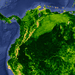
Global MYD13A1 data are provided every 16 days at 500-meter spatial resolution as a gridded level-3 product in the Sinusoidal projection. Vegetation indices are used for global monitoring of vegetation conditions and are used in products displaying land cover and land cover changes. These data may be used as input for modeling global biogeochemical and hydrologic processes and global and regional climate. These data also may be used for characterizing land surface biophysical properties and processes, including primary production and land cover conversion.
Version-5 MODIS Vegetation Indices products have attained Validation Stage 3.
Vegetation Indices production is phased between Terra and Aqua acquisitions, with Terra beginning on Day 001 and Aqua beginning on Day 008.
Please visit LP DAAC 'Citing Our Data' page for information on citing LP DAAC datasets.
Terms of Use
Terms of Use
MODIS data and products acquired through the LP DAAC have no restrictions on subsequent use, sale, or redistribution.
Explore with Earth Engine
Code Editor (JavaScript)
var dataset = ee.ImageCollection('MODIS/MYD13A1')
                  .filter(ee.Filter.date('2014-04-01', '2014-06-01'));
var ndvi = dataset.select('NDVI');
var ndviVis = {
  palette: [
    'ffffff', 'ce7e45', 'df923d', 'f1b555', 'fcd163', '99b718', '74a901',
    '66a000', '529400', '3e8601', '207401', '056201', '004c00', '023b01',
    '012e01', '011d01', '011301'
  ],
};
Map.setCenter(-7.03, 31.05, 2);
Map.addLayer(ndvi, ndviVis, 'NDVI');