Page Summary
-
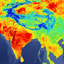
This dataset provides daily per-pixel temperature and emissivity values using the generalized split-window LST algorithm.
-
The product includes layers for LSTs, quality control, observation times, view zenith angles, clear sky coverages, and bands 31 and 32 emissivities.
-
The V5 Aqua/MODIS LST/E products are validated to Stage-2 through field campaigns and radiance-based studies.
- Dataset Availability
- 2002-07-08T00:00:00Z–2017-03-30T00:00:00Z
- Dataset Producer
- NASA LP DAAC at the USGS EROS Center
- Cadence
- 1 Day
- Tags
Description
The MODIS/Aqua Land Surface Temperature and Emissivity (LST/E) product, MYD11A1, provides per-pixel temperature and emissivity values, which are produced daily using the generalized split-window LST algorithm. This algorithm is optimally used to separate ranges of atmospheric column water vapor and lower boundary air surface temperatures into tractable sub-ranges. The surface emissivities in bands 31 and 32 are estimated from land cover types.
The V5 MYD11A1 products are projected in a Sinusoidal grid by mapping the level-2 LST product (MYD11_L2) on 1-kilometer (precisely 0.928-km) grids. The MYD11A1 product comprises the following Science Data Set (SDS) layers for daytime and nighttime observations: LSTs, quality control assessments, observation times, view zenith angles, clear sky coverages, and bands 31 and 32 emissivities from land cover types.
The V5 Aqua/MODIS LST/E products, including MYD11A1, are validated to Stage-2 through field campaigns and radiance-based validation studies.
Please visit LP DAAC 'Citing Our Data' page for information on citing LP DAAC datasets.
Terms of Use
Terms of Use
MODIS data and products acquired through the LP DAAC have no restrictions on subsequent use, sale, or redistribution.