Page Summary
-
This dataset for Enhanced Vegetation Index (EVI) has been superseded by MODIS/MYD09GA_006_EVI.
-
The dataset is available from 2002-07-04 to 2017-03-30 and is provided by Google with a daily cadence.
-
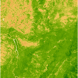
The EVI is generated from Near-IR, Red, and Blue bands and ranges from -1.0 to 1.0.
-
MODIS data and products from LP DAAC have no restrictions on use, sale, or redistribution.
- Dataset Availability
- 2002-07-04T00:00:00Z–2017-03-30T00:00:00Z
- Dataset Producer
- Cadence
- 1 Day
- Tags
Description
The Enhanced Vegetation Index (EVI) is generated from the Near-IR, Red and Blue bands of each scene, and ranges in value from -1.0 to 1.0. See Huete et al. (2002) for details. This product is generated from the MODIS/MYD09GA surface reflectance composites.
Bands
Bands
Pixel size: 463.313 meters (all bands)
| Name | Pixel Size | Description |
|---|---|---|
EVI |
463.313 meters | Enhanced Vegetation Index |
Terms of Use
Terms of Use
MODIS data and products acquired through the LP DAAC have no restrictions on subsequent use, sale, or redistribution.