Page Summary
-
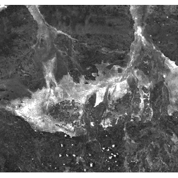
This dataset provides the Burn Area Index (BAI) derived from MODIS/MYD09GA surface reflectance composites.
-
The Burn Area Index measures the spectral distance of each pixel from a reference charcoal point to emphasize charcoal signals in post-fire images.
-
This dataset is available daily from July 4, 2002, to March 30, 2017, and is provided by Google.
-
There are no restrictions on the subsequent use, sale, or redistribution of MODIS data and products acquired through the LP DAAC.
- Dataset Availability
- 2002-07-04T00:00:00Z–2017-03-30T00:00:00Z
- Dataset Producer
- Cadence
- 1 Day
- Tags
Description
The Burn Area Index (BAI) is generated from the Red and Near-IR bands, and measures the spectral distance of each pixel from a reference spectral point (the measured reflectance of charcoal). This index is intended to emphasize the charcoal signal in post-fire images. See Chuvieco et al. (2002) for details. This product is generated from the MODIS/MYD09GA surface reflectance composites.
Bands
Bands
Pixel size: 463.313 meters (all bands)
| Name | Pixel Size | Description |
|---|---|---|
BAI |
463.313 meters | Burn Area Index |
Terms of Use
Terms of Use
MODIS data and products acquired through the LP DAAC have no restrictions on subsequent use, sale, or redistribution.