Page Summary
-
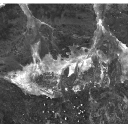
The Burn Area Index (BAI) is derived from MODIS surface reflectance data to highlight the presence of charcoal in post-fire images.
-
The dataset provides global daily coverage with a pixel size of 463.313 meters for the BAI band.
-
Data is available from February 24, 2000, to February 17, 2023, and has no restrictions on use, sale, or redistribution.
-
The dataset is available through Google Earth Engine for analysis and visualization.
- Dataset Availability
- 2000-02-24T00:00:00Z–2023-02-17T00:00:00Z
- Dataset Producer
- Cadence
- 1 Day
- Tags
Description
The Burn Area Index (BAI) is generated from the Red and Near-IR bands, and measures the spectral distance of each pixel from a reference spectral point (the measured reflectance of charcoal). This index is intended to emphasize the charcoal signal in post-fire images. See Chuvieco et al. (2002) for details. This product is generated from the MODIS/006/MOD09GA surface reflectance composites.
Bands
Bands
Pixel size: 463.313 meters (all bands)
| Name | Pixel Size | Description |
|---|---|---|
BAI |
463.313 meters | Burn Area Index |
Terms of Use
Terms of Use
MODIS data and products acquired through the LP DAAC have no restrictions on subsequent use, sale, or redistribution.
Explore with Earth Engine
Code Editor (JavaScript)
var dataset = ee.ImageCollection('MODIS/MOD09GA_006_BAI')
                  .filter(ee.Filter.date('2018-04-01', '2018-06-01'));
var scaled = dataset.select('BAI');
var scaledVis = {
  min: 0.0,
  max: 100.0,
};
Map.setCenter(-7.03125, 31.0529339857, 2);
Map.addLayer(scaled, scaledVis, 'Scaled');