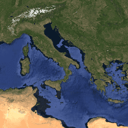
The MODerate-resolution Imaging
Spectroradiometer (MODIS) Reflectance product MCD43A4 provides
500-meter reflectance data adjusted using a bidirectional reflectance
distribution function (BRDF) to model the values as if they were taken
from nadir view. The MCD43A4 product contains 16 days of data provided
in a level-3 gridded data set in Sinusoidal projection.
Both Terra and Aqua data are used in the generation of this product, providing
the highest probability for quality input data and designating it as
an MCD, meaning Combined, product.
Version-5 MODIS/Terra+Aqua BRDF/Albedo
products are Validated Stage 1, meaning that accuracy has been
estimated using a small number of independent measurements obtained
from selected locations and time periods and ground-truth/field
program efforts. Although there may be later improved versions, these
data are ready for use in scientific publications.
The MODerate-resolution Imaging Spectroradiometer (MODIS) Reflectance product MCD43A4 provides 500-meter reflectance data adjusted using a bidirectional reflectance distribution function (BRDF) to model the values as if they were taken from nadir view. The MCD43A4 product contains 16 days of data provided in a level-3 gridded data set in Sinusoidal projection. …
[[["Easy to understand","easyToUnderstand","thumb-up"],["Solved my problem","solvedMyProblem","thumb-up"],["Other","otherUp","thumb-up"]],[["Missing the information I need","missingTheInformationINeed","thumb-down"],["Too complicated / too many steps","tooComplicatedTooManySteps","thumb-down"],["Out of date","outOfDate","thumb-down"],["Samples / code issue","samplesCodeIssue","thumb-down"],["Other","otherDown","thumb-down"]],[],[[["\u003cp\u003eThis MODIS MCD43A4 dataset provides 500-meter reflectance data, adjusted using BRDF, and is presented in a 16-day, level-3 gridded format in Sinusoidal projection.\u003c/p\u003e\n"],["\u003cp\u003eThe dataset covers a period from February 18, 2000, to March 14, 2017, and incorporates both Terra and Aqua data for enhanced quality.\u003c/p\u003e\n"],["\u003cp\u003eThis dataset has been superseded by a newer version, MODIS/061/MCD43A4, which is recommended for use instead.\u003c/p\u003e\n"],["\u003cp\u003eMODIS data and products acquired through the LP DAAC have no restrictions on subsequent use, sale, or redistribution.\u003c/p\u003e\n"],["\u003cp\u003eThough scientifically validated, users should be aware that later, improved versions of this dataset may be available.\u003c/p\u003e\n"]]],[],null,["# MCD43A4.005 BRDF-Adjusted Reflectance 16-Day Global 500m [deprecated]\n\n**Caution:** This dataset has been superseded by [MODIS/061/MCD43A4](/earth-engine/datasets/catalog/MODIS_061_MCD43A4). \n\nDataset Availability\n: 2000-02-18T00:00:00Z--2017-03-14T00:00:00Z\n\nDataset Provider\n:\n\n\n [NASA LP DAAC at the USGS EROS Center](https://lpdaac.usgs.gov/dataset_discovery/modis/modis_products_table/mcd43a4)\n\nCadence\n: 8 Days\n\nTags\n:\n 16-day \n brdf \n global \n mcd43a4 \n modis \n nbar \n reflectance \n satellite-imagery \n surface-reflectance \nusgs \n\n#### Description\n\nThe MODerate-resolution Imaging\nSpectroradiometer (MODIS) Reflectance product MCD43A4 provides\n500-meter reflectance data adjusted using a bidirectional reflectance\ndistribution function (BRDF) to model the values as if they were taken\nfrom nadir view. The MCD43A4 product contains 16 days of data provided\nin a level-3 gridded data set in Sinusoidal projection.\n\nBoth Terra and Aqua data are used in the generation of this product, providing\nthe highest probability for quality input data and designating it as\nan MCD, meaning Combined, product.\n\nVersion-5 MODIS/Terra+Aqua BRDF/Albedo\nproducts are Validated Stage 1, meaning that accuracy has been\nestimated using a small number of independent measurements obtained\nfrom selected locations and time periods and ground-truth/field\nprogram efforts. Although there may be later improved versions, these\ndata are ready for use in scientific publications.\n\nPlease visit [LP DAAC 'Citing Our Data' page](https://lpdaac.usgs.gov/citing_our_data) for information on citing LP DAAC datasets.\n\n### Bands\n\n**Bands**\n\n| Name | Pixel Size | Description |\n|------|------------|-------------|\n\n### Terms of Use\n\n**Terms of Use**\n\nMODIS data and products acquired through the LP DAAC have no restrictions on subsequent use, sale, or redistribution.\n**Important:** Earth Engine is a platform for petabyte-scale scientific analysis and visualization of geospatial datasets, both for public benefit and for business and government users. Earth Engine is free to use for research, education, and nonprofit use. To get started, please [register for Earth Engine access.](https://console.cloud.google.com/earth-engine) \n[MCD43A4.005 BRDF-Adjusted Reflectance 16-Day Global 500m \\[deprecated\\]](/earth-engine/datasets/catalog/MODIS_MCD43A4) \nThe MODerate-resolution Imaging Spectroradiometer (MODIS) Reflectance product MCD43A4 provides 500-meter reflectance data adjusted using a bidirectional reflectance distribution function (BRDF) to model the values as if they were taken from nadir view. The MCD43A4 product contains 16 days of data provided in a level-3 gridded data set in Sinusoidal projection. ... \nMODIS/MCD43A4, 16-day,brdf,global,mcd43a4,modis,nbar,reflectance,satellite-imagery,surface-reflectance,usgs \n2000-02-18T00:00:00Z/2017-03-14T00:00:00Z \n-90 -180 90 180 \nGoogle Earth Engine \nhttps://developers.google.com/earth-engine/datasets\n\n- [](https://doi.org/https://lpdaac.usgs.gov/dataset_discovery/modis/modis_products_table/mcd43a4)\n- [](https://doi.org/https://developers.google.com/earth-engine/datasets/catalog/MODIS_MCD43A4)"]]