Page Summary
-
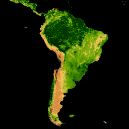
This dataset provides 8-day composite Leaf Area Index (LAI) and Fraction of Photosynthetically Active Radiation (FPAR) data globally at 500m resolution from the Aqua sensor.
-
The data is available from July 4, 2002, to February 18, 2023, and is provided by NASA LP DAAC at the USGS EROS Center.
-
Key bands include
Fpar_500mandLai_500m, along with associated quality and standard deviation information. -
The dataset has no restrictions on use, sale, or redistribution, but it has been superseded by MODIS/061/MYD15A2H.

- Dataset Availability
- 2002-07-04T00:00:00Z–2023-02-18T00:00:00Z
- Dataset Producer
- NASA LP DAAC at the USGS EROS Center
- Cadence
- 8 Days
- Tags
Description
The MYD15A2H V6 MODIS combined Leaf Area Index (LAI) and Fraction of Photosynthetically Active Radiation (FPAR) product is an 8-day composite dataset at 500m resolution. The algorithm chooses the "best" pixel available from all the acquisitions of the Aqua sensor from within the 8-day period.
Documentation:
Bands
Pixel Size
500 meters
Bands
| Name | Units | Min | Max | Scale | Pixel Size | Description |
|---|---|---|---|---|---|---|
Fpar_500m |
% | 0 | 100 | 0.01 | meters | Fraction of Photosynthetically Active Radiation |
Lai_500m |
Area fraction | 0 | 100 | 0.1 | meters | Leaf Area Index |
FparLai_QC |
0 | 254 | meters | Quality for LAI and FPAR |
||
FparExtra_QC |
0 | 254 | meters | Extra detail Quality for LAI and FPAR |
||
FparStdDev_500m |
% | 0 | 100 | 0.01 | meters | Standard deviation of FPAR |
LaiStdDev_500m |
Area fraction | 0 | 100 | 0.1 | meters | Standard deviation of LAI |
Terms of Use
Terms of Use
MODIS data and products acquired through the LP DAAC have no restrictions on subsequent use, sale, or redistribution.
Citations
Please visit LP DAAC 'Citing Our Data' page for information on citing LP DAAC datasets.
DOIs
Explore with Earth Engine
Code Editor (JavaScript)
var collection = ee.ImageCollection('MODIS/006/MYD15A2H')
                  .filterDate('2019-01-01', '2019-10-01');

var colorizedVis = {
  min: 0,
  max: 100,
  palette: [
    'ffffff', 'ce7e45', 'df923d', 'f1b555', 'fcd163', '99b718', '74a901',
    '66a000', '529400', '3e8601', '207401', '056201', '004c00', '023b01',
    '012e01', '011d01', '011301'
  ],
};

Map.setCenter(-10.88, 40.94, 2);
Map.addLayer(collection.select('Lai_500m'), colorizedVis, 'Lai');
Map.addLayer(collection.select('Fpar_500m'), colorizedVis, 'Fpar');