MOD14A2.006: Terra Thermal Anomalies & Fire 8-Day Global 1km [deprecated]
Stay organized with collections
Save and categorize content based on your preferences.
Page Summary
This dataset, MODIS/006/MOD14A2, has been superseded by MODIS/061/MOD14A2.
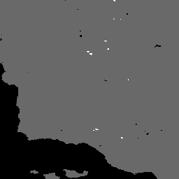
The MOD14A2 V6 dataset provides 8-day fire mask composites at 1km resolution along with a quality information layer.
The dataset is available from 2000-02-18 to 2023-02-10 and is provided by NASA LP DAAC at the USGS EROS Center.
The dataset includes bands for FireMask and QA with corresponding bitmask descriptions.
MODIS data and products from the LP DAAC have no restrictions on subsequent use, sale, or redistribution.
The MOD14A2 V6 dataset provides 8-day fire mask composites
at 1km resolution. It contains the maximum value of the individual
pixel classes over the compositing period. Along with the fire
mask, an associated quality information layer is also provided.
The MOD14A2 V6 dataset provides 8-day fire mask composites at 1km resolution. It contains the maximum value of the individual pixel classes over the compositing period. Along with the fire mask, an associated quality information layer is also provided. Documentation: User's Guide Algorithm Theoretical Basis Document (ATBD) General Documentation
[[["Easy to understand","easyToUnderstand","thumb-up"],["Solved my problem","solvedMyProblem","thumb-up"],["Other","otherUp","thumb-up"]],[["Missing the information I need","missingTheInformationINeed","thumb-down"],["Too complicated / too many steps","tooComplicatedTooManySteps","thumb-down"],["Out of date","outOfDate","thumb-down"],["Samples / code issue","samplesCodeIssue","thumb-down"],["Other","otherDown","thumb-down"]],[],[],["The MOD14A2 V6 dataset offers 8-day fire mask composites at 1km resolution, spanning from 2000-02-18 to 2023-02-10. It presents the maximum fire pixel class values over each 8-day period, alongside a quality assurance (QA) layer. The dataset, provided by NASA LP DAAC, is accessible via Google Earth Engine using the code snippet `ee.ImageCollection(\"MODIS/006/MOD14A2\")`. The associated fire mask and QA bands contains specific bitmask that allows to identify the fire confidence.\n"]]