Page Summary
-
This dataset, providing BRDF/Albedo Quality information at 500m resolution daily over a 16-day period, has been superseded by MODIS/061/MCD43A2.
-
It includes quality and observation data for MODIS land bands 1-7, along with overall BRDF/Albedo quality information.
-
The dataset is available from 2000-02-24 to 2023-02-10 and is provided by NASA LP DAAC.
-
Data acquired through LP DAAC have no restrictions on subsequent use, sale, or redistribution.
- Dataset Availability
- 2000-02-24T00:00:00Z–2023-02-10T00:00:00Z
- Dataset Producer
- NASA LP DAAC at the USGS EROS Center
- Cadence
- 1 Day
- Tags
Description
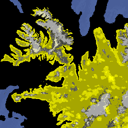
The MCD43A2 V6 Bidirectional Reflectance Distribution Function and Albedo (BRDF/Albedo) Quality dataset is a 500 meter daily 16-day product. It contains all the quality information for the corresponding 16-day MCD43A3 Albedo and the MCD43A4 Nadir-BRDF (NBAR) products.
The MCD43A2 contains individual band quality and observation information for the MODIS land bands 1-7, along with the overall BRDF/Albedo quality information.
See dataset user guide for more information.
Documentation:
Bands
Bands
Pixel size: 500 meters (all bands)
| Name | Units | Min | Max | Scale | Pixel Size | Description | |||||||||||||||||||||||||||||||||||||||||||||||||||||||||||||||||||||||||||||||||||||||||||||
|---|---|---|---|---|---|---|---|---|---|---|---|---|---|---|---|---|---|---|---|---|---|---|---|---|---|---|---|---|---|---|---|---|---|---|---|---|---|---|---|---|---|---|---|---|---|---|---|---|---|---|---|---|---|---|---|---|---|---|---|---|---|---|---|---|---|---|---|---|---|---|---|---|---|---|---|---|---|---|---|---|---|---|---|---|---|---|---|---|---|---|---|---|---|---|---|---|---|---|---|
Snow_BRDF_Albedo |
500 meters | Snow-free or snow BRDF/albedo retrieved |
|||||||||||||||||||||||||||||||||||||||||||||||||||||||||||||||||||||||||||||||||||||||||||||||||
BRDF_Albedo_Platform |
500 meters | BRDF albedo platform information |
|||||||||||||||||||||||||||||||||||||||||||||||||||||||||||||||||||||||||||||||||||||||||||||||||
BRDF_Albedo_LandWaterType |
500 meters | Land/water type |
|||||||||||||||||||||||||||||||||||||||||||||||||||||||||||||||||||||||||||||||||||||||||||||||||
BRDF_Albedo_LocalSolarNoon |
deg | 0 | 254 | 500 meters | Solar zenith angle of local solar noon |
||||||||||||||||||||||||||||||||||||||||||||||||||||||||||||||||||||||||||||||||||||||||||||||
BRDF_Albedo_ValidObs_Band1 |
500 meters | Valid observation for band 1 |
|||||||||||||||||||||||||||||||||||||||||||||||||||||||||||||||||||||||||||||||||||||||||||||||||
BRDF_Albedo_ValidObs_Band2 |
500 meters | Valid observation for band 2 (same bit meaning as in band 1) |
|||||||||||||||||||||||||||||||||||||||||||||||||||||||||||||||||||||||||||||||||||||||||||||||||
BRDF_Albedo_ValidObs_Band3 |
500 meters | Valid observation for band 3 (same bit meaning as in band 1) |
|||||||||||||||||||||||||||||||||||||||||||||||||||||||||||||||||||||||||||||||||||||||||||||||||
BRDF_Albedo_ValidObs_Band4 |
500 meters | Valid observation for band 4 (same bit meaning as in band 1) |
|||||||||||||||||||||||||||||||||||||||||||||||||||||||||||||||||||||||||||||||||||||||||||||||||
BRDF_Albedo_ValidObs_Band5 |
500 meters | Valid observation for band 5 (same bit meaning as in band 1) |
|||||||||||||||||||||||||||||||||||||||||||||||||||||||||||||||||||||||||||||||||||||||||||||||||
BRDF_Albedo_ValidObs_Band6 |
500 meters | Valid observation for band 6 (same bit meaning as in band 1) |
|||||||||||||||||||||||||||||||||||||||||||||||||||||||||||||||||||||||||||||||||||||||||||||||||
BRDF_Albedo_ValidObs_Band7 |
500 meters | Valid observation for band 7 (same bit meaning as in band 1) |
|||||||||||||||||||||||||||||||||||||||||||||||||||||||||||||||||||||||||||||||||||||||||||||||||
BRDF_Albedo_Band_Quality_Band1 |
500 meters | BRDF inversion information for band 1 |
|||||||||||||||||||||||||||||||||||||||||||||||||||||||||||||||||||||||||||||||||||||||||||||||||
BRDF_Albedo_Band_Quality_Band2 |
500 meters | BRDF inversion information for band 2 |
|||||||||||||||||||||||||||||||||||||||||||||||||||||||||||||||||||||||||||||||||||||||||||||||||
BRDF_Albedo_Band_Quality_Band3 |
500 meters | BRDF inversion information for band 3 |
|||||||||||||||||||||||||||||||||||||||||||||||||||||||||||||||||||||||||||||||||||||||||||||||||
BRDF_Albedo_Band_Quality_Band4 |
500 meters | BRDF inversion information for band 4 |
|||||||||||||||||||||||||||||||||||||||||||||||||||||||||||||||||||||||||||||||||||||||||||||||||
BRDF_Albedo_Band_Quality_Band5 |
500 meters | BRDF inversion information for band 5 |
|||||||||||||||||||||||||||||||||||||||||||||||||||||||||||||||||||||||||||||||||||||||||||||||||
BRDF_Albedo_Band_Quality_Band6 |
500 meters | BRDF inversion information for band 6 |
|||||||||||||||||||||||||||||||||||||||||||||||||||||||||||||||||||||||||||||||||||||||||||||||||
BRDF_Albedo_Band_Quality_Band7 |
500 meters | BRDF inversion information for band 7 |
|||||||||||||||||||||||||||||||||||||||||||||||||||||||||||||||||||||||||||||||||||||||||||||||||
BRDF_Albedo_Uncertainty |
0 | 32766 | 0.001 | 500 meters | BRDF inversion information |
||||||||||||||||||||||||||||||||||||||||||||||||||||||||||||||||||||||||||||||||||||||||||||||
Terms of Use
Terms of Use
MODIS data and products acquired through the LP DAAC have no restrictions on subsequent use, sale, or redistribution.
Citations
Please visit LP DAAC 'Citing Our Data' page for information on citing LP DAAC datasets.
DOIs
Explore with Earth Engine
Code Editor (JavaScript)
var dataset = ee.ImageCollection('MODIS/006/MCD43A2')
                  .filter(ee.Filter.date('2018-01-01', '2018-05-01'));
var defaultVisualization = dataset.select('Snow_BRDF_Albedo');
var defaultVisualizationVis = {
  min: 0.0,
  max: 1.0,
};
Map.setCenter(6.746, 46.529, 6);
Map.addLayer(
    defaultVisualization, defaultVisualizationVis, 'Default visualization');