- Доступность набора данных
- 2013-04-01T13:46:38Z–2020-11-14T03:12:43Z
- Производитель наборов данных
- Геологическая служба США
- Теги
Описание
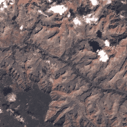
Значения OLI DN уровня 1 из коллекции Landsat 8, представляющие масштабированную, откалиброванную яркость, измеренную непосредственно на датчике.
Снимки Landsat с наивысшим доступным качеством данных относятся к уровню 1 и считаются пригодными для анализа временных рядов. Уровень 1 включает данные, обработанные с помощью технологии Level-1 Precision Terrain (L1TP), которые имеют хорошо охарактеризованную радиометрию и откалиброваны между различными датчиками Landsat. Георегистрация снимков уровня 1 будет согласованной и находиться в пределах заданных допусков [<=12 м среднеквадратичной ошибки (RMSE)]. Все данные Landsat уровня 1 можно считать согласованными и откалиброванными (независимо от датчика) по всей коллекции. Дополнительную информацию см. в документации USGS .
Группы
Группы
| Имя | Размер пикселя | Длина волны | Описание | ||||||||||||||||||||||||||||||||||||||||||||||||||||||||||||||||||||||||||||||||||||||||||||||||
|---|---|---|---|---|---|---|---|---|---|---|---|---|---|---|---|---|---|---|---|---|---|---|---|---|---|---|---|---|---|---|---|---|---|---|---|---|---|---|---|---|---|---|---|---|---|---|---|---|---|---|---|---|---|---|---|---|---|---|---|---|---|---|---|---|---|---|---|---|---|---|---|---|---|---|---|---|---|---|---|---|---|---|---|---|---|---|---|---|---|---|---|---|---|---|---|---|---|---|---|
B1 | 30 метров | 0,43 - 0,45 мкм | Прибрежный аэрозоль | ||||||||||||||||||||||||||||||||||||||||||||||||||||||||||||||||||||||||||||||||||||||||||||||||
B2 | 30 метров | 0,45 - 0,51 мкм | Синий | ||||||||||||||||||||||||||||||||||||||||||||||||||||||||||||||||||||||||||||||||||||||||||||||||
B3 | 30 метров | 0,53 - 0,59 мкм | Зеленый | ||||||||||||||||||||||||||||||||||||||||||||||||||||||||||||||||||||||||||||||||||||||||||||||||
B4 | 30 метров | 0,64 - 0,67 мкм | Красный | ||||||||||||||||||||||||||||||||||||||||||||||||||||||||||||||||||||||||||||||||||||||||||||||||
B5 | 30 метров | 0,85 - 0,88 мкм | Ближний инфракрасный диапазон | ||||||||||||||||||||||||||||||||||||||||||||||||||||||||||||||||||||||||||||||||||||||||||||||||
B6 | 30 метров | 1,57 - 1,65 мкм | Коротковолновое инфракрасное излучение 1 | ||||||||||||||||||||||||||||||||||||||||||||||||||||||||||||||||||||||||||||||||||||||||||||||||
B7 | 30 метров | 2,11 - 2,29 мкм | Коротковолновое инфракрасное излучение 2 | ||||||||||||||||||||||||||||||||||||||||||||||||||||||||||||||||||||||||||||||||||||||||||||||||
B8 | 15 метров | 0,52 - 0,90 мкм | Панхроматический диапазон 8 | ||||||||||||||||||||||||||||||||||||||||||||||||||||||||||||||||||||||||||||||||||||||||||||||||
B9 | 15 метров | 1,36 - 1,38 мкм | Перистые | ||||||||||||||||||||||||||||||||||||||||||||||||||||||||||||||||||||||||||||||||||||||||||||||||
BQA | 30 метров | Битовая маска Landsat Collection 1 QA ( см. страницу Landsat QA ) | |||||||||||||||||||||||||||||||||||||||||||||||||||||||||||||||||||||||||||||||||||||||||||||||||
Свойства изображения
Свойства изображения
| Имя | Тип | Описание |
|---|---|---|
| BPF_NAME_OLI | НИТЬ | Имя файла параметров смещения (BPF), использованного для генерации продукта, если таковой имеется. Это относится только к продуктам, содержащим полосы OLI. |
| ОБЛАЧНЫЙ ПОКРЫТИЕ | ДВОЙНОЙ | Процент облачности (0-100), -1 = не рассчитывается. |
| ПЛАНИРОВАННАЯ_ЗЕМЛЯ_ОБЛАЧНОСТЬ | ДВОЙНОЙ | Процент облачности над сушей (0-100), -1 = не рассчитывается. |
| КАТЕГОРИЯ_КОЛЛЕКЦИИ | НИТЬ | Уровень сцены (Т1 или Т2) |
| НОМЕР_КОЛЛЕКЦИИ | ДВОЙНОЙ | Номер коллекции. |
| CPF_NAME | НИТЬ | Имя файла параметров калибровки. |
| ТИП ДАННЫХ | НИТЬ | Идентификатор типа данных. (L1T или L1G) |
| ДАТА_ПОЛУЧЕНИЯ | НИТЬ | Дата получения изображения. "ГГГГ-ММ-ДД" |
| ДАТУМ | НИТЬ | Эталонные данные, используемые при создании изображения. |
| Расстояние Земля_Солнце | ДВОЙНОЙ | Расстояние от Земли до Солнца в астрономических единицах (а.е.). |
| ELEVATION_SOURCE | НИТЬ | Исходный файл модели высот, используемый для стандартных продуктов с коррекцией рельефа (L1T). |
| ЭЛЛИПСОИД | НИТЬ | Эллипсоид, используемый при создании изображений. |
| EPHEMERIS_TYPE | НИТЬ | Тип данных «эфемериды», используемый для выполнения геометрической коррекции (окончательный или прогнозный). |
| ДАТА ФАЙЛА | ДВОЙНОЙ | Дата файла указана в миллисекундах с начала эпохи. |
| GEOMETRIC_RMSE_MODEL | ДВОЙНОЙ | Суммарная среднеквадратная ошибка (RMSE) геометрических остатков (в метрах) в поперечном и продольном направлениях, измеренная на опорных точках, используемых для коррекции геометрической точности. Отсутствует в продуктах L1G. |
| GEOMETRIC_RMSE_MODEL_X | ДВОЙНОЙ | Среднеквадратичная ошибка (RMSE) геометрических остатков по оси X (в метрах), измеренных на опорных точках, используемых для коррекции геометрической точности. Отсутствует в продуктах L1G. |
| GEOMETRIC_RMSE_MODEL_Y | ДВОЙНОЙ | Среднеквадратичная ошибка (RMSE) геометрических остатков по оси Y (в метрах), измеренных на опорных точках, используемых для коррекции геометрической точности. Отсутствует в продуктах L1G. |
| GRID_CELL_SIZE_PANCHROMATIC | ДВОЙНОЙ | Размер ячейки сетки, используемый при создании изображения для панхроматического диапазона. |
| GRID_CELL_SIZE_REFLECTIVE | ДВОЙНОЙ | Размер ячейки сетки, используемый при создании изображения для отражающей полосы. |
| GROUND_CONTROL_POINTS_MODEL | ДВОЙНОЙ | Количество используемых опорных точек на местности. Не используется в продуктах L1GT. Значения: 0 - 999 (0 используется для продуктов L1T, в которых применялось уточнение для нескольких сцен). |
| ВЕРСИЯ ТОЧЕК НАЗЕМНОГО КОНТРОЛЯ | ДВОЙНОЙ | Количество опорных точек, использованных при проверке продукта с поправкой на рельеф местности. Значения: от -1 до 1615 (-1 = недоступно) |
| КАЧЕСТВО ИЗОБРАЖЕНИЯ | ДВОЙНОЙ | Качество изображения: 0 = наихудшее, 9 = наилучшее, -1 = качество не рассчитывается. |
| КАЧЕСТВО ИЗОБРАЖЕНИЯ_ОЛИВКИ | ДВОЙНОЙ | Композитное качество изображения для полос OLI. Значения: 9 = Лучшее. 1 = Худшее. 0 = Качество изображения не рассчитывается. Этот параметр присутствует только в том случае, если полосы OLI присутствуют в продукте. |
| LANDSAT_PRODUCT_ID | НИТЬ | Система именования каждого изображения Landsat Collection 1 Level-1 основана на параметрах получения и обработки данных. Формат: LXSS_LLLL_PPPRRR_YYYYMMDD_ггггммдд_CC_TX
|
| LANDSAT_SCENE_ID | НИТЬ | Система именования изображений до начала сбора данных основана на параметрах съемки. Это была система именования, использовавшаяся до начала сбора данных 1. Формат: LXSPPRRRYYYYDDDGSIVV
|
| КАРТНАЯ ПРОЕКЦИЯ | НИТЬ | Проекция, используемая для представления трехмерной поверхности Земли в продукте уровня 1. |
| НАДИР_ВЫКЛ.НАДИР | НИТЬ | Надирное или вненадирное положение сцены. |
| ОРИЕНТАЦИЯ | НИТЬ | Ориентация, использованная при создании изображения. Значения: NOMINAL = Номинальный путь, NORTH_UP = Север вверх, TRUE_NORTH = Истинный Север, USER = Пользователь |
| ПАНХРОМАТИЧЕСКИЕ_ЛИНИИ | ДВОЙНОЙ | Количество товарных линий для панхроматического диапазона. |
| ПАНХРОМАТИЧЕСКИЕ_ОБРАЗЦЫ | ДВОЙНОЙ | Количество образцов продукции для панхроматических диапазонов. |
| ВЕРСИЯ_ПРОГРАММНОГО_ОБРАБОТКИ | НИТЬ | Название и версия программного обеспечения, использованного для обработки данных и создания продукта L1. |
| RADIANCE_ADD_BAND_1 | ДВОЙНОЙ | Аддитивный коэффициент масштабирования используется для преобразования калиброванного значения DN в яркость для диапазона 1. |
| RADIANCE_ADD_BAND_2 | ДВОЙНОЙ | Аддитивный коэффициент масштабирования используется для преобразования калиброванного значения DN в яркость для диапазона 2. |
| RADIANCE_ADD_BAND_3 | ДВОЙНОЙ | Аддитивный коэффициент масштабирования используется для преобразования калиброванной DN в яркость для диапазона 3. |
| RADIANCE_ADD_BAND_4 | ДВОЙНОЙ | Аддитивный коэффициент масштабирования используется для преобразования калиброванной DN в яркость для диапазона 4. |
| RADIANCE_ADD_BAND_5 | ДВОЙНОЙ | Аддитивный коэффициент масштабирования используется для преобразования калиброванной DN в яркость для диапазона 5. |
| RADIANCE_ADD_BAND_6 | ДВОЙНОЙ | Аддитивный коэффициент масштабирования используется для преобразования калиброванной DN в яркость для диапазона 6. |
| RADIANCE_ADD_BAND_7 | ДВОЙНОЙ | Аддитивный коэффициент масштабирования используется для преобразования калиброванной DN в яркость для диапазона 7. |
| RADIANCE_ADD_BAND_8 | ДВОЙНОЙ | Аддитивный коэффициент масштабирования используется для преобразования калиброванной DN в яркость для диапазона 8. |
| RADIANCE_ADD_BAND_9 | ДВОЙНОЙ | Аддитивный коэффициент масштабирования используется для преобразования калиброванной DN в яркость для диапазона 9. |
| RADIANCE_MULT_BAND_1 | ДВОЙНОЙ | Мультипликативный коэффициент масштабирования используется для преобразования калиброванного диапазона DN 1 в яркость. |
| RADIANCE_MULT_BAND_2 | ДВОЙНОЙ | Мультипликативный коэффициент масштабирования используется для преобразования калиброванного диапазона DN 2 в яркость. |
| RADIANCE_MULT_BAND_3 | ДВОЙНОЙ | Мультипликативный коэффициент масштабирования используется для преобразования калиброванного диапазона DN 3 в яркость. |
| RADIANCE_MULT_BAND_4 | ДВОЙНОЙ | Мультипликативный коэффициент масштабирования используется для преобразования калиброванного диапазона DN 4 в яркость. |
| RADIANCE_MULT_BAND_5 | ДВОЙНОЙ | Мультипликативный коэффициент масштабирования используется для преобразования калиброванного диапазона DN 5 в яркость. |
| RADIANCE_MULT_BAND_6 | ДВОЙНОЙ | Мультипликативный коэффициент масштабирования используется для преобразования калиброванного диапазона DN 6 в яркость. |
| RADIANCE_MULT_BAND_7 | ДВОЙНОЙ | Мультипликативный коэффициент масштабирования используется для преобразования калиброванного диапазона DN 7 в яркость. |
| RADIANCE_MULT_BAND_8 | ДВОЙНОЙ | Мультипликативный коэффициент масштабирования, используемый для преобразования калиброванного диапазона DN 8 в яркость. |
| RADIANCE_MULT_BAND_9 | ДВОЙНОЙ | Мультипликативный коэффициент масштабирования используется для преобразования калиброванного диапазона DN 9 в яркость. |
| REFLECTANCE_ADD_BAND_1 | ДВОЙНОЙ | Аддитивный коэффициент масштабирования используется для преобразования калиброванного диапазона DN 1 в коэффициент отражения. |
| REFLECTANCE_ADD_BAND_2 | ДВОЙНОЙ | Аддитивный коэффициент масштабирования используется для преобразования калиброванного диапазона DN 2 в коэффициент отражения. |
| REFLECTANCE_ADD_BAND_3 | ДВОЙНОЙ | Аддитивный коэффициент масштабирования используется для преобразования калиброванного диапазона DN 3 в коэффициент отражения. |
| REFLECTANCE_ADD_BAND_4 | ДВОЙНОЙ | Аддитивный коэффициент масштабирования используется для преобразования калиброванного диапазона DN 4 в коэффициент отражения. |
| REFLECTANCE_ADD_BAND_5 | ДВОЙНОЙ | Аддитивный коэффициент масштабирования используется для преобразования калиброванного диапазона DN 5 в коэффициент отражения. |
| REFLECTANCE_ADD_BAND_7 | ДВОЙНОЙ | Множитель, используемый для преобразования калиброванного диапазона 7 DN в коэффициент отражения. |
| REFLECTANCE_ADD_BAND_8 | ДВОЙНОЙ | Множитель, используемый для преобразования калиброванного диапазона DN 8-го диапазона в коэффициент отражения. |
| REFLECTANCE_ADD_BAND_9 | ДВОЙНОЙ | Минимально достижимое значение спектрального коэффициента отражения для диапазона 8. |
| REFLECTANCE_MULT_BAND_1 | ДВОЙНОЙ | Множитель, используемый для преобразования калиброванного диапазона DN 1 в коэффициент отражения. |
| REFLECTANCE_MULT_BAND_2 | ДВОЙНОЙ | Множитель, используемый для преобразования калиброванного диапазона DN 2 в коэффициент отражения. |
| REFLECTANCE_MULT_BAND_3 | ДВОЙНОЙ | Множитель, используемый для преобразования калиброванного диапазона 3 DN в коэффициент отражения. |
| REFLECTANCE_MULT_BAND_4 | ДВОЙНОЙ | Множитель, используемый для преобразования калиброванного диапазона 4 DN в коэффициент отражения. |
| REFLECTANCE_MULT_BAND_5 | ДВОЙНОЙ | Множитель, используемый для преобразования калиброванного диапазона 5 DN в коэффициент отражения. |
| REFLECTANCE_MULT_BAND_6 | ДВОЙНОЙ | Множитель, используемый для преобразования калиброванного диапазона 6 DN в коэффициент отражения. |
| REFLECTANCE_MULT_BAND_7 | ДВОЙНОЙ | Множитель, используемый для преобразования калиброванного диапазона 7 DN в коэффициент отражения. |
| REFLECTANCE_MULT_BAND_8 | ДВОЙНОЙ | Множитель, используемый для преобразования калиброванного диапазона DN 8-го диапазона в коэффициент отражения. |
| REFLECTANCE_MULT_BAND_9 | ДВОЙНОЙ | Множитель, используемый для преобразования калиброванного диапазона 9 DN в коэффициент отражения. |
| ОТРАЖАЮЩИЕ_ЛИНИИ | ДВОЙНОЙ | Количество товарных линий светоотражающих лент. |
| ОТРАЖАЮЩИЕ_ОБРАЗЦЫ | ДВОЙНОЙ | Количество образцов продукции с отражающими полосами. |
| Идентификатор_запроса | НИТЬ | Идентификатор запроса: nnnymmdd0000_0000
|
| ОПЦИЯ RESAMPLING_OPTION | НИТЬ | Параметр передискретизации, использованный при создании изображения. |
| ИМЯ_ФАЙЛА_RLUT | НИТЬ | Имя файла таблицы поиска линеаризации отклика (RLUT), использованной для генерации продукта, если таковая имеется. |
| УГОЛ КАТАНИЯ | ДВОЙНОЙ | Величина угла крена космического аппарата в центре сцены. |
| SATURATION_BAND_1 | НИТЬ | Флаг, указывающий на насыщенность пикселей для полосы 1 («Y»/«N») |
| SATURATION_BAND_2 | НИТЬ | Флаг, указывающий на насыщенность пикселей для полосы 2 («Y»/«N») |
| SATURATION_BAND_3 | НИТЬ | Флаг, указывающий на насыщенность пикселей для полосы 3 («Y»/«N») |
| SATURATION_BAND_4 | НИТЬ | Флаг, указывающий на насыщенность пикселей для полосы 4 («Y»/«N») |
| SATURATION_BAND_5 | НИТЬ | Флаг, указывающий на насыщенность пикселей для полосы 5 («Y»/«N») |
| SATURATION_BAND_6 | НИТЬ | Флаг, указывающий на насыщенность пикселей для полосы 6 («Y»/«N») |
| SATURATION_BAND_7 | НИТЬ | Флаг, указывающий на насыщенность пикселей для полосы 7 («Y»/«N») |
| SATURATION_BAND_8 | НИТЬ | Флаг, указывающий на насыщенность пикселей для полосы 8 («Y»/«N») |
| SATURATION_BAND_9 | НИТЬ | Флаг, указывающий на насыщенность пикселей для полосы 9 («Y»/«N») |
| SCENE_CENTER_TIME | НИТЬ | Время центра сцены полученного изображения. HH:MM:SS.SSSSSSSZ
|
| Идентификатор датчика | НИТЬ | Датчик, используемый для сбора данных. |
| Идентификатор космического аппарата | НИТЬ | Идентификация космического аппарата. |
| STATION_ID | НИТЬ | Наземная станция/организация, получившая данные. |
| SUN_AZIMUTH | ДВОЙНОЙ | Угол азимута Солнца в градусах для местоположения центра изображения в момент получения изображения. |
| ВЫСОТА_СОЛНЦА | ДВОЙНОЙ | Угол возвышения Солнца в градусах для центра изображения в момент получения изображения. |
| TARGET_WRS_PATH | ДВОЙНОЙ | Наилучший путь WRS-2 к центру изображения, находящемуся в прямой видимости. |
| TARGET_WRS_ROW | ДВОЙНОЙ | Ближайшая строка WRS-2 к центру изображения, расположенному в прямой видимости. Строки 880-889 и 990-999 зарезервированы для полярных регионов, где они не определены в WRS-2. |
| TRUNCATION_OLI | НИТЬ | Область OLCI усечена. |
| UTM_ZONE | ДВОЙНОЙ | Номер зоны UTM, используемый в проекции карты продукта. |
| WRS_PATH | ДВОЙНОЙ | Номер орбитального пути WRS (001 - 251). |
| WRS_ROW | ДВОЙНОЙ | Спутник Landsat, ряд WRS (001-248). |
Условия эксплуатации
Условия эксплуатации
Данные Landsat создаются на федеральном уровне и, следовательно, находятся в общественном достоянии, поэтому их можно использовать, передавать или воспроизводить без ограничений, связанных с авторским правом.
Указание на Геологическую службу США (USGS) как на источник данных должно быть обеспечено путем включения текстовой ссылки, подобной приведенному ниже примеру.
(Название продукта, изображения, фотографии или набора данных) предоставлено Геологической службой США.
Пример: Изображение Landsat-7 предоставлено Геологической службой США.
Дополнительные сведения о правильном цитировании и указании источников продукции Геологической службы США см. в Руководстве по системе визуальной идентификации Геологической службы США .