Page Summary
-
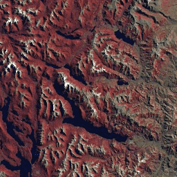
The GLS2005 data set includes 9500 orthorectified satellite images covering Earth's land masses from 2004-2007, primarily using Landsat 5 data.
-
This specific collection contains a subset of the GLS2005 images from the L5 ETM sensor, available from 2003-08-14 to 2008-05-29.
-
The dataset is provided by the USGS and includes seven bands with different pixel sizes and wavelengths.
-
Landsat datasets are in the public domain and can be used without copyright restriction, with acknowledgement of the USGS as the data source encouraged.
- Dataset Availability
- 2003-08-14T00:00:00Z–2008-05-29T00:00:00Z
- Dataset Producer
- USGS
- Tags
Description
The GLS2005 data set is a collection of 9500 orthorectified leaf-on medium-resolution satellite images collected between 2004 and 2007 and covering the Earth's land masses. GLS2005 uses mainly Landsat 5 and gap-filled Landsat 7 data with EO-1 ALI and Terra ASTER data filling in any data holes.
This collection contains just the subset of the GLS2005 images from the L5 ETM sensor.
Bands
Bands
Pixel size: varies
| Name | Pixel Size | Wavelength | Description |
|---|---|---|---|
10 |
30 meters | 0.45 - 0.52 μm | Blue |
20 |
30 meters | 0.52 - 0.60 μm | Green |
30 |
30 meters | 0.63 - 0.69 μm | Red |
40 |
30 meters | 0.76 - 0.90 μm | Near infrared |
50 |
30 meters | 1.55 - 1.75 μm | Shortwave infrared 1 |
60 |
60 meters | 10.40 - 12.50 μm | Thermal Infrared 1. Resampled from 60m to 30m. |
70 |
30 meters | 2.08 - 2.35 μm | Shortwave infrared 2 |
Terms of Use
Terms of Use
Landsat datasets are federally created data and therefore reside in the public domain and may be used, transferred, or reproduced without copyright restriction.
Acknowledgement or credit of the USGS as data source should be provided by including a line of text citation such as the example shown below.
(Product, Image, Photograph, or Dataset Name) courtesy of the U.S. Geological Survey
Example: Landsat-7 image courtesy of the U.S. Geological Survey
See the USGS Visual Identity System Guidance for further details on proper citation and acknowledgement of USGS products.
Explore with Earth Engine
Code Editor (JavaScript)
var dataset = ee.ImageCollection('LANDSAT/GLS2005_L5');
var trueColor321 = dataset.select(['30', '20', '10']);
Map.setCenter(6.746, 46.529, 6);
Map.addLayer(trueColor321, {}, 'True Color (321)');