- Disponibilidad del conjunto de datos
- 1972-07-25T00:00:00Z–1983-02-20T00:00:00Z
- Proveedor del conjunto de datos
- USGS
- Etiquetas
Descripción
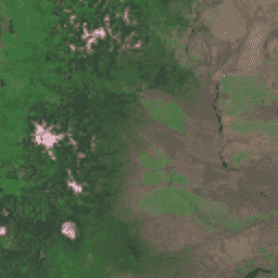
El Global Land Survey (GLS) de 1975 es una colección global de imágenes del escáner multiespectral (MSS) de Landsat. La mayoría de las escenas se adquirieron con Landsat 1-3 entre 1972 y 1983. Algunos vacíos en los datos de Landsat 1 a 3 se completaron con escenas adquiridas por Landsat 4 y 5 entre 1982 y 1987. Estos datos contienen 4 bandas espectrales: verde, rojo, una banda NIR y una banda SWIR. En la presentación típica de color falso, las imágenes aparecen en rojo porque la banda del NIR, que se muestra en rojo, destaca la vegetación.
Bandas
Bandas
Tamaño de píxel: 60 metros (todas las bandas)
| Nombre | Tamaño de los píxeles | Longitud de onda | Descripción |
|---|---|---|---|
10 |
60 metros | De 500 a 600 nm | Verde |
20 |
60 metros | 600-700 nm | Rojo |
30 |
60 metros | 700 a 800 nm | Infrarrojo cercano |
40 |
60 metros | De 800 a 1,100 nm | Infrarrojo de longitud de onda corta |
Condiciones de Uso
Condiciones de Uso
Los conjuntos de datos de Landsat son datos creados a nivel federal y, por lo tanto, son de dominio público y se pueden usar, transferir o reproducir sin restricciones de derechos de autor.
Se debe proporcionar el reconocimiento o crédito del USGS como fuente de datos, para lo cual se debe incluir una línea de texto de cita, como se muestra en el siguiente ejemplo.
(Nombre del producto, la imagen, la fotografía o el conjunto de datos) cortesía del Servicio Geológico de EE.UU.
Ejemplo: Imagen de Landsat-7 cortesía del Servicio Geológico de EE.UU.
Consulta la Guía del sistema de identidad visual del USGS para obtener más detalles sobre la cita y el reconocimiento adecuados de los productos del USGS.
Citas
Imagen de GLS 1975 cortesía del Servicio Geológico de EE.UU.
Explora con Earth Engine
Editor de código (JavaScript)
var dataset = ee.ImageCollection('LANDSAT/GLS1975');
var falseColor = dataset.select(['30', '20', '10']);
var falseColorVis = {
  gamma: 1.6,
};
Map.setCenter(44.517, 25.998, 5);
Map.addLayer(falseColor, falseColorVis, 'False Color');