Page Summary
-
This dataset provides global fire boundaries based on the MODIS dataset MCD64A1, identifying each fire event with a unique number.
-
The data covers the period from January 1, 2001, to January 1, 2021.
-
The dataset is available under the CC-BY-4.0 license.
-
It can be explored and analyzed using the Google Earth Engine platform.
- Dataset Availability
- 2001-01-01T00:00:00Z–2021-01-01T00:00:00Z
- Dataset Producer
- European Commission, Joint Research Centre, Global Wildfire Information System
- Tags
Description
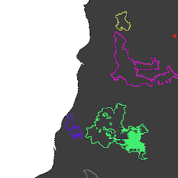
Fire boundaries based on the MODIS dataset MCD64A1. The data were computed based on an algorithm that relies on encoding in a graph structure a space-time relationship among patches of burned areas.
Each fire has a unique number identifying the event.
Table Schema
Table Schema
| Name | Type | Description |
|---|---|---|
| Id | INT | Numeric id of the fire |
| InitialDate | INT | Initial fire date in milliseconds since 1970-01-01 |
Terms of Use
Terms of Use
Citations
Artés, T., Oom, D., De Rigo, D., Durrant, T. H., Maianti, P., Libertà, G., & San-Miguel-Ayanz, J. (2019). A global wildfire dataset for the analysis of fire regimes and fire behaviour. Scientific data, 6(1), 1-11. doi:10.1038/s41597-019-0312-2
DOIs
Explore with Earth Engine
Code Editor (JavaScript)
// Folder name for a series of tables.
var folder = 'JRC/GWIS/GlobFire/v2/DailyPerimeters';

// List available tables using ee.data.listAssets with asynchronous callback.
function printAssetList(listAssetsOutput) {
  print('Asset list:', listAssetsOutput['assets']);
}
ee.data.listAssets(folder, {}, printAssetList);

// Define a table name (table id) identified from the list of available tables.
var tableName = 'JRC/GWIS/GlobFire/v2/DailyPerimeters/2020';

var computeArea = function(f) {
  return f.set({'area': f.area()});
};

// Import a selected table as a FeatureCollection.
var features = ee.FeatureCollection(tableName).map(computeArea);

// Visualization parameters for linear fire area gradient.
var visParams = {
  palette: ['f5ff64', 'b5ffb4', 'beeaff', 'ffc0e8', '8e8dff', 'adadad'],
  min: 0,
  max: 600000000,
  opacity: 0.8,
};

// Paint fire perimeters to an image using computed fire area as the value property.
var image = ee.Image().float().paint(features, 'area');

// Display the image to the map (include features for exploring with Inspector).
Map.addLayer(image, visParams, 'GlobFire 2020');
Map.addLayer(features, null, 'For Inspector', false);
Map.setCenter(-121.23, 39.7, 12);