- ความพร้อมใช้งานของชุดข้อมูล
- 2012-01-01T00:00:00Z–2012-01-01T00:00:00Z
- ผู้ผลิตชุดข้อมูล
- AHN
- แท็ก
คำอธิบาย
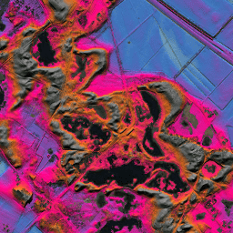
DEM ของ AHN คือ DEM ขนาด 0.5 ม. ที่ครอบคลุมเนเธอร์แลนด์ โดยสร้างจาก ข้อมูล LIDAR ที่ถ่ายในช่วงฤดูใบไม้ผลิระหว่างปี 2007 ถึง 2012
โดยมีตัวอย่างระดับพื้นดินที่นำรายการอื่นๆ ทั้งหมดเหนือพื้นดินออก (เช่น อาคาร สะพาน ต้นไม้ ฯลฯ) เวอร์ชันนี้ไม่มีการประมาณค่า โดย พื้นที่ที่นำออบเจ็กต์ออกจะเว้นว่างไว้และไม่มีการเติมค่า ที่ประมาณ ระบบจะแปลง Point Cloud เป็นตารางกริดขนาด 0.5 ม. โดยใช้วิธี การถ่วงน้ำหนักตามระยะทางผกผันยกกำลังสอง
ย่านความถี่
ย่านความถี่
ขนาดพิกเซล: 0.5 เมตร (ทุกแถบ)
| ชื่อ | หน่วย | ขนาดพิกเซล | คำอธิบาย |
|---|---|---|---|
elevation |
ม. | 0.5 เมตร | ระดับความสูง |
ข้อกำหนดในการใช้งาน
ข้อกำหนดในการใช้งาน
ชุดข้อมูลของ AHN พร้อมใช้งานเป็นข้อมูลแบบเปิด ซึ่งหมายความว่าทุกคนสามารถใช้ข้อมูลได้โดยไม่มีค่าใช้จ่ายและไม่มีข้อจำกัด ดูข้อมูลเพิ่มเติมได้ที่หน้าOpen Data โดยการดาวน์โหลดจะพร้อมใช้งาน ภายใต้ข้อกำหนดของ สัญญาอนุญาต CC-0
สำรวจด้วย Earth Engine
ตัวแก้ไขโค้ด (JavaScript)
var dataset = ee.Image('AHN/AHN2_05M_NON');
var elevation = dataset.select('elevation');
var elevationVis = {
  min: -5.0,
  max: 30.0,
};
Map.setCenter(5.80258, 51.78547, 14);
Map.addLayer(elevation, elevationVis, 'Elevation');