Page Summary
-
This page lists various datasets related to fire and hot spot characterization, burned areas, fire regimes, and wildfire risk.
-
Several datasets provide fire and hot spot characterization data from GOES-16, 17, 18, and 19 satellites, including fire masks, temperature, area, and radiative power.
-
GlobFire datasets offer daily and final fire event detections and boundaries based on the MODIS MCD64A1 dataset.
-
LANDFIRE provides numerous datasets related to vegetation, fire regimes, and fire effects, such as Biophysical Settings, Existing Vegetation characteristics, Fire Regime Groups, and Succession Classes.
-
The MTBS dataset contains burned area boundaries for completed fires across the United States, and the Wildfire Risk to Communities dataset depicts components of wildfire risk nationwide.
-
GOES-16 FDCC Series ABI Level 2 Fire/Hot Spot Characterization CONUS
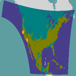
The Fire (HSC) product contains four images: one in the form of a fire mask and the other three with pixel values identifying fire temperature, fire area, and fire radiative power. The ABI L2+ FHS metadata mask assigns a flag to every earth-navigated pixel that … abi fdc fire goes goes-16 goes-east -
GOES-16 FDCF Series ABI Level 2 Fire/Hot Spot Characterization Full Disk
The Fire (HSC) product contains four images: one in the form of a fire mask and the other three with pixel values identifying fire temperature, fire area, and fire radiative power. The ABI L2+ FHS metadata mask assigns a flag to every earth-navigated pixel that … abi fdc fire goes goes-16 goes-east -
GOES-17 FDCC Series ABI Level 2 Fire/Hot Spot Characterization CONUS

The Fire (HSC) product contains four images: one in the form of a fire mask and the other three with pixel values identifying fire temperature, fire area, and fire radiative power. The ABI L2+ FHS metadata mask assigns a flag to every earth-navigated pixel that … abi fdc fire goes goes-17 goes-s -
GOES-17 FDCF Series ABI Level 2 Fire/Hot Spot Characterization Full Disk
The Fire (HSC) product contains four images: one in the form of a fire mask and the other three with pixel values identifying fire temperature, fire area, and fire radiative power. The ABI L2+ FHS metadata mask assigns a flag to every earth-navigated pixel that … abi fdc fire goes goes-17 goes-s -
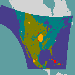
GOES-18 FDCC Series ABI Level 2 Fire/Hot Spot Characterization CONUS
The Fire (HSC) product contains four images: one in the form of a fire mask and the other three with pixel values identifying fire temperature, fire area, and fire radiative power. The ABI L2+ FHS metadata mask assigns a flag to every earth-navigated pixel that … abi fdc fire goes goes-18 goes-t -
GOES-18 FDCF Series ABI Level 2 Fire/Hot Spot Characterization Full Disk

The Fire (HSC) product contains four images: one in the form of a fire mask and the other three with pixel values identifying fire temperature, fire area, and fire radiative power. The ABI L2+ FHS metadata mask assigns a flag to every earth-navigated pixel that … abi fdc fire goes goes-18 goes-t -
GOES-19 FDCC Series ABI Level 2 Fire/Hot Spot Characterization CONUS
GOES satellites are geostationary weather satellites run by NOAA. The Fire (HSC) product contains four images: one in the form of a fire mask and the other three with pixel values identifying fire temperature, fire area, and fire radiative power. The ABI L2+ FHS metadata … abi fdc fire goes goes-19 goes-east -
GOES-19 FDCF Series ABI Level 2 Fire/Hot Spot Characterization Full Disk
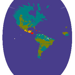
The Fire (HSC) product contains four images: one in the form of a fire mask and the other three with pixel values identifying fire temperature, fire area, and fire radiative power. The ABI L2+ FHS metadata mask assigns a flag to every earth-navigated pixel that … abi fdc fire goes goes-19 goes-east -
GlobFire Daily Fire Event Detection Based on MCD64A1
Fire boundaries based on the MODIS dataset MCD64A1. The data were computed based on an algorithm that relies on encoding in a graph structure a space-time relationship among patches of burned areas. Each fire has a unique number identifying the event. area burnt disaster fire globfire mcd64a1 -
GlobFire Final Fire Event Detection Based on MCD64A1

Fire boundaries based on the MODIS dataset MCD64A1. The data were computed based on an algorithm that relies on encoding in a graph structure a space-time relationship among patches of burned areas. Each fire has a unique number identifying the event. area burnt disaster fire globfire mcd64a1 -
LANDFIRE BPS (Biophysical Settings) v1.4.0

LANDFIRE (LF), Landscape Fire and Resource Management Planning Tools, is a shared program between the wildland fire management programs of the U.S. Department of Agriculture's Forest Service, U.S. Department of the Interior's Geological Survey, and The Nature Conservancy. LANDFIRE (LF) layers are created using predictive … doi fire forest-biomass landfire nature-conservancy usda -
LANDFIRE ESP AK (Environmental Site Potential) v1.2.0
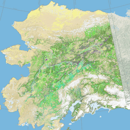
LANDFIRE (LF), Landscape Fire and Resource Management Planning Tools, is a shared program between the wildland fire management programs of the U.S. Department of Agriculture's Forest Service, U.S. Department of the Interior's Geological Survey, and The Nature Conservancy. LANDFIRE (LF) layers are created using predictive … doi fire forest-biomass landfire nature-conservancy usda -
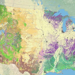
LANDFIRE ESP CONUS (Environmental Site Potential) v1.2.0

LANDFIRE (LF), Landscape Fire and Resource Management Planning Tools, is a shared program between the wildland fire management programs of the U.S. Department of Agriculture's Forest Service, U.S. Department of the Interior's Geological Survey, and The Nature Conservancy. LANDFIRE (LF) layers are created using predictive … doi fire forest-biomass landfire nature-conservancy usda -
LANDFIRE ESP HI (Environmental Site Potential) v1.2.0
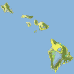
LANDFIRE (LF), Landscape Fire and Resource Management Planning Tools, is a shared program between the wildland fire management programs of the U.S. Department of Agriculture's Forest Service, U.S. Department of the Interior's Geological Survey, and The Nature Conservancy. LANDFIRE (LF) layers are created using predictive … doi fire forest-biomass landfire nature-conservancy usda -
LANDFIRE EVC (Existing Vegetation Cover) v1.4.0

LANDFIRE (LF), Landscape Fire and Resource Management Planning Tools, is a shared program between the wildland fire management programs of the U.S. Department of Agriculture's Forest Service, U.S. Department of the Interior's Geological Survey, and The Nature Conservancy. LANDFIRE (LF) layers are created using predictive … doi fire forest-biomass landfire nature-conservancy usda -
LANDFIRE EVH (Existing Vegetation Height) v1.4.0
LANDFIRE (LF), Landscape Fire and Resource Management Planning Tools, is a shared program between the wildland fire management programs of the U.S. Department of Agriculture's Forest Service, U.S. Department of the Interior's Geological Survey, and The Nature Conservancy. LANDFIRE (LF) layers are created using predictive … doi fire forest-biomass landfire nature-conservancy usda -
LANDFIRE EVT (Existing Vegetation Type) v1.4.0

LANDFIRE (LF), Landscape Fire and Resource Management Planning Tools, is a shared program between the wildland fire management programs of the U.S. Department of Agriculture's Forest Service, U.S. Department of the Interior's Geological Survey, and The Nature Conservancy. LANDFIRE (LF) layers are created using predictive … doi fire forest-biomass landfire nature-conservancy usda -
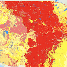
LANDFIRE FRG (Fire Regime Groups) v1.2.0

LANDFIRE (LF), Landscape Fire and Resource Management Planning Tools, is a shared program between the wildland fire management programs of the U.S. Department of Agriculture's Forest Service, U.S. Department of the Interior's Geological Survey, and The Nature Conservancy. Landfire (LF) Historical fire regimes, intervals, and … doi fire landfire nature-conservancy usda usgs -
LANDFIRE MFRI (Mean Fire Return Interval) v1.2.0

LANDFIRE (LF), Landscape Fire and Resource Management Planning Tools, is a shared program between the wildland fire management programs of the U.S. Department of Agriculture's Forest Service, U.S. Department of the Interior's Geological Survey, and The Nature Conservancy. Landfire (LF) Historical fire regimes, intervals, and … doi fire landfire nature-conservancy usda usgs -
LANDFIRE PLS (Percent Low-severity Fire) v1.2.0

LANDFIRE (LF), Landscape Fire and Resource Management Planning Tools, is a shared program between the wildland fire management programs of the U.S. Department of Agriculture's Forest Service, U.S. Department of the Interior's Geological Survey, and The Nature Conservancy. Landfire (LF) Historical fire regimes, intervals, and … doi fire landfire nature-conservancy usda usgs -
LANDFIRE PMS (Percent of Mixed-severity Fire) v1.2.0

LANDFIRE (LF), Landscape Fire and Resource Management Planning Tools, is a shared program between the wildland fire management programs of the U.S. Department of Agriculture's Forest Service, U.S. Department of the Interior's Geological Survey, and The Nature Conservancy. Landfire (LF) Historical fire regimes, intervals, and … doi fire landfire nature-conservancy usda usgs -
LANDFIRE PRS (Percent of Replacement-severity Fire) v1.2.0

LANDFIRE (LF), Landscape Fire and Resource Management Planning Tools, is a shared program between the wildland fire management programs of the U.S. Department of Agriculture's Forest Service, U.S. Department of the Interior's Geological Survey, and The Nature Conservancy. Landfire (LF) Historical fire regimes, intervals, and … doi fire landfire nature-conservancy usda usgs -
LANDFIRE SClass (Succession Classes) v1.4.0
LANDFIRE (LF), Landscape Fire and Resource Management Planning Tools, is a shared program between the wildland fire management programs of the U.S. Department of Agriculture's Forest Service, U.S. Department of the Interior's Geological Survey, and The Nature Conservancy. Landfire (LF) Historical fire regimes, intervals, and … doi fire landfire nature-conservancy usda usgs -
LANDFIRE VCC (Vegetation Condition Class) v1.4.0

LANDFIRE (LF), Landscape Fire and Resource Management Planning Tools, is a shared program between the wildland fire management programs of the U.S. Department of Agriculture's Forest Service, U.S. Department of the Interior's Geological Survey, and The Nature Conservancy. Landfire (LF) Historical fire regimes, intervals, and … doi fire landfire nature-conservancy usda usgs -
LANDFIRE VDep (Vegetation Departure) v1.4.0

LANDFIRE (LF), Landscape Fire and Resource Management Planning Tools, is a shared program between the wildland fire management programs of the U.S. Department of Agriculture's Forest Service, U.S. Department of the Interior's Geological Survey, and The Nature Conservancy. Landfire (LF) Historical fire regimes, intervals, and … doi fire landfire nature-conservancy usda usgs -
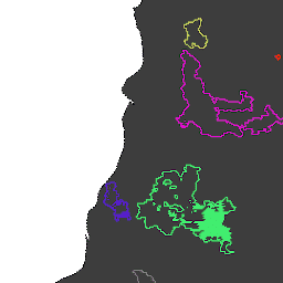
MTBS Burned Area Boundaries
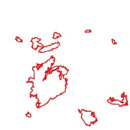
The Monitoring Trends in Burn Severity (MTBS) burned area boundaries dataset contains the extent polygons of the burned areas of all currently completed MTBS fires for the continental United States, Alaska, Hawaii, and Puerto Rico. Below NBR stands for "Normalized Burn Ratio", while dNBR stands … eros fire gtac mtbs table usda -
Wildfire Risk to Communities v0
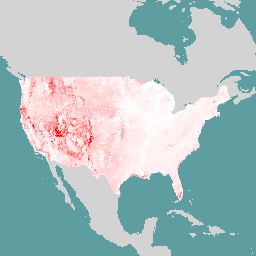
This dataset depicts components of wildfire risk for all lands in the United States that: 1) are landscape-wide (i.e., measurable at every pixel across the landscape); and 2) represent in situ risk - risk at the location where the adverse effects take place on the … burn fire usda wildfire