Page Summary
-
The United States Census Bureau releases the TIGER geodatabase containing various census boundaries and road data.
-
TIGER datasets include 2020 and 2010 census blocks and block groups, 5-digit ZIP Code Tabulation Areas, and 2016 and 2018 county and state boundaries.
-
The Conservation Science Partners (CSP) Ecologically Relevant Geomorphology (ERGo) Datasets provide detailed, multi-scale data on landforms and physiographic characteristics for the US, including Lithology, CHILI, Landforms, and Topographic and Physiographic Diversity.
-
USFS TreeMap versions 2020 and 2022 offer detailed spatial information on forest characteristics across the forested areas of the United States, including tree count, biomass, and carbon.
-
TIGER: 2020 Tabulation (Census) Block
The United States Census Bureau regularly releases a geodatabase named TIGER. This dataset contains the 2020 census blocks, roughly equivalent to a city block. There are just over eight million polygon features covering the United States, the District of Columbia, Puerto Rico, and the Island … census city infrastructure-boundaries neighborhood table tiger -
TIGER: US Census Block Groups (BG) 2010

The United States Census Bureau regularly releases a geodatabase named TIGER. This dataset contains the 2010 census block groups, which is a cluster of blocks within the same census tract that have the same first digit of their four-digit census block number. There are just … census city infrastructure-boundaries neighborhood table tiger -
TIGER: US Census Block Groups (BG) 2020
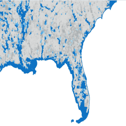
The United States Census Bureau regularly releases a geodatabase named TIGER. This dataset contains the 2020 census block groups, which is a cluster of blocks within the same census tract that have the same first digit of their four-digit census block number. There are just … census city infrastructure-boundaries neighborhood table tiger -
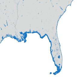
TIGER: US Census Blocks
The United States Census Bureau regularly releases a geodatabase named TIGER. This dataset contains the 2010 census blocks, roughly equivalent to a city block. There are just over 11 million polygon features covering the United States, the District of Columbia, Puerto Rico, and the Island … census city infrastructure-boundaries neighborhood table tiger -
TIGER: US Census Counties 2016
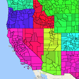
The United States Census Bureau TIGER dataset contains the 2016 boundaries for primary legal divisions of US states. In most states, these entities are termed "counties". In Louisiana, these divisions are known as "parishes". Alaska has governmental entities called "boroughs" which fill a similar governmental … census county infrastructure-boundaries table tiger us -
TIGER: US Census Counties 2018

The United States Census Bureau TIGER dataset contains the 2018 boundaries for primary legal divisions of US states. In most states, these entities are termed "counties". In Louisiana, these divisions are known as "parishes". Alaska has governmental entities called "boroughs" which fill a similar governmental … census county infrastructure-boundaries table tiger us -
TIGER: US Census Roads
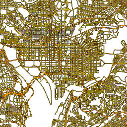
This United States Census Bureau TIGER dataset contains all road segments from the 2016 release, containing more than 19 million individual line features covering the United States, the District of Columbia, Puerto Rico, and the Island Areas. Each feature represents a road segment geometry (a … census infrastructure-boundaries roads table tiger us -
TIGER: US Census States 2016
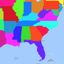
The United States Census Bureau TIGER dataset contains the 2016 boundaries for the primary governmental divisions of the United States. In addition to the fifty states, the Census Bureau treats the District of Columbia, Puerto Rico, and each of the island areas (American Samoa, the … census infrastructure-boundaries state states table tiger -
TIGER: US Census States 2018

The United States Census Bureau TIGER dataset contains the 2018 boundaries for the primary governmental divisions of the United States. In addition to the fifty states, the Census Bureau treats the District of Columbia, Puerto Rico, and each of the island areas (American Samoa, the … census infrastructure-boundaries state states table tiger -
TIGER: US Census Tracts
The United States Census Bureau regularly releases a geodatabase named TIGER. This dataset contains the 2020 census tracts. Tract areas vary tremendously, but in urban areas are roughly equivalent to a neighborhood. There are just over 85000 polygon features covering the United States, the District … census city infrastructure-boundaries neighborhood table tiger -
TIGER: US Census Tracts Demographic - Profile 1
The United States Census Bureau regularly releases a geodatabase named TIGER. This table contains the 2010 census Demographic Profile 1 values aggregated by census tract. Tract areas vary tremendously, but in urban areas are roughly equivalent to a neighborhood. There are about 74,000 polygon features … census infrastructure-boundaries table tiger us -
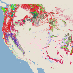
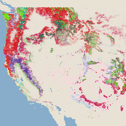
US Lithology
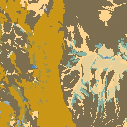
The Lithology dataset provides classes of the general types of parent material of soil on the surface. It is not derived from any DEM. The Conservation Science Partners (CSP) Ecologically Relevant Geomorphology (ERGo) Datasets, Landforms and Physiography contain detailed, multi-scale data on landforms and physiographic … aspect csp elevation elevation-topography ergo geophysical -
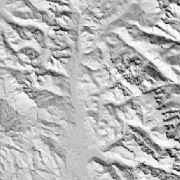
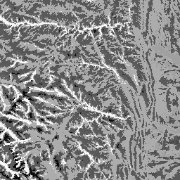
US NED CHILI (Continuous Heat-Insolation Load Index)
CHILI is a surrogate for effects of insolation and topographic shading on evapotranspiration represented by calculating insolation at early afternoon, sun altitude equivalent to equinox. It is based on the USGS's 10m NED DEM (available in EE as USGS/NED). The Conservation Science Partners (CSP) Ecologically … aspect csp elevation elevation-topography ergo geophysical -
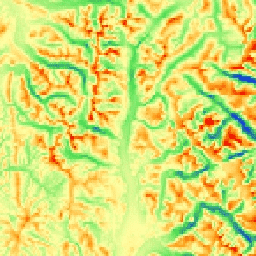
US NED Landforms
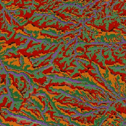
The ALOS Landform dataset provides landform classes created by combining the Continuous Heat-Insolation Load Index (CHILI) and the multi-scale Topographic Position Index (mTPI) datasets. It is based on the USGS's 10m NED DEM (available in EE as USGS/NED). The Conservation Science Partners (CSP) Ecologically Relevant … aspect csp elevation elevation-topography ergo geophysical -
US NED Physiographic Diversity
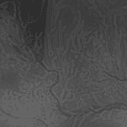
The Physiographic Diversity dataset provides an index of the diversity of physiographic types. It was calculated using the Shannon diversity index at multiple scales (km): 115.8, 89.9, 35.5, 13.1, 5.6, 2.8, and 1.2. It is based on the USGS's 10m NED DEM (available in EE … aspect csp elevation elevation-topography ergo geophysical -
US NED Topographic Diversity
Topographic diversity (D) is a surrogate variable that represents the variety of temperature and moisture conditions available to species as local habitats. It expresses the logic that a higher variety of topo-climate niches should support higher diversity (especially plant) and support species persistence given climatic … aspect csp elevation elevation-topography ergo geophysical -
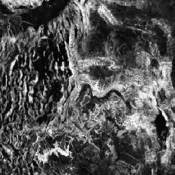
US NED mTPI (Multi-Scale Topographic Position Index)
The mTPI distinguishes ridge from valley forms. It is calculated using elevation data for each location subtracted by the mean elevation within a neighborhood. mTPI uses moving windows of radius (km): 115.8, 89.9, 35.5, 13.1, 5.6, 2.8, and 1.2. It is based on the USGS's … aspect csp elevation elevation-topography ergo geophysical -
US Physiography
The Physiography dataset represents the spatial intersection of landforms (available in EE as ERGo/1_0/US/landforms) and lithology (available in EE as ERGo/1_0/US/lithology) data layers. It provides 247 unique combinations out of a possible 270. The values for each type are formed by concatenating the landform and … aspect csp elevation elevation-topography ergo geophysical -
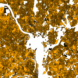
USFS TreeMap v2020
This product is part of the TreeMap data suite. It provides detailed spatial information on forest characteristics including number of live and dead trees, biomass, and carbon across the entire forested extent of the United States in 2020. TreeMap v2020 contains 22-band 30 x 30m … aboveground biomass carbon climate-change conus forest -
USFS TreeMap v2022
This product is part of the TreeMap data suite. It provides detailed spatial information on forest characteristics including number of live and dead trees, biomass, and carbon across the entire forested extent of the United States in 2022. TreeMap v2022 contains 22-band 30 x 30m … aboveground biomass carbon climate-change conus forest