AI-generated Key Takeaways
-
Global accessibility maps measure land-based travel time to cities and healthcare facilities.
-
The datasets cover areas between 85 degrees north and 60 degrees south.
-
Accessibility maps and friction surfaces are available for nominal years 2015 and 2019.
-
Some datasets include "walking-only" travel times or speeds.
-
Accessibility to Cities 2015
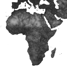
This global accessibility map enumerates land-based travel time to the nearest densely-populated area for all areas between 85 degrees north and 60 degrees south for a nominal year 2015. Densely-populated areas are defined as contiguous areas with 1,500 or more inhabitants per square kilometer or … accessibility jrc map oxford population twente -
Accessibility to Healthcare 2019

This global accessibility map enumerates land-based travel time (in minutes) to the nearest hospital or clinic for all areas between 85 degrees north and 60 degrees south for a nominal year 2019. It also includes "walking-only" travel time, using non-motorized means of transportation only. Major … accessibility jrc map oxford population twente -
Global Friction Surface 2019
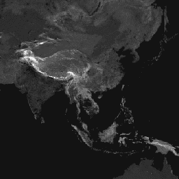
This global friction surface enumerates land-based travel speed for all land pixels between 85 degrees north and 60 degrees south for a nominal year 2019. It also includes "walking-only" travel speed, using non-motorized means of transportation only. This map was produced through a collaboration between … accessibility jrc map oxford population twente