Page Summary
-
The DESS China Terrace Map v1 is a 30m resolution map of China's terraces in 2018, developed using supervised pixel-based classification on Google Earth Engine with an overall accuracy of 94%.
-
The Tsinghua FROM-GLC Year of Change to Impervious Surface dataset provides annual global impervious surface area change information from 1985 to 2018 at 30m resolution.
-
DESS China Terrace Map v1
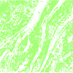
This dataset is a China terrace map at 30 m resolution in 2018. It was developed through supervised pixel-based classification using multisource and multi-temporal data based on the Google Earth Engine platform. The overall accuracy and kappa coefficient achieved 94% and 0.72, respectively. This first … agriculture landcover landuse landuse-landcover tsinghua -
Tsinghua FROM-GLC Year of Change to Impervious Surface
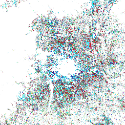
This dataset contains annual change information of global impervious surface area from 1985 to 2018 at a 30m resolution. Change from pervious to impervious was determined using a combined approach of supervised classification and temporal consistency checking. Impervious pixels are defined as above 50% impervious. … built population tsinghua urban