Page Summary
-
The content describes various global and regional digital elevation models (DEMs) and related datasets, including those focused on land topography, ocean bathymetry, and hydrographic information.
-
Several datasets are based on SRTM and ALOS DEMs, providing different resolutions and processing enhancements like void-filling or error removal.
-
Some datasets are specifically designed for ecological and hydrological applications, offering products like landform classes, topographic diversity, and hydrographically conditioned DEMs.
-
Datasets from organizations such as JAXA, NRCan, NOAA, USGS, CSP, NASA, and WWF are included, covering areas like global, Canadian, and US territories.
-
The datasets offer varying horizontal resolutions, from 1 arc-second (approximately 30 meters) to 1 arc-minute and 30 arc-seconds.
-
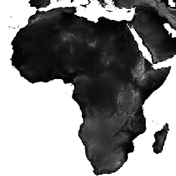
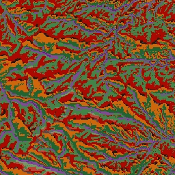
ALOS DSM: Global 30m v4.1
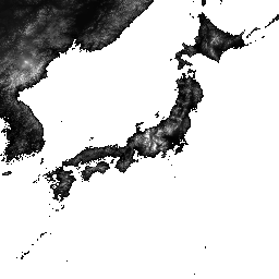
ALOS World 3D - 30m (AW3D30) is a global digital surface model (DSM) dataset with a horizontal resolution of approximately 30 meters (1 arcsec mesh). The dataset is based on the DSM dataset (5-meter mesh version) of the World 3D Topographic Data. More details are … alos dem elevation elevation-topography geophysical jaxa -
Canadian Digital Elevation Model
The Canadian Digital Elevation Model (CDEM) is part of Natural Resources Canada's (NRCan) altimetry system and stems from the existing Canadian Digital Elevation Data (CDED). In these data, elevations can be either ground or reflective surface elevations. The CDEM is comprised of multiple DEMs with … canada dem elevation elevation-topography geophysical topography -
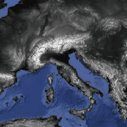
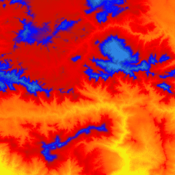
ETOPO1: Global 1 Arc-Minute Elevation
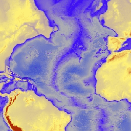
ETOPO1 is a 1 arc-minute global relief model of Earth''s surface that integrates land topography and ocean bathymetry. It was built from numerous global and regional data sets. It contains two elevation bands: ice_surface and bedrock. bedrock dem elevation elevation-topography geophysical ice -
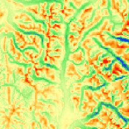
GMTED2010: Global Multi-resolution Terrain Elevation Data 2010
The Global Multi-resolution Terrain Elevation Data 2010 (GMTED2010) dataset contains elevation data for the globe collected from various sources at 7.5 arc-seconds resolution. More details are available in the dataset report. The primary source dataset for GMTED2010 is NGA''s SRTM Digital Terrain Elevation Data (DTED®, … dem elevation elevation-topography geophysical srtm topography -
GTOPO30: Global 30 Arc-Second Elevation
GTOPO30 is a global digital elevation model (DEM) with a horizontal grid spacing of 30 arc seconds (approximately 1 kilometer). The DEM was derived from several raster and vector sources of topographic information. Completed in late 1996, GTOPO30 was developed over a three-year period through … dem elevation elevation-topography geophysical nasa topography -
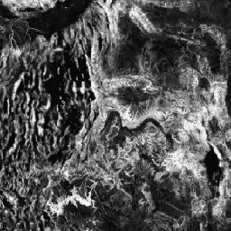
Global ALOS CHILI (Continuous Heat-Insolation Load Index)
CHILI is a surrogate for effects of insolation and topographic shading on evapotranspiration represented by calculating insolation at early afternoon, sun altitude equivalent to equinox. It is based on the 30m "AVE" band of JAXA's ALOS DEM (available in EE as JAXA/ALOS/AW3D30_V1_1). The Conservation Science … aspect csp elevation elevation-topography ergo geophysical -
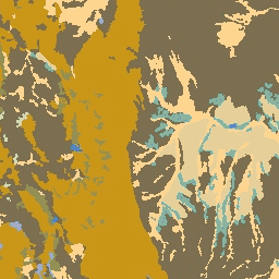
Global ALOS Landforms

The ALOS Landform dataset provides landform classes created by combining the Continuous Heat-Insolation Load Index (ALOS CHILI) and the multi-scale Topographic Position Index (ALOS mTPI) datasets. It is based on the 30m "AVE" band of JAXA's ALOS DEM (available in EE as JAXA/ALOS/AW3D30_V1_1). The Conservation … aspect csp elevation elevation-topography ergo geophysical -
Global ALOS Topographic Diversity

Topographic diversity (D) is a surrogate variable that represents the variety of temperature and moisture conditions available to species as local habitats. It expresses the logic that a higher variety of topo-climate niches should support higher diversity (especially plant) and support species persistence given climatic … aspect csp elevation elevation-topography ergo geophysical -
Global ALOS mTPI (Multi-Scale Topographic Position Index)

The mTPI distinguishes ridge from valley forms. It is calculated using elevation data for each location subtracted by the mean elevation within a neighborhood. mTPI uses moving windows of radius (km): 115.8, 89.9, 35.5, 13.1, 5.6, 2.8, and 1.2. It is based on the 30m … aspect csp elevation elevation-topography ergo geophysical -
Global SRTM CHILI (Continuous Heat-Insolation Load Index)

CHILI is a surrogate for effects of insolation and topographic shading on evapotranspiration represented by calculating insolation at early afternoon, sun altitude equivalent to equinox. It is based on the 30m SRTM DEM (available in EE as USGS/SRTMGL1_003). The Conservation Science Partners (CSP) Ecologically Relevant … aspect csp elevation elevation-topography ergo geophysical -
Global SRTM Landforms

The SRTM Landform dataset provides landform classes created by combining the Continuous Heat-Insolation Load Index (SRTM CHILI) and the multi-scale Topographic Position Index (SRTM mTPI) datasets. It is based on the 30m SRTM DEM (available in EE as USGS/SRTMGL1_003). The Conservation Science Partners (CSP) Ecologically … aspect csp elevation elevation-topography ergo geophysical -
Global SRTM Topographic Diversity
Topographic diversity (D) is a surrogate variable that represents the variety of temperature and moisture conditions available to species as local habitats. It expresses the logic that a higher variety of topo-climate niches should support higher diversity (especially plant) and support species persistence given climatic … aspect csp elevation elevation-topography ergo geophysical -
Global SRTM mTPI (Multi-Scale Topographic Position Index)
The mTPI distinguishes ridge from valley forms. It is calculated using elevation data for each location subtracted by the mean elevation within a neighborhood. mTPI uses moving windows of radius (km): 115.8, 89.9, 35.5, 13.1, 5.6, 2.8, and 1.2. It is based on the 30m … aspect csp elevation elevation-topography ergo geophysical -
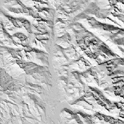
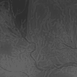
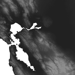
MERIT DEM: Multi-Error-Removed Improved-Terrain DEM
MERIT DEM a high accuracy global DEM at 3 arc second resolution (~90 m at the equator) produced by eliminating major error components from existing DEMs (NASA SRTM3 DEM, JAXA AW3D DEM, Viewfinder Panoramas DEM). MERIT DEM separates absolute bias, stripe noise, speckle noise and … dem elevation elevation-topography merit topography -
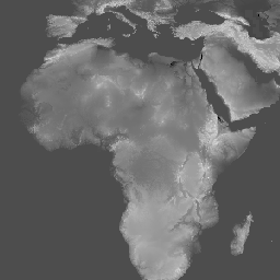
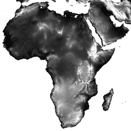
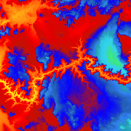
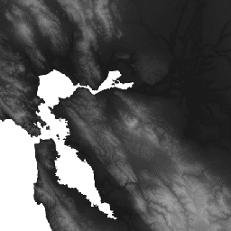
NASA SRTM Digital Elevation 30m
The Shuttle Radar Topography Mission (SRTM, see Farr et al. 2007) digital elevation data is an international research effort that obtained digital elevation models on a near-global scale. This SRTM V3 product (SRTM Plus) is provided by NASA JPL at a resolution of 1 arc-second … dem elevation elevation-topography geophysical nasa srtm -
NASADEM: NASA 30m Digital Elevation Model
NASADEM is a reprocessing of SRTM data, with improved accuracy by incorporating auxiliary data from ASTER GDEM, ICESat GLAS, and PRISM datasets. The most significant processing improvements involve void reduction through improved phase unwrapping and using ICESat GLAS data for control. Documentation: User's Guide dem elevation elevation-topography geophysical nasa srtm -
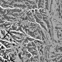
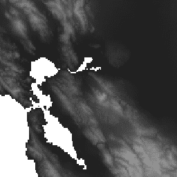
SRTM Digital Elevation Data Version 4

The Shuttle Radar Topography Mission (SRTM) digital elevation dataset was originally produced to provide consistent, high-quality elevation data at near global scope. This version of the SRTM digital elevation data has been processed to fill data voids, and to facilitate its ease of use. dem elevation elevation-topography geophysical srtm topography -
US Lithology
The Lithology dataset provides classes of the general types of parent material of soil on the surface. It is not derived from any DEM. The Conservation Science Partners (CSP) Ecologically Relevant Geomorphology (ERGo) Datasets, Landforms and Physiography contain detailed, multi-scale data on landforms and physiographic … aspect csp elevation elevation-topography ergo geophysical -
US NED CHILI (Continuous Heat-Insolation Load Index)

CHILI is a surrogate for effects of insolation and topographic shading on evapotranspiration represented by calculating insolation at early afternoon, sun altitude equivalent to equinox. It is based on the USGS's 10m NED DEM (available in EE as USGS/NED). The Conservation Science Partners (CSP) Ecologically … aspect csp elevation elevation-topography ergo geophysical -
US NED Landforms
The ALOS Landform dataset provides landform classes created by combining the Continuous Heat-Insolation Load Index (CHILI) and the multi-scale Topographic Position Index (mTPI) datasets. It is based on the USGS's 10m NED DEM (available in EE as USGS/NED). The Conservation Science Partners (CSP) Ecologically Relevant … aspect csp elevation elevation-topography ergo geophysical -
US NED Physiographic Diversity
The Physiographic Diversity dataset provides an index of the diversity of physiographic types. It was calculated using the Shannon diversity index at multiple scales (km): 115.8, 89.9, 35.5, 13.1, 5.6, 2.8, and 1.2. It is based on the USGS's 10m NED DEM (available in EE … aspect csp elevation elevation-topography ergo geophysical -
US NED Topographic Diversity

Topographic diversity (D) is a surrogate variable that represents the variety of temperature and moisture conditions available to species as local habitats. It expresses the logic that a higher variety of topo-climate niches should support higher diversity (especially plant) and support species persistence given climatic … aspect csp elevation elevation-topography ergo geophysical -
US NED mTPI (Multi-Scale Topographic Position Index)

The mTPI distinguishes ridge from valley forms. It is calculated using elevation data for each location subtracted by the mean elevation within a neighborhood. mTPI uses moving windows of radius (km): 115.8, 89.9, 35.5, 13.1, 5.6, 2.8, and 1.2. It is based on the USGS's … aspect csp elevation elevation-topography ergo geophysical -
US Physiography
The Physiography dataset represents the spatial intersection of landforms (available in EE as ERGo/1_0/US/landforms) and lithology (available in EE as ERGo/1_0/US/lithology) data layers. It provides 247 unique combinations out of a possible 270. The values for each type are formed by concatenating the landform and … aspect csp elevation elevation-topography ergo geophysical -
USGS 3DEP 10m National Map Seamless (1/3 Arc-Second)
This is the seamless 3DEP DEM dataset for the U.S. with full coverage of the 48 conterminous states, Hawaii, and U.S. territories. Alaska coverage is partially available now and is being expanded to statewide coverage as part of the Alaska Mapping Initiative. Ground spacing is … 3dep dem elevation elevation-topography geophysical topography -
USGS 3DEP 1m National Map
This is a tiled collection of images with 1m pixel size from the 3D Elevation Program (3DEP). The 3DEP data holdings serve as the elevation layer of The National Map and provide foundational elevation information for earth science studies and mapping applications in the United … 3dep dem elevation elevation-topography geophysical topography -
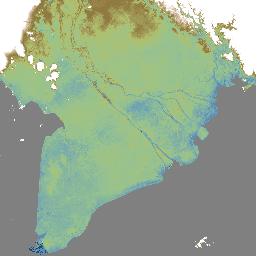
WWF HydroSHEDS Hydrologically Conditioned DEM, 15 Arc-Seconds
HydroSHEDS is a mapping product that provides hydrographic information for regional and global-scale applications in a consistent format. It offers a suite of geo-referenced datasets (vector and raster) at various scales, including river networks, watershed boundaries, drainage directions, and flow accumulations. HydroSHEDS is based on … conditioned dem elevation geophysical hydrography hydrology -
WWF HydroSHEDS Hydrologically Conditioned DEM, 3 Arc-Seconds
HydroSHEDS is a mapping product that provides hydrographic information for regional and global-scale applications in a consistent format. It offers a suite of geo-referenced datasets (vector and raster) at various scales, including river networks, watershed boundaries, drainage directions, and flow accumulations. HydroSHEDS is based on … conditioned dem elevation geophysical hydrography hydrology -
WWF HydroSHEDS Hydrologically Conditioned DEM, 30 Arc-Seconds
HydroSHEDS is a mapping product that provides hydrographic information for regional and global-scale applications in a consistent format. It offers a suite of geo-referenced datasets (vector and raster) at various scales, including river networks, watershed boundaries, drainage directions, and flow accumulations. HydroSHEDS is based on … conditioned dem elevation geophysical hydrography hydrology -
WWF HydroSHEDS Void-Filled DEM, 3 Arc-Seconds
HydroSHEDS is a mapping product that provides hydrographic information for regional and global-scale applications in a consistent format. It offers a suite of geo-referenced datasets (vector and raster) at various scales, including river networks, watershed boundaries, drainage directions, and flow accumulations. HydroSHEDS is based on … dem elevation geophysical hydrography hydrology hydrosheds