Not: ASTER cihazıyla ilgili teknik sorunlar nedeniyle 28 Kasım 2024 ile 16 Ocak 2025 tarihleri arasında veri toplama işleminde boşluk vardır. Daha fazla bilgi için USGS duyurusuna bakın. Gelişmiş Uzay Kaynaklı Termal Emisyon ve Yansıma Radyometresi (ASTER), …
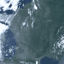
Ocean and Land Color Instrument (OLCI) Earth Observation Full Resolution (EFR) veri kümesi, 21 spektral bantta atmosferin üst kısmındaki ışınları içerir.Merkez dalga boyları 0,4 µm ile 1,02 µm arasında değişir.Uzamsal çözünürlük 300 m olup dünya çapında kapsama alanı yaklaşık 2 günde bir güncellenir. OLCI, …
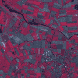
Landsat 4 TM Collection 2 Tier 1, atmosferin en üst katmanında (TOA) yansıma için kalibre edilmiştir. Kalibrasyon katsayıları, görüntü meta verilerinden çıkarılır. TOA hesaplamasıyla ilgili ayrıntılar için Chander ve diğerleri (2009) çalışmasına bakın.
Landsat 4 TM Collection 2 Tier 2, atmosferin en üst katmanında (TOA) kalibre edilmiş yansıtma. Kalibrasyon katsayıları, görüntü meta verilerinden çıkarılır. TOA hesaplamasıyla ilgili ayrıntılar için Chander ve diğerleri (2009) çalışmasına bakın.
Landsat 5 TM Collection 2 Tier 1, atmosferin en üst katmanında (TOA) yansıma için kalibre edilmiştir. Kalibrasyon katsayıları, görüntü meta verilerinden çıkarılır. TOA hesaplamasıyla ilgili ayrıntılar için Chander ve diğerleri (2009) çalışmasına bakın.
Landsat 5 TM Collection 2 Tier 2, atmosferin en üst katmanında (TOA) kalibre edilmiş yansıtma. Kalibrasyon katsayıları, görüntü meta verilerinden çıkarılır. TOA hesaplamasıyla ilgili ayrıntılar için Chander ve diğerleri (2009) çalışmasına bakın.
Landsat 7 Collection 2 Tier 1, atmosferin en üst katmanındaki (TOA) yansıtma için kalibre edilmiştir. Kalibrasyon katsayıları, görüntü meta verilerinden çıkarılır. TOA hesaplamasıyla ilgili ayrıntılar için Chander ve diğerleri (2009) çalışmasına bakın. Landsat 7'nin yörüngesinin 2017'den beri daha erken bir edinme zamanına doğru kaydığını unutmayın.
Landsat 7 Collection 2 Tier 1 ve atmosfer üstü (TOA) yansıtma için kalibre edilmiş gerçek zamanlı veriler. Kalibrasyon katsayıları, görüntü meta verilerinden çıkarılır. TOA hesaplamasıyla ilgili ayrıntılar için Chander ve diğerleri (2009) çalışmasına bakın. Landsat 7'nin yörüngesinin daha erken bir edinme zamanına doğru kaydığını unutmayın.
Landsat 7 Collection 2 Tier 2, atmosferin en üst katmanında (TOA) yansıtma için kalibre edilmiştir. Kalibrasyon katsayıları, görüntü meta verilerinden çıkarılır. TOA hesaplamasıyla ilgili ayrıntılar için Chander ve diğerleri (2009) çalışmasına bakın. Landsat 7'nin yörüngesinin 2017'den beri daha erken bir edinme zamanına doğru kaydığını unutmayın.
Landsat 8 Collection 2 Tier 1, atmosferin en üst katmanında (TOA) yansıtma için kalibre edilmiştir. Kalibrasyon katsayıları, görüntü meta verilerinden çıkarılır. TOA hesaplamasıyla ilgili ayrıntılar için Chander ve diğerleri (2009) çalışmasına bakın. Mevcut en yüksek veri kalitesine sahip Landsat sahneleri 1. katmana yerleştirilir ve ...
Landsat 8 Collection 2 Tier 1 ve atmosfer üstü (TOA) yansıtma için kalibre edilmiş gerçek zamanlı veriler. Kalibrasyon katsayıları, görüntü meta verilerinden çıkarılır. TOA hesaplamasıyla ilgili ayrıntılar için Chander ve diğerleri (2009) çalışmasına bakın. Mevcut en yüksek veri kalitesine sahip Landsat sahneleri 1. Katman'a yerleştirilir.
Landsat 8 Collection 2 Tier 2 kalibre edilmiş atmosferin en üst katmanındaki (TOA) yansıtma. Kalibrasyon katsayıları, görüntü meta verilerinden çıkarılır. TOA hesaplamasıyla ilgili ayrıntılar için Chander ve diğerleri (2009) çalışmasına bakın. İşleme sırasında 1. katman ölçütlerini karşılamayan sahneler 2. katmana atanır. Bu kapsamda, sistematik …
Landsat 9 Collection 2 Tier 1, atmosfer üstü (TOA) yansıtma için kalibre edilmiştir. Kalibrasyon katsayıları, görüntü meta verilerinden çıkarılır. TOA hesaplamasıyla ilgili ayrıntılar için Chander ve diğerleri (2009) çalışmasına bakın. Mevcut en yüksek veri kalitesine sahip Landsat sahneleri 1. katmana yerleştirilir ve ...
Landsat 9 Collection 2 Tier 2, atmosferin en üst katmanında (TOA) yansıtma için kalibre edilmiştir. Kalibrasyon katsayıları, görüntü meta verilerinden çıkarılır. TOA hesaplamasıyla ilgili ayrıntılar için Chander ve diğerleri (2009) çalışmasına bakın. İşleme sırasında 1. katman ölçütlerini karşılamayan sahneler 2. katmana atanır. Bu kapsamda, sistematik …
[[["Anlaması kolay","easyToUnderstand","thumb-up"],["Sorunumu çözdü","solvedMyProblem","thumb-up"],["Diğer","otherUp","thumb-up"]],[["İhtiyacım olan bilgiler yok","missingTheInformationINeed","thumb-down"],["Çok karmaşık / çok fazla adım var","tooComplicatedTooManySteps","thumb-down"],["Güncel değil","outOfDate","thumb-down"],["Çeviri sorunu","translationIssue","thumb-down"],["Örnek veya kod sorunu","samplesCodeIssue","thumb-down"],["Diğer","otherDown","thumb-down"]],[],[],["Several datasets provide top-of-atmosphere (TOA) reflectance data. Landsat collections (4, 5, 7, 8, and 9) from USGS offer Tier 1 and Tier 2 calibrated TOA reflectance, with Landsat 7's orbit drifting. The Sentinel-3 OLCI dataset provides radiances at 21 spectral bands. ASTER's multispectral data collection is paused due to technical issues. Calibration coefficients are extracted from image metadata, and TOA computation details are available in Chander et al. (2009).\n"]]