Page Summary
-
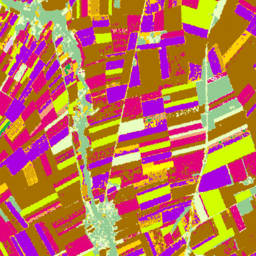
The ESA WorldCereal 10 m v100 product suite provides global annual and seasonal crop maps and confidence levels.
-
The ESA WorldCereal Active Cropland 10 m v100 suite offers global seasonal active cropland markers.
-
The ESA WorldCover 10m products for 2020 (v100) and 2021 (v200) provide global 10m resolution land cover maps with 11 classes.
-
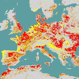
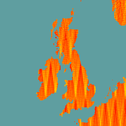
EUCROPMAP provides European crop type maps based on Sentinel and LUCAS Copernicus data for 2018 and 2022.
-
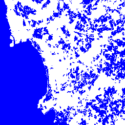
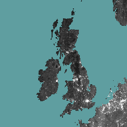
The World Settlement Footprint 2015 dataset is a global 10m resolution binary mask showing the extent of human settlements derived from satellite imagery.
-
Dynamic Surface Water Extent from Sentinel-1 (DSWx-S1) V1
This dataset contains Level-3 Dynamic OPERA surface water extent from Sentinel-1 (DSWX-S1). DSWx-S1 provides near-global geographical mapping of surface water extent over land at a spatial resolution of 30 meters over the Military Grid reference System (MGRS) grid system, with a temporal revisit frequency between … geophysical nasa opera sentinel1-derived surface surface-ground-water -
ESA WorldCereal 10 m v100
The European Space Agency (ESA) WorldCereal 10 m 2021 product suite consists of global-scale annual and seasonal crop maps and their related confidence. They were generated as part of the ESA-WorldCereal project. More information on the content of these products and the methodology used to … agriculture copernicus crop esa global landcover -
ESA WorldCereal Active Cropland 10 m v100

The European Space Agency (ESA) WorldCereal Active Cropland 10 m 2021 product suite contains global-scale seasonal active cropland markers. They were generated as part of the ESA-WorldCereal project. The active cropland products indicate whether or not a pixel identified as temporary crops has been actively … agriculture copernicus crop esa global landcover -
ESA WorldCover 10m v100
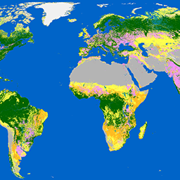
The European Space Agency (ESA) WorldCover 10 m 2020 product provides a global land cover map for 2020 at 10 m resolution based on Sentinel-1 and Sentinel-2 data. The WorldCover product comes with 11 land cover classes and has been generated in the framework of … esa landcover landuse landuse-landcover sentinel1-derived sentinel2-derived -
ESA WorldCover 10m v200

The European Space Agency (ESA) WorldCover 10 m 2021 product provides a global land cover map for 2021 at 10 m resolution based on Sentinel-1 and Sentinel-2 data. The WorldCover product comes with 11 land cover classes and has been generated in the framework of … esa landcover landuse landuse-landcover sentinel1-derived sentinel2-derived -
EUCROPMAP
European crop type maps based on Sentinel-1 and LUCAS Copernicus 2018 in-situ observations for 2018, and a combination of Sentinel-1, Sentinel-2, and auxiliary data with LUCAS Copernicus 2022 observations for 2022. Based on the unique LUCAS 2018 Copernicus in-situ survey, this dataset represents the first … agriculture crop eu jrc lucas sentinel1-derived -
Global Seasonal Sentinel-1 Interferometric Coherence and Backscatter V2019 Backscatter
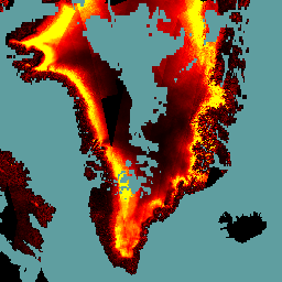
This data set is the first-of-its-kind spatial representation of multi-seasonal, global C-band Synthetic Aperture Radar (SAR) interferometric repeat-pass coherence and backscatter signatures. Coverage comprises land masses and ice sheets from 82 degrees Northern to 79 degrees Southern latitudes. The data set is derived from multi-temporal … backscatter earth-big-data jpl nasa polarization radar -
Global Seasonal Sentinel-1 Interferometric Coherence and Backscatter V2019 Coherence
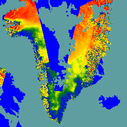
This data set is the first-of-its-kind spatial representation of multi-seasonal, global C-band Synthetic Aperture Radar (SAR) interferometric repeat-pass coherence and backscatter signatures. Coverage comprises land masses and ice sheets from 82 degrees Northern to 79 degrees Southern latitudes. The data set is derived from multi-temporal … earth-big-data jpl nasa polarization radar sar -
Global Seasonal Sentinel-1 Interferometric Coherence and Backscatter V2019 Decay Model Parameters
This data set is the first-of-its-kind spatial representation of multi-seasonal, global C-band Synthetic Aperture Radar (SAR) interferometric repeat-pass coherence and backscatter signatures. Coverage comprises land masses and ice sheets from 82 degrees Northern to 79 degrees Southern latitudes. The data set is derived from multi-temporal … earth-big-data jpl nasa polarization radar sar -
Global Seasonal Sentinel-1 Interferometric Coherence and Backscatter V2019 Incidence Layover Shadow
This data set is the first-of-its-kind spatial representation of multi-seasonal, global C-band Synthetic Aperture Radar (SAR) interferometric repeat-pass coherence and backscatter signatures. Coverage comprises land masses and ice sheets from 82 degrees Northern to 79 degrees Southern latitudes. The data set is derived from multi-temporal … earth-big-data jpl nasa polarization radar sar -
OPERA Radiometric Terrain-Corrected SAR Backscatter from Sentinel-1 Static Layers V1.0
This product contains static radar geometry layers associated with the OPERA Radiometric Terrain Corrected SAR Backscatter from Sentinel-1 dataset. Due to the S1 mission’s narrow orbital tube, radar-geometry layers such as incidence angle, local incidence angle, number of looks, and RTC Area Normalization Factor (ANF) … jpl nasa opera sar satellite-imagery sentinel1-derived -
OPERA Radiometric Terrain-Corrected SAR Backscatter from Sentinel-1 V1.0
This product consists of radar backscatter normalized with respect to the topography. It maps signals related to the physical properties of ground scattering objects, such as surface roughness and soil moisture and/or vegetation. The OPERA RTC-S1 product is derived from Copernicus Sentinel-1 Interferometric Wide (IW) … backscatter jpl nasa opera polarization radar -
Satellite Embedding V1
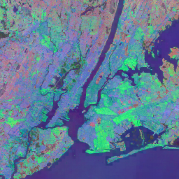
The Google Satellite Embedding dataset is a global, analysis-ready collection of learned geospatial embeddings. Each 10-meter pixel in this dataset is a 64-dimensional representation, or "embedding vector," that encodes temporal trajectories of surface conditions at and around that pixel as measured by various Earth observation … annual global google landsat-derived satellite-imagery sentinel1-derived -
World Settlement Footprint 2015
The World Settlement Footprint (WSF) 2015 is a 10m resolution binary mask outlining the extent of human settlements globally derived by means of 2014-2015 multitemporal Landsat-8 and Sentinel-1 imagery (of which ~217,000 and ~107,000 scenes have been processed, respectively). The temporal dynamics of human settlements … landcover landsat-derived population sentinel1-derived settlement urban