Page Summary
-
Daymet V4 provides gridded estimates of daily weather parameters for Continental North America, Hawaii, and Puerto Rico, derived from meteorological station data and supporting sources.
-
This dataset offers temporally consistent global maps of aboveground and belowground biomass carbon density for 2010 at a 300-m spatial resolution.
-
Daymet V4: Daily Surface Weather and Climatological Summaries
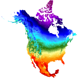
Daymet V4 provides gridded estimates of daily weather parameters for Continental North America, Hawaii, and Puerto Rico (Data for Puerto Rico is available starting in 1950). It is derived from selected meteorological station data and various supporting data sources. Compared to the previous version, Daymet … climate daily daylight flux geophysical nasa -
Global Aboveground and Belowground Biomass Carbon Density Maps
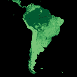
This dataset provides temporally consistent and harmonized global maps of aboveground and belowground biomass carbon density for the year 2010 at a 300-m spatial resolution. The aboveground biomass map integrates land-cover specific, remotely sensed maps of woody, grassland, cropland, and tundra biomass. Input maps were … aboveground biomass carbon density forest forest-biomass