Page Summary
-
The content lists numerous global environmental datasets primarily from NOAA and NASA/NOAA missions, covering weather, climate, and land surface characteristics.
-
Datasets include climate reanalysis, weather forecasts, precipitation and temperature analyses, and detailed satellite-derived products like vegetation indices, fire detection, and nighttime lights.
-
Several products are derived from AVHRR and VIIRS sensors, providing data on surface reflectance, vegetation, sea surface temperature, and atmospheric properties at various spatial and temporal resolutions.
-
The collection also includes historical hurricane data, drought monitoring information, and elevation models.
-
Data availability varies, with some datasets dating back to the 1800s and others offering near real-time or daily updates, with some data types currently having updates paused.
-
CFSR: Climate Forecast System Reanalysis
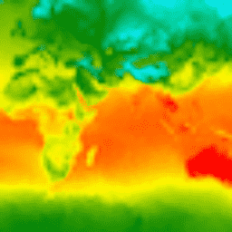
The National Centers for Environmental Prediction (NCEP) Climate Forecast System Reanalysis (CFSR) was designed and executed as a global, high-resolution, coupled atmosphere-ocean-land surface-sea ice system to provide the best estimate of the state of these coupled domains over the 32-year period of record from January … climate daylight flux forecast geophysical ncep -
CFSV2: NCEP Climate Forecast System Version 2, 6-Hourly Products Harmonized
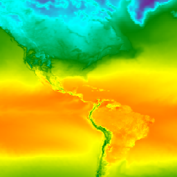
The National Centers for Environmental Prediction (NCEP) Climate Forecast System (CFS) is a fully coupled model representing the interaction between the Earth's atmosphere, oceans, land, and sea ice. CFS was developed at the Environmental Modeling Center (EMC) at NCEP. The operational CFS was upgraded to … climate daylight flux forecast geophysical ncep -
CPC Global Unified Gauge-Based Analysis of Daily Precipitation

The CPC Unified Gauge-Based Analysis of Global Daily Precipitation dataset offers daily precipitation estimates over land from 1979 to the present. Developed by NOAA's Climate Prediction Center (CPC), it leverages an optimal interpolation technique to combine data from a global network of rain gauges, with … daily noaa precipitation weather -
CPC Global Unified Temperature

This dataset provides a gridded analysis of daily surface air temperature over global land areas, including daily maximum (Tmax), minimum (Tmin) temperatures. Spanning from 1979 to the present, the data is presented on 0.5-degree latitude/longitude grids, aligning with the resolution of CPC's gauge-based global daily … climate daily noaa precipitation weather -
ETOPO1: Global 1 Arc-Minute Elevation
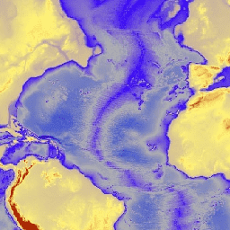
ETOPO1 is a 1 arc-minute global relief model of Earth''s surface that integrates land topography and ocean bathymetry. It was built from numerous global and regional data sets. It contains two elevation bands: ice_surface and bedrock. bedrock dem elevation elevation-topography geophysical ice -
GFS: Global Forecast System 384-Hour Predicted Atmosphere Data
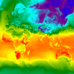
The Global Forecast System (GFS) is a weather forecast model produced by the National Centers for Environmental Prediction (NCEP). The GFS dataset consists of selected model outputs (described below) as gridded forecast variables. The 384-hour forecasts, with 1-hour (up to 120 hours) and 3-hour (after … climate cloud flux forecast geophysical humidity -
GIMMS NDVI From AVHRR Sensors (3rd Generation)

GIMMS NDVI is generated from several NOAA's AVHRR sensors for a global 1/12-degree lat/lon grid. The latest version of the GIMMS NDVI dataset is named NDVI3g (third generation GIMMS NDVI from AVHRR sensors). avhrr nasa ndvi noaa vegetation vegetation-indices -
GOES-16 FDCC Series ABI Level 2 Fire/Hot Spot Characterization CONUS
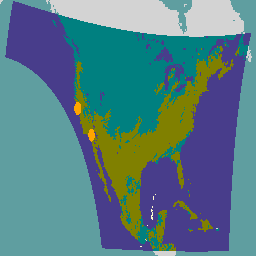
The Fire (HSC) product contains four images: one in the form of a fire mask and the other three with pixel values identifying fire temperature, fire area, and fire radiative power. The ABI L2+ FHS metadata mask assigns a flag to every earth-navigated pixel that … abi fdc fire goes goes-16 goes-east -
GOES-16 FDCF Series ABI Level 2 Fire/Hot Spot Characterization Full Disk
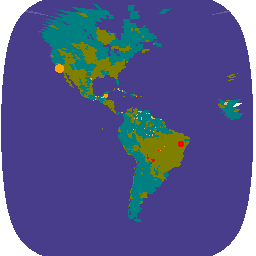
The Fire (HSC) product contains four images: one in the form of a fire mask and the other three with pixel values identifying fire temperature, fire area, and fire radiative power. The ABI L2+ FHS metadata mask assigns a flag to every earth-navigated pixel that … abi fdc fire goes goes-16 goes-east -
GOES-16 MCMIPC Series ABI Level 2 Cloud and Moisture Imagery CONUS
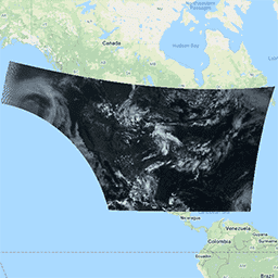
The Cloud and Moisture Imagery products are all at 2km resolution. Bands 1-6 are reflective. The dimensionless "reflectance factor" quantity is normalized by the solar zenith angle. These bands support the characterization of clouds, vegetation, snow/ice, and aerosols. Bands 7-16 are emissive. The brightness temperature … abi atmosphere goes goes-16 goes-east goes-r -
GOES-16 MCMIPF Series ABI Level 2 Cloud and Moisture Imagery Full Disk
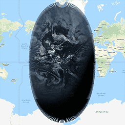
The Cloud and Moisture Imagery products are all at 2km resolution. Bands 1-6 are reflective. The dimensionless "reflectance factor" quantity is normalized by the solar zenith angle. These bands support the characterization of clouds, vegetation, snow/ice, and aerosols. Bands 7-16 are emissive. The brightness temperature … abi atmosphere goes goes-16 goes-east goes-r -
GOES-16 MCMIPM Series ABI Level 2 Cloud and Moisture Imagery Mesoscale
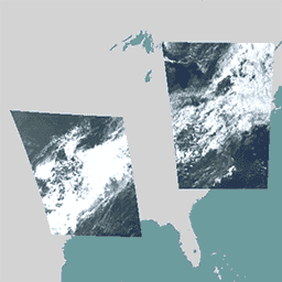
The Cloud and Moisture Imagery products are all at 2km resolution. Bands 1-6 are reflective. The dimensionless "reflectance factor" quantity is normalized by the solar zenith angle. These bands support the characterization of clouds, vegetation, snow/ice, and aerosols. Bands 7-16 are emissive. The brightness temperature … abi atmosphere goes goes-16 goes-east goes-r -
GOES-17 FDCC Series ABI Level 2 Fire/Hot Spot Characterization CONUS
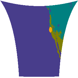
The Fire (HSC) product contains four images: one in the form of a fire mask and the other three with pixel values identifying fire temperature, fire area, and fire radiative power. The ABI L2+ FHS metadata mask assigns a flag to every earth-navigated pixel that … abi fdc fire goes goes-17 goes-s -
GOES-17 FDCF Series ABI Level 2 Fire/Hot Spot Characterization Full Disk
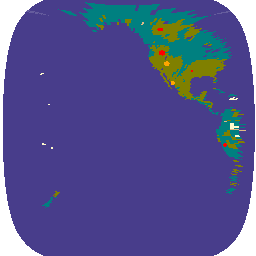
The Fire (HSC) product contains four images: one in the form of a fire mask and the other three with pixel values identifying fire temperature, fire area, and fire radiative power. The ABI L2+ FHS metadata mask assigns a flag to every earth-navigated pixel that … abi fdc fire goes goes-17 goes-s -
GOES-17 MCMIPC Series ABI Level 2 Cloud and Moisture Imagery CONUS
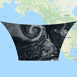
The Cloud and Moisture Imagery products are all at 2km resolution. Bands 1-6 are reflective. The dimensionless "reflectance factor" quantity is normalized by the solar zenith angle. These bands support the characterization of clouds, vegetation, snow/ice, and aerosols. Bands 7-16 are emissive. The brightness temperature … abi atmosphere goes goes-17 goes-s mcmip -
GOES-17 MCMIPF Series ABI Level 2 Cloud and Moisture Imagery Full Disk
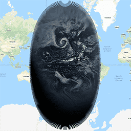
The Cloud and Moisture Imagery products are all at 2km resolution. Bands 1-6 are reflective. The dimensionless "reflectance factor" quantity is normalized by the solar zenith angle. These bands support the characterization of clouds, vegetation, snow/ice, and aerosols. Bands 7-16 are emissive. The brightness temperature … abi atmosphere goes goes-17 goes-s mcmip -
GOES-17 MCMIPM Series ABI Level 2 Cloud and Moisture Imagery Mesoscale

The Cloud and Moisture Imagery products are all at 2km resolution. Bands 1-6 are reflective. The dimensionless "reflectance factor" quantity is normalized by the solar zenith angle. These bands support the characterization of clouds, vegetation, snow/ice, and aerosols. Bands 7-16 are emissive. The brightness temperature … abi atmosphere goes goes-17 goes-s mcmip -
GOES-18 FDCC Series ABI Level 2 Fire/Hot Spot Characterization CONUS

The Fire (HSC) product contains four images: one in the form of a fire mask and the other three with pixel values identifying fire temperature, fire area, and fire radiative power. The ABI L2+ FHS metadata mask assigns a flag to every earth-navigated pixel that … abi fdc fire goes goes-18 goes-t -
GOES-18 FDCF Series ABI Level 2 Fire/Hot Spot Characterization Full Disk
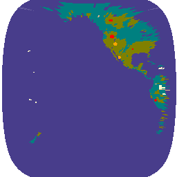
The Fire (HSC) product contains four images: one in the form of a fire mask and the other three with pixel values identifying fire temperature, fire area, and fire radiative power. The ABI L2+ FHS metadata mask assigns a flag to every earth-navigated pixel that … abi fdc fire goes goes-18 goes-t -
GOES-18 MCMIPC Series ABI Level 2 Cloud and Moisture Imagery CONUS

The Cloud and Moisture Imagery products are all at 2km resolution. Bands 1-6 are reflective. The dimensionless "reflectance factor" quantity is normalized by the solar zenith angle. These bands support the characterization of clouds, vegetation, snow/ice, and aerosols. Bands 7-16 are emissive. The brightness temperature … abi atmosphere goes goes-18 goes-t goes-west -
GOES-18 MCMIPF Series ABI Level 2 Cloud and Moisture Imagery Full Disk
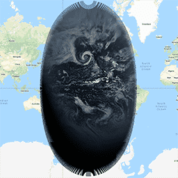
The Cloud and Moisture Imagery products are all at 2km resolution. Bands 1-6 are reflective. The dimensionless "reflectance factor" quantity is normalized by the solar zenith angle. These bands support the characterization of clouds, vegetation, snow/ice, and aerosols. Bands 7-16 are emissive. The brightness temperature … abi atmosphere goes goes-18 goes-t goes-west -
GOES-18 MCMIPM Series ABI Level 2 Cloud and Moisture Imagery Mesoscale
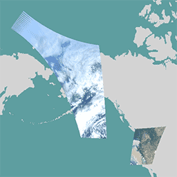
The Cloud and Moisture Imagery products are all at 2km resolution. Bands 1-6 are reflective. The dimensionless "reflectance factor" quantity is normalized by the solar zenith angle. These bands support the characterization of clouds, vegetation, snow/ice, and aerosols. Bands 7-16 are emissive. The brightness temperature … abi atmosphere goes goes-18 goes-t goes-west -
GOES-19 FDCC Series ABI Level 2 Fire/Hot Spot Characterization CONUS

GOES satellites are geostationary weather satellites run by NOAA. The Fire (HSC) product contains four images: one in the form of a fire mask and the other three with pixel values identifying fire temperature, fire area, and fire radiative power. The ABI L2+ FHS metadata … abi fdc fire goes goes-19 goes-east -
GOES-19 FDCF Series ABI Level 2 Fire/Hot Spot Characterization Full Disk

The Fire (HSC) product contains four images: one in the form of a fire mask and the other three with pixel values identifying fire temperature, fire area, and fire radiative power. The ABI L2+ FHS metadata mask assigns a flag to every earth-navigated pixel that … abi fdc fire goes goes-19 goes-east -
GOES-19 MCMIPC Series ABI Level 2 Cloud and Moisture Imagery CONUS

The Cloud and Moisture Imagery products are all at 2km resolution. Bands 1-6 are reflective. The dimensionless "reflectance factor" quantity is normalized by the solar zenith angle. These bands support the characterization of clouds, vegetation, snow/ice, and aerosols. Bands 7-16 are emissive. The brightness temperature … abi atmosphere goes goes-19 goes-east goes-u -
GOES-19 MCMIPF Series ABI Level 2 Cloud and Moisture Imagery Full Disk

The Cloud and Moisture Imagery products are all at 2km resolution. Bands 1-6 are reflective. The dimensionless "reflectance factor" quantity is normalized by the solar zenith angle. These bands support the characterization of clouds, vegetation, snow/ice, and aerosols. Bands 7-16 are emissive. The brightness temperature … abi atmosphere goes goes-19 goes-east goes-u -
GOES-19 MCMIPM Series ABI Level 2 Cloud and Moisture Imagery Mesoscale

The Cloud and Moisture Imagery products are all at 2km resolution. Bands 1-6 are reflective. The dimensionless "reflectance factor" quantity is normalized by the solar zenith angle. These bands support the characterization of clouds, vegetation, snow/ice, and aerosols. Bands 7-16 are emissive. The brightness temperature … abi atmosphere goes goes-19 goes-east goes-u -
International Best Track Archive for Climate Stewardship Project

The International Best Track Archive for Climate Stewardship (IBTrACS) provides location and intensity for global tropical cyclones. The data span from the 1840s to present, generally providing data at 3-hour intervals. While the best track data is focused on position and intensity (maximum sustained wind … climate hurricane noaa table weather -
NCEP-DOE Reanalysis 2 (Gaussian Grid), Total Cloud Coverage
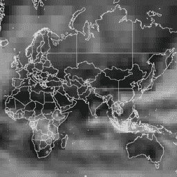
NCEP-DOE Reanalysis 2 project is using a state-of-the-art analysis/forecast system to perform data assimilation using past data from 1979 through the previous year. atmosphere climate cloud geophysical ncep noaa -
NCEP/NCAR Reanalysis Data, Sea-Level Pressure

The NCEP/NCAR Reanalysis Project is a joint project between the National Centers for Environmental Prediction (NCEP, formerly "NMC") and the National Center for Atmospheric Research (NCAR). The goal of this joint effort is to produce new atmospheric analyses using historical data as well as to … atmosphere climate geophysical ncep noaa pressure -
NCEP/NCAR Reanalysis Data, Surface Temperature

The NCEP/NCAR Reanalysis Project is a joint project between the National Centers for Environmental Prediction (NCEP, formerly "NMC") and the National Center for Atmospheric Research (NCAR). The goal of this joint effort is to produce new atmospheric analyses using historical data as well as to … atmosphere climate geophysical ncep noaa reanalysis -
NCEP/NCAR Reanalysis Data, Water Vapor
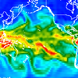
The NCEP/NCAR Reanalysis Project is a joint project between the National Centers for Environmental Prediction (NCEP, formerly "NMC") and the National Center for Atmospheric Research (NCAR). The goal of this joint effort is to produce new atmospheric analyses using historical data as well as to … atmosphere climate geophysical ncep noaa reanalysis -
NOAA AVHRR Pathfinder Version 5.3 Collated Global 4km Sea Surface Temperature

The AVHRR Pathfinder Version 5.3 Sea Surface Temperature dataset (PFV53) is a collection of global, twice-daily 4km sea surface temperature data produced in a partnership by the NOAA National Oceanographic Data Center and the University of Miami's Rosenstiel School of Marine and Atmospheric Science. PFV53 … avhrr noaa oceans sst temperature wind -
NOAA CDR AVHRR AOT: Daily Aerosol Optical Thickness Over Global Oceans, v04

The NOAA Climate Data Record (CDR) of Aerosol Optical Thickness (AOT) is a collection of global daily 0.1 degree derived data from the PATMOS-x AVHRR level-2b channel 1 (0.63 micron) orbital clear-sky radiance. The aerosol product is generated from AVHRR imagery in cloud-free conditions during … aerosol atmosphere atmospheric avhrr cdr daily -
NOAA CDR AVHRR LAI FAPAR: Leaf Area Index and Fraction of Absorbed Photosynthetically Active Radiation, Version 5

The NOAA Climate Data Record (CDR) of AVHRR Leaf Area Index (LAI) and Fraction of Absorbed Photosynthetically Active Radiation (FAPAR) dataset contains derived values that characterize the canopy and photosynthetic activity of plants. This dataset is derived from the NOAA AVHRR Surface Reflectance product and … avhrr cdr daily fapar lai land -
NOAA CDR AVHRR NDVI: Normalized Difference Vegetation Index, Version 5
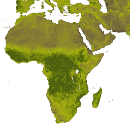
The NOAA Climate Data Record (CDR) of AVHRR Normalized Difference Vegetation Index (NDVI) contains gridded daily NDVI derived from the NOAA AVHRR Surface Reflectance product. It provides a measurement of surface vegetation coverage activity, gridded at a resolution of 0.05° and computed globally over land … avhrr cdr daily land ndvi noaa -
NOAA CDR AVHRR: Surface Reflectance, Version 5

The NOAA Climate Data Record (CDR) of AVHRR Surface Reflectance contains gridded daily surface reflectance and brightness temperatures derived from the Advanced Very High Resolution Radiometer (AVHRR) sensors onboard seven NOAA polar orbiting satellites. The data are gridded at a resolution of 0.05° and computed … avhrr cdr daily land noaa reflectance -
NOAA CDR GRIDSAT-B1: Geostationary IR Channel Brightness Temperature
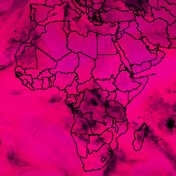
Note: This dataset has not been updated by the provider since 2024-03-31 due to ongoing infrastructure updates. There is no current timeline for when dataset updates will resume. This dataset provides a high quality Climate Data Record (CDR) of global infrared measurements from geostationary satellites. … brightness cdr climate infrared noaa reflectance -
NOAA CDR OISST v02r01: Optimum Interpolation Sea Surface Temperature
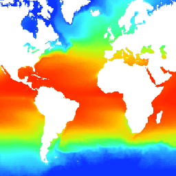
The NOAA 1/4 degree daily Optimum Interpolation Sea Surface Temperature (OISST) provides complete ocean temperature fields constructed by combining bias-adjusted observations from different platforms (satellite, ships, buoys) on a regular global grid, with gaps filled in by interpolation. Satellite data from the Advanced Very High … avhrr cdr daily ice noaa ocean -
NOAA CDR PATMOSX: Cloud Properties, Reflectance, and Brightness Temperatures, Version 5.3
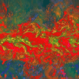
This dataset provides high quality Climate Data Record (CDR) of multiple cloud properties along with Advanced Very High Resolution Radiometer (AVHRR) Pathfinder Atmospheres Extended (PATMOS-x) brightness temperatures and reflectances. These data have been fitted to a 0.1 x 0.1 equal angle-grid with both ascending and … atmospheric avhrr brightness cdr climate cloud -
NOAA CDR VIIRS LAI FAPAR: Leaf Area Index and Fraction of Absorbed Photosynthetically Active Radiation, Version 1

This Climate Data Record (CDR) combines datasets for Leaf Area Index (LAI) and Fraction of Absorbed Photosynthetically Active Radiation (FAPAR), two biophysical variables that can be used to evaluate vegetation stress, forecast agricultural yields, and other modeling and resource management applications. LAI tracks the one-sided … cdr daily fapar lai land noaa -
NOAA CDR VIIRS NDVI: Normalized Difference Vegetation Index, Version 1

This dataset contains gridded daily Normalized Difference Vegetation Index (NDVI) derived from the NOAA Climate Data Record (CDR) of Visible Infrared Imaging Radiometer Suite (VIIRS) Surface Reflectance. The data record spans from 2014 onward using data from NOAA polar orbiting satellites. The data are projected … cdr daily land ndvi noaa vegetation-indices -
NOAA CDR WHOI: Sea Surface Temperature, Version 2
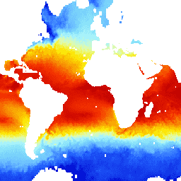
The Sea Surface Temperature - WHOI dataset is part of the NOAA Ocean Surface Bundle (OSB) and provides a high quality Climate Data Record (CDR) of sea surface temperature over ice-free oceans. The SST values are found through modeling the diurnal variability in combination with … atmospheric cdr hourly noaa ocean oceans -
NOAA CDR: Ocean Heat Fluxes, Version 2

The Ocean Heat Fluxes dataset is part of the NOAA Ocean Surface Bundle (OSB) and provides a high quality Climate Data Record (CDR) of the air/ocean heat fluxes over ice-free oceans. This dataset is calculated from the OSB CDR parameters of near-surface atmospheric and sea … atmospheric cdr flux heat hourly noaa -
NOAA CDR: Ocean Near-Surface Atmospheric Properties, Version 2
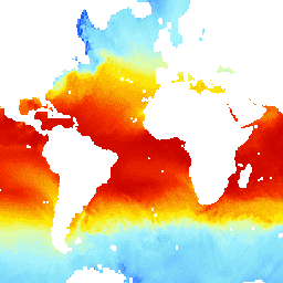
The Ocean Near-Surface Atmospheric Properties dataset is part of the NOAA Ocean Surface Bundle (OSB) and provides a high quality Climate Data Record (CDR) of air temperature, wind speed, and specific humidity over ice-free ocean surfaces. These atmospheric properties are calculated based on brightness temperature … atmospheric cdr hourly humidity noaa ocean -
NOAA NHC HURDAT2 Atlantic Hurricane Catalog

Hurricane best track database (HURDAT2). Atlantic basin 1851-2018. climate hurricane nhc noaa table weather -
NOAA NHC HURDAT2 Pacific Hurricane Catalog
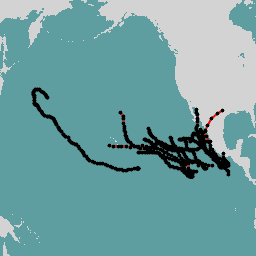
Hurricane best track database (HURDAT2). Pacific basin 1949-2018. climate hurricane nhc noaa table weather -
PERSIANN-CDR: Precipitation Estimation From Remotely Sensed Information Using Artificial Neural Networks-Climate Data Record
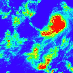
PERSIANN-CDR is a daily quasi-global precipitation product that spans the period from 1983-01-01 to present. The data is produced quarterly, with a typical lag of three months. The product is developed by the Center for Hydrometeorology and Remote Sensing at the University of California, Irvine … cdr climate geophysical noaa precipitation weather -
RTMA: Real-Time Mesoscale Analysis
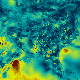
The Real-Time Mesoscale Analysis (RTMA) is a high-spatial and temporal resolution analysis for near-surface weather conditions. This dataset includes hourly analyses at 2.5 km for CONUS. atmosphere climate cloud geophysical humidity noaa -
United States Drought Monitor

The U.S. Drought Monitor is a map released every Thursday, showing parts of the U.S. that are in drought. The map uses five classifications: abnormally dry (D0), showing areas that may be going into or are coming out of drought, and four levels of drought: … community-dataset drought noaa precipitation sat-io usda -
VIIRS Nighttime Day/Night Annual Band Composites V2.1
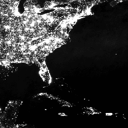
Annual global VIIRS nighttime lights dataset is a time series produced from monthly cloud-free average radiance grids spanning 2013 to 2021. Data for 2022 are available in the NOAA/VIIRS/DNB/ANNUAL_V22 dataset. An initial filtering step removed sunlit, moonlit and cloudy pixels, leading to rough composites that … annual dnb eog lights nighttime noaa -
VIIRS Nighttime Day/Night Annual Band Composites V2.2
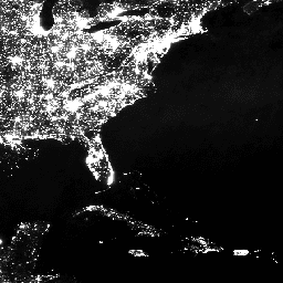
Annual global VIIRS nighttime lights dataset is a time series produced from monthly cloud-free average radiance grids for 2022. Data for earlier years are available in the NOAA/VIIRS/DNB/ANNUAL_V21 dataset. An initial filtering step removed sunlit, moonlit and cloudy pixels, leading to rough composites that contains … annual dnb eog lights nighttime noaa -
VIIRS Nighttime Day/Night Band Composites Version 1
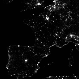
Monthly average radiance composite images using nighttime data from the Visible Infrared Imaging Radiometer Suite (VIIRS) Day/Night Band (DNB). As these data are composited monthly, there are many areas of the globe where it is impossible to get good quality data coverage for that month. … dnb eog lights monthly nighttime noaa -
VIIRS Stray Light Corrected Nighttime Day/Night Band Composites Version 1
Monthly average radiance composite images using nighttime data from the Visible Infrared Imaging Radiometer Suite (VIIRS) Day/Night Band (DNB). As these data are composited monthly, there are many areas of the globe where it is impossible to get good quality data coverage for that month. … dnb eog lights monthly nighttime noaa -
VNP09GA: VIIRS Surface Reflectance Daily 500m and 1km

The Visible Infrared Imaging Radiometer Suite (VIIRS) daily surface reflectance (VNP09GA) product provides an estimate of land surface reflectance from the Suomi National Polar-Orbiting Partnership (S-NPP) VIIRS sensor. Data are provided for three imagery bands (I1, I2, I3) at nominal 500 meter resolution (~463 meter) … daily nasa noaa npp reflectance satellite-imagery -
VNP09H1: VIIRS Surface Reflectance 8-Day L3 Global 500m

The 8-day Visible Infrared Imaging Radiometer Suite (VIIRS) Surface Reflectance (VNP09H1) Version 1 composite product provides an estimate of land surface reflectance from the Suomi National Polar-orbiting Partnership (Suomi NPP) VIIRS sensor for three imagery bands (I1, I2, I3) at nominal 500m resolution (~463m). The … daily nasa noaa npp reflectance satellite-imagery -
VNP13A1.002: VIIRS Vegetation Indices 16-Day 500m

The Suomi National Polar-Orbiting Partnership (S-NPP) NASA Visible Infrared Imaging Radiometer Suite (VIIRS) Vegetation Indices (VNP13A1) data product provides vegetation indices by a process of selecting the best available pixel over a 16-day acquisition period at 500 meter resolution. The VNP13 data products are designed … 16-day evi nasa ndvi noaa npp -
VNP14A1.002: Thermal Anomalies/Fire Daily L3 Global 1km SIN Grid

The daily Suomi National Polar-Orbiting Partnership NASA Visible Infrared Imaging Radiometer Suite (VIIRS) Thermal Anomalies/Fire (VNP14A1) Version 1 data product provides daily information about active fires and other thermal anomalies. The VNP14A1 data product is a global, 1km gridded composite of fire pixels detected from … fire land nasa noaa surface viirs -
VNP15A2H: LAI/FPAR 8-Day L4 Global 500m SIN Grid

The Visible Infrared Imaging Radiometer Suite (VIIRS) Leaf Area Index (LAI) and Fraction of Photosynthetically Active Radiation (FPAR) Version 1 data product provides information about the vegetative canopy layer at 500 meter resolution (VNP15A2H). The VIIRS sensor is located onboard the NOAA/NASA joint Suomi National … land nasa noaa surface vegetation-indices viirs -
VNP21A1D.002: Day Land Surface Temperature and Emissivity Daily 1km

The NASA Suomi National Polar-Orbiting Partnership (Suomi NPP) Visible Infrared Imaging Radiometer Suite (VIIRS) Land Surface Temperature and Emissivity (LST&E) Day Version 1 product (VNP21A1D) is compiled daily from daytime Level 2 Gridded (L2G) intermediate products. The L2G process maps the daily VNP21 swath granules … climate daily day land nasa noaa -
VNP21A1N.002: Night Land Surface Temperature and Emissivity Daily 1km

The NASA Suomi National Polar-Orbiting Partnership (Suomi NPP) Visible Infrared Imaging Radiometer Suite (VIIRS) Land Surface Temperature and Emissivity (LST&E) Night Version 1 product (VNP21A1N) is compiled daily from nighttime Level 2 Gridded (L2G) intermediate products. The L2G process maps the daily VNP21 swath granules … climate daily land nasa night noaa -
VNP22Q2: Land Surface Phenology Yearly L3 Global 500m SIN Grid
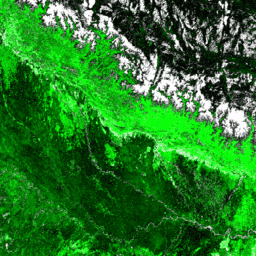
The Suomi National Polar-Orbiting Partnership (Suomi NPP) NASA Visible Infrared Imaging Radiometer Suite (VIIRS) Land Cover Dynamics data product provides global land surface phenology (GLSP) metrics at yearly intervals. The VNP22Q2 data product is derived from time series of the two-band Enhanced Vegetation Index (EVI2) … land landuse-landcover nasa ndvi noaa npp -
VNP43IA1: BRDF/Albedo Model Parameters Daily L3 Global 500m SIN Grid

The Suomi National Polar-Orbiting Partnership (Suomi NPP) NASA Visible Infrared Imaging Radiometer Suite (VIIRS) Bidirectional Reflectance Distribution Function (BRDF) and Albedo Model Parameters (VNP43IA1) Version 1 product provides kernel weights (parameters) at 500 resolution. The VNP43IA1 product is produced daily using 16 days of VIIRS … land nasa noaa satellite-imagery surface viirs -
VNP43IA2: BRDF/Albedo Quality Daily L3 Global 500m SIN Grid

The Suomi National Polar-Orbiting Partnership (Suomi NPP) NASA Visible Infrared Imaging Radiometer Suite (VIIRS) Bidirectional Reflectance Distribution Function (BRDF) and Albedo Quality (VNP43IA2) Version 1 product provides BRDF and Albedo quality at 500m resolution. The VNP43IA2 product is produced daily using 16 days of VIIRS … land nasa noaa satellite-imagery surface viirs -
VNP43IA4: BRDF/Albedo Quality Daily L3 Global 500m SIN Grid

The NASA/NOAA Suomi National Polar-orbiting Partnership (Suomi NPP) Visible Infrared Imaging Radiometer Suite (VIIRS) Nadir Bidirectional Reflectance Distribution Function (BRDF) Adjusted Reflectance (NBAR) Version 2 product provides NBAR estimates at 500 meter resolution. The VNP43IA4 product is produced daily using 16 days of VIIRS data … brdf land nasa noaa satellite-imagery surface -
VNP46A1: VIIRS Daily Gridded Day Night Band 500m Linear Lat Lon Grid Night
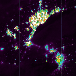
The Suomi National Polar-orbiting Partnership (SNPP) Visible Infrared Imaging Radiometer Suite (VIIRS) supports a Day-Night Band (DNB) sensor that provides global daily measurements of nocturnal visible and near-infrared (NIR) light that are suitable for Earth system science and applications. The VIIRS DNB's ultra-sensitivity in lowlight … daily dnb nasa noaa population viirs -
VNP46A2: VIIRS Lunar Gap-Filled BRDF Nighttime Lights Daily L3 Global 500m

The Suomi National Polar-orbiting Partnership (SNPP) Visible Infrared Imaging Radiometer Suite (VIIRS) supports a Day-Night Band (DNB) sensor that provides global daily measurements of nocturnal visible and near-infrared(NIR) light that are suitable for Earth system science and applications. The VIIRS DNB's ultra-sensitivity in lowlight conditions … brdf daily nasa nighttime noaa population -
VNP64A1: Burned Area Monthly L4 Global 500m SIN Grid

The daily Suomi National Polar-Orbiting Partnership (Suomi NPP) NASA Visible Infrared Imaging Radiometer Suite (VIIRS) Burned Area (VNP64A1) Version 1 data product is a monthly, global gridded 500m product containing per-pixel burned area and quality information. The VNP64 burned area mapping approach employs 750m VIIRS … burn change-detection fire land nasa noaa