Page Summary
-
The NEON Canopy Height Model (CHM) provides estimates of the height of the top of the canopy above bare earth, derived from LiDAR point cloud data.
-
The NEON Digital Elevation Model (DEM) includes digital models of the surface (DSM) and terrain (DTM) derived from LiDAR data, representing surface features and bare earth elevation respectively.
-
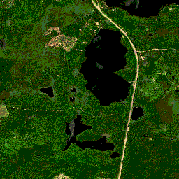
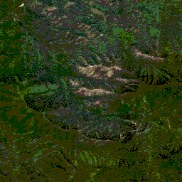
NEON RGB Camera Imagery offers high-resolution orthorectified camera images with a spatial resolution of 0.1 m.
-
NEON Surface Bidirectional and Directional Reflectance products are hyperspectral VSWIR data with 426 bands, providing reflectance values scaled by a factor of 10000.
-
NEON Canopy Height Model (CHM)
Height of the top of canopy above bare earth (Canopy Height Model; CHM). The CHM is derived from the NEON LiDAR point cloud and is generated by creating a continuous surface of canopy height estimates across the entire spatial domain of the LiDAR survey. The … airborne canopy forest forest-biomass highres lidar -
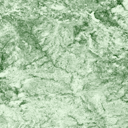
NEON Canopy Nitrogen Content (CNC)
Modelled canopy nitrogen concentration calibrated with NEON plant foliar chemistry observations and predicted with L1 surface directional reflectance, derived from the NEON Imaging Spectrometer (NIS). Bands include 1) canopy nitrogen percent, 2) canopy nitrogen model uncertainty, 3) classification result for needle vs. non-needle model and … airborne canopy forest highres hyperspectral neon -
NEON Digital Elevation Model (DEM)
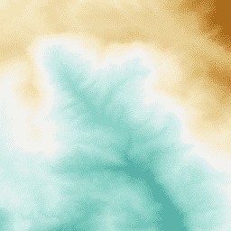
Digital models of the surface (DSM) and terrain (DTM) derived from NEON LiDAR data. DSM: Surface features (topographic information with vegetation and man-made structures present). DTM: Bare earth elevation (topographic information with vegetation and man-made structures removed). Images are given in meters above mean sea … airborne dem elevation-topography forest highres lidar -
NEON RGB Camera Imagery
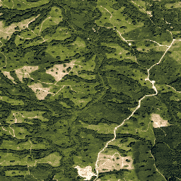
High resolution Red-Green-Blue (RGB) orthorectified camera images mosaicked and output onto a fixed, uniform spatial grid using nearest-neighbor resampling; spatial resolution is 0.1 m. The digital camera is part of a suite of instruments on the NEON Airborne Observation Platform (AOP) that also includes a … airborne forest highres neon neon-prod-earthengine orthophoto -
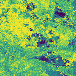
NEON Surface Bidirectional Reflectance
The NEON AOP Surface Bidirectional Reflectance is a hyperspectral VSWIR (visible to shortwave infrared) data product, containing 426 bands spanning wavelengths from ~380 nm to 2510 nm. Reflectance is scaled by a factor of 10000. Wavelengths between 1340-1445 nm and 1790-1955 nm are set to … airborne forest highres hyperspectral neon neon-prod-earthengine -
NEON Surface Directional Reflectance
The NEON AOP Surface Directional Reflectance is a hyperspectral VSWIR (visible to shortwave infrared) data product, containing 426 bands spanning wavelengths from ~380 nm to 2510 nm. Reflectance is scaled by a factor of 10000. Wavelengths between 1340-1445 nm and 1790-1955 nm are set to … airborne forest hyperspectral neon neon-prod-earthengine publisher-dataset