Page Summary
-
Several Copernicus Global Ocean Bio-Geo-Chemical Forecast datasets provide 10-day forecasts for various parameters updated weekly.
-
The Copernicus Satellite Ocean Color Daily Data offers global daily estimates of chlorophyll-a concentration and remote sensing reflectance from multiple satellite sensors.
-
GFW (Global Fishing Watch) datasets provide daily fishing effort and vessel presence data, measured in hours.
-
Global Ocean Colour (Copernicus-GlobColour) datasets offer comprehensive Bio-Geo-Chemical products derived from multiple satellite sources.
-
Additional Copernicus datasets include Global Ocean Physics Analysis and Forecast, Global Ocean Waves Analysis and Forecast and Static Bathymetry, and Multi Observation Global Ocean Sea Surface Salinity and Sea Surface Density products.
-
The WDOECM and WDPA datasets provide information on Other Effective Area-based Conservation Measures and Protected Areas, respectively.
-
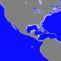
Copernicus Global In-situ Observations of Ocean Currents - Argo
The In Situ TAC is a distributed centre organized around 7 oceanographic regions: the global ocean and the 6 EUROGOOS regional alliances. It involves 14 partners from 11 countries in Europe. It doesn't deploy any observing system and relies on data, exclusively funded by other … copernicus currents insitu marine ocean oceans -
Copernicus Global In-situ Observations of Ocean Currents - Drifter
The In Situ TAC is a distributed centre organized around 7 oceanographic regions: the global ocean and the 6 EUROGOOS regional alliances. It involves 14 partners from 11 countries in Europe. It doesn't deploy any observing system and relies on data, exclusively funded by other … copernicus currents insitu marine ocean oceans -
Copernicus Global In-situ Observations of Ocean Currents - Radar Radial
The In Situ TAC is a distributed centre organized around 7 oceanographic regions: the global ocean and the 6 EUROGOOS regional alliances. It involves 14 partners from 11 countries in Europe. It doesn't deploy any observing system and relies on data, exclusively funded by other … copernicus currents insitu marine ocean oceans -
Copernicus Global In-situ Observations of Ocean Currents - Radar Total
The In Situ TAC is a distributed centre organized around 7 oceanographic regions: the global ocean and the 6 EUROGOOS regional alliances. It involves 14 partners from 11 countries in Europe. It doesn't deploy any observing system and relies on data, exclusively funded by other … copernicus currents insitu marine ocean oceans -
Copernicus Global Ocean Bio-Geo-Chemical Forecast - BIO
The Operational Mercator Ocean biogeochemical global ocean analysis and forecast system at 1/4 degree is providing 10 days of 3D global ocean forecasts updated weekly. The time series is aggregated in time, in order to reach a two full year's time series sliding window. This … copernicus daily forecast marine ocean oceans -
Copernicus Global Ocean Bio-Geo-Chemical Forecast - CAR

The Operational Mercator Ocean biogeochemical global ocean analysis and forecast system at 1/4 degree is providing 10 days of 3D global ocean forecasts updated weekly. The time series is aggregated in time, in order to reach a two full year's time series sliding window. This … copernicus daily forecast marine ocean oceans -
Copernicus Global Ocean Bio-Geo-Chemical Forecast - CO2

The Operational Mercator Ocean biogeochemical global ocean analysis and forecast system at 1/4 degree is providing 10 days of 3D global ocean forecasts updated weekly. The time series is aggregated in time, in order to reach a two full year's time series sliding window. This … copernicus daily forecast marine ocean oceans -
Copernicus Global Ocean Bio-Geo-Chemical Forecast - NUT

The Operational Mercator Ocean biogeochemical global ocean analysis and forecast system at 1/4 degree is providing 10 days of 3D global ocean forecasts updated weekly. The time series is aggregated in time, in order to reach a two full year's time series sliding window. This … copernicus daily forecast marine ocean oceans -
Copernicus Global Ocean Bio-Geo-Chemical Forecast - OPTICS
The Operational Mercator Ocean biogeochemical global ocean analysis and forecast system at 1/4 degree is providing 10 days of 3D global ocean forecasts updated weekly. The time series is aggregated in time, in order to reach a two full year's time series sliding window. This … copernicus daily forecast marine ocean oceans -
Copernicus Global Ocean Bio-Geo-Chemical Forecast - PFT
The Operational Mercator Ocean biogeochemical global ocean analysis and forecast system at 1/4 degree is providing 10 days of 3D global ocean forecasts updated weekly. The time series is aggregated in time, in order to reach a two full year's time series sliding window. This … copernicus daily forecast marine ocean oceans -
Copernicus Global Ocean Bio-Geo-Chemical Forecast - PLANKTON
The Operational Mercator Ocean biogeochemical global ocean analysis and forecast system at 1/4 degree is providing 10 days of 3D global ocean forecasts updated weekly. The time series is aggregated in time, in order to reach a two full year's time series sliding window. This … copernicus daily forecast marine ocean oceans -
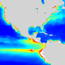
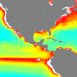
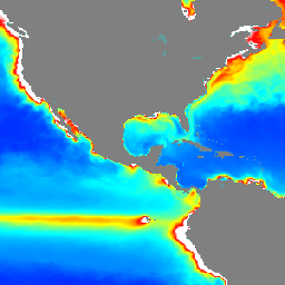
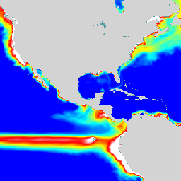
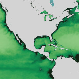
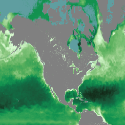
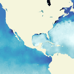
Copernicus Satellite Ocean Color Daily Data
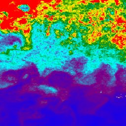
This dataset provides global daily estimates of ocean surface chlorophyll-a concentration and remote sensing reflectance derived from multiple satellite sensors. Remote-sensing reflectance (or Rrs) is defined as the ratio of water-leaving radiance to downwelling irradiance and serves as the main input to algorithms used to … chlorophyll-a copernicus daily marine oceans -
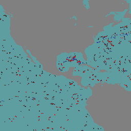
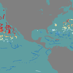
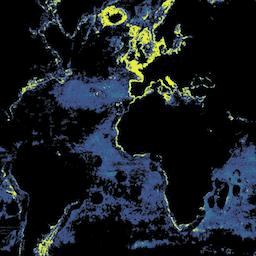
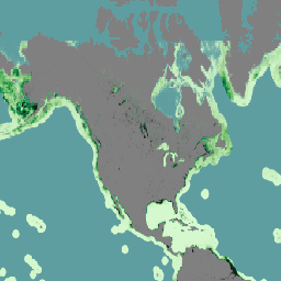
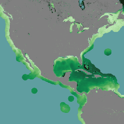
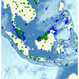
GFW (Global Fishing Watch) Daily Fishing Hours

Fishing effort, measured in hours of inferred fishing activity. Each asset is the effort for a given flag state and day, with one band for the fishing activity of each gear type. See sample Earth Engine scripts. Also see the main GFW site for program … fishing gfw marine monthly ocean oceans -
GFW (Global Fishing Watch) Daily Vessel Hours
Fishing vessel presence, measured in hours per square km. Each asset is the vessel presence for a given flag state and day, with one band for the presence of each gear type. See sample Earth Engine scripts. Also see the main GFW site for program … fishing gfw marine monthly ocean oceans -
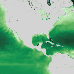
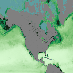
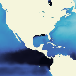
Global Ocean Colour: Bio-Geo-Chemical, L4, from Satellite Observations, Optics, Multi-Sensor 4KM
The Global Ocean Colour (Copernicus-GlobColour) dataset is a Bio-Geo-Chemical (BGC) product developed by ACRI-ST. Derived from multiple satellite sources like SeaWiFS, MODIS, and OLCI. It provides a comprehensive range of oceanographic variables, including: Chlorophyll (CHL), Phytoplankton Functional types and sizes (PFT), Primary Production (PP), Suspended … copernicus marine oceans -
Global Ocean Colour: Bio-Geo-Chemical, L4, from Satellite Observations, Plankton, Multi-Sensor, 4KM
The Global Ocean Colour (Copernicus-GlobColour) dataset is a Bio-Geo-Chemical (BGC) product developed by ACRI-ST. Derived from multiple satellite sources like SeaWiFS, MODIS, and OLCI. It provides a comprehensive range of oceanographic variables, including: Chlorophyll (CHL), Phytoplankton Functional types and sizes (PFT), Primary Production (PP), Suspended … copernicus marine oceans -
Global Ocean Colour: Bio-Geo-Chemical, L4, from Satellite Observations, Plankton, OLCI, 300M
The Global Ocean Colour (Copernicus-GlobColour) dataset is a Bio-Geo-Chemical (BGC) product developed by ACRI-ST. Derived from multiple satellite sources like SeaWiFS, MODIS, and OLCI. It provides a comprehensive range of oceanographic variables, including: Chlorophyll (CHL), Phytoplankton Functional types and sizes (PFT), Primary Production (PP), Suspended … copernicus marine oceans -
Global Ocean Colour: Bio-Geo-Chemical, L4, from Satellite Observations, Primary Production, Multi-Sensor 4KM
The Global Ocean Colour (Copernicus-GlobColour) dataset is a Bio-Geo-Chemical (BGC) product developed by ACRI-ST. Derived from multiple satellite sources like SeaWiFS, MODIS, and OLCI. It provides a comprehensive range of oceanographic variables, including: Chlorophyll (CHL), Phytoplankton Functional types and sizes (PFT), Primary Production (PP), Suspended … copernicus marine oceans -
Global Ocean Colour: Bio-Geo-Chemical, L4, from Satellite Observations, Reflectance, Multi-Sensor 4KM
The Global Ocean Colour (Copernicus-GlobColour) dataset is a Bio-Geo-Chemical (BGC) product developed by ACRI-ST. Derived from multiple satellite sources like SeaWiFS, MODIS, and OLCI. It provides a comprehensive range of oceanographic variables, including: Chlorophyll (CHL), Phytoplankton Functional types and sizes (PFT), Primary Production (PP), Suspended … copernicus marine oceans -
Global Ocean Colour: Bio-Geo-Chemical, L4, from Satellite Observations, Reflectance, OLCI 300M
The Global Ocean Colour (Copernicus-GlobColour) dataset is a Bio-Geo-Chemical (BGC) product developed by ACRI-ST. Derived from multiple satellite sources like SeaWiFS, MODIS, and OLCI. It provides a comprehensive range of oceanographic variables, including: Chlorophyll (CHL), Phytoplankton Functional types and sizes (PFT), Primary Production (PP), Suspended … copernicus marine oceans -
Global Ocean Colour: Bio-Geo-Chemical, L4, from Satellite Observations, Transparency, Multi-Sensor, 4KM
The Global Ocean Colour (Copernicus-GlobColour) dataset is a Bio-Geo-Chemical (BGC) product developed by ACRI-ST. Derived from multiple satellite sources like SeaWiFS, MODIS, and OLCI. It provides a comprehensive range of oceanographic variables, including: Chlorophyll (CHL), Phytoplankton Functional types and sizes (PFT), Primary Production (PP), Suspended … copernicus marine oceans -
Global Ocean Colour: Bio-Geo-Chemical, L4, from Satellite Observations, Transparency, OLCI, 4KM
The Global Ocean Colour (Copernicus-GlobColour) dataset is a Bio-Geo-Chemical (BGC) product developed by ACRI-ST. Derived from multiple satellite sources like SeaWiFS, MODIS, and OLCI. It provides a comprehensive range of oceanographic variables, including: Chlorophyll (CHL), Phytoplankton Functional types and sizes (PFT), Primary Production (PP), Suspended … copernicus marine oceans -
Global Ocean Physics Analysis and Forecast Daily
Copernicus Marine Physics 2D Daily Mean Fields (cmems_mod_glo_phy_anfc_0.083deg_P1D-m) deliver global daily-averaged ocean surface and bottom variables at 8km resolution. The Operational Mercator global ocean analysis and forecast system is providing 10 days of 2D global ocean forecasts updated daily. The time series is aggregated in … copernicus daily forecast marine oceans -
Global Ocean Waves Analysis and Forecast
The operational global ocean analysis and forecast system of Meteo-France with a resolution of 1/12 degree is providing daily analyses and 10 days forecasts for the global ocean sea surface waves. This product includes 3-hourly instantaneous fields of integrated wave parameters from the total spectrum … copernicus forecast hourly marine oceans -
Global Ocean Waves Static Bathymetry
Static bathymetry for the Global Ocean Waves Analysis and Forecast system. This dataset provides the sea floor depth in meters. The global wave system of Meteo-France is based on the wave model MFWAM which is a third generation wave model. MFWAM uses the computing code … bathymetry copernicus marine oceans -
Multi Observation Global Ocean Sea Surface Salinity and Sea Surface Density : Daily, Multi-Year Reprocessed
Multi Observation Global Ocean Sea Surface Salinity and Sea Surface Density is an oceanographic product that provides daily, global, and gap-free Level-4 (L4) analyses of Sea Surface Salinity (SSS) and Sea Surface Density (SSD) at a high resolution of 1/8 degree. This product is generated … copernicus marine oceans -
Multi Observation Global Ocean Sea Surface Salinity and Sea Surface Density : Daily, Near Real Time
Multi Observation Global Ocean Sea Surface Salinity and Sea Surface Density is an oceanographic product that provides daily, global, and gap-free Level-4 (L4) analyses of Sea Surface Salinity (SSS) and Sea Surface Density (SSD) at a high resolution of 1/8 degree. This product is generated … copernicus marine oceans -
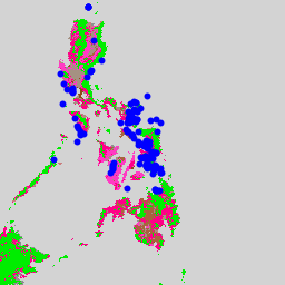
WDKBA: World Database of Key Biodiversity Areas (KBAs) - September 2025
If you are interested in accessing the KBA dataset please complete the KBA data request form which will allow access directly in GEE once approved. Key Biodiversity Areas (KBAs) are 'sites contributing significantly to the global persistence of biodiversity’, in terrestrial, freshwater and marine ecosystems. … biodiversity boundaries ecosystems global iucn management -
WDOECM: Other Effective Area-based Conservation Measures (points)
A geographically defined area other than a Protected Area, which is governed and managed in ways that achieve positive and sustained long-term outcomes for the in situ conservation of biodiversity, with associated ecosystem functions and services and where applicable, cultural, spiritual, socio-economic, and other locally … boundaries ecosystems iucn marine mpa protected -
WDOECM: Other Effective Area-based Conservation Measures (polygons)
A geographically defined area other than a Protected Area, which is governed and managed in ways that achieve positive and sustained long-term outcomes for the in situ conservation of biodiversity, with associated ecosystem functions and services and where applicable, cultural, spiritual, socio-economic, and other locally … boundaries ecosystems iucn marine mpa protected -
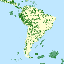
WDPA: World Database on Protected Areas (points)
The World Database on Protected Areas (WDPA) is the most up-to-date and complete source of information on protected areas, updated monthly with submissions from governments, non-governmental organizations, landowners, and communities. It is managed by the United Nations Environment Programme's World Conservation Monitoring Centre (UNEP-WCMC) with … boundaries ecosystems iucn marine mpa protected -
WDPA: World Database on Protected Areas (polygons)
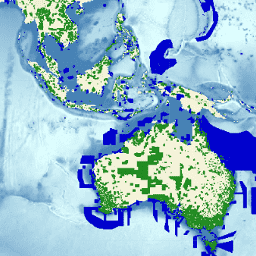
The World Database on Protected Areas (WDPA) is the most up-to-date and complete source of information on protected areas, updated monthly with submissions from governments, non-governmental organizations, landowners, and communities. It is managed by the United Nations Environment Programme's World Conservation Monitoring Centre (UNEP-WCMC) with … boundaries ecosystems iucn marine mpa protected