Datasets tagged human-modification in Earth Engine
Sử dụng bộ sưu tập để sắp xếp ngăn nắp các trang
Lưu và phân loại nội dung dựa trên lựa chọn ưu tiên của bạn.
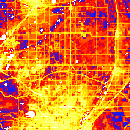
Tập dữ liệu Sửa đổi của con người trên toàn cầu (gHM) cung cấp số đo tích luỹ về việc con người sửa đổi đất liền trên toàn cầu ở độ phân giải 1 km vuông. Các giá trị gHM nằm trong khoảng từ 0,0 đến 1,0 và được tính bằng cách ước tính tỷ lệ của một vị trí nhất định (pixel) đã được sửa đổi, cường độ ước tính …
Sản phẩm pixel Khu vực bị cháy Fire_cci của MODIS phiên bản 5.1 (FireCCI51) là một tập dữ liệu có độ phân giải không gian ~250m trên toàn cầu hằng tháng, chứa thông tin về khu vực bị cháy cũng như dữ liệu phụ trợ. Tập dữ liệu này dựa trên độ phản xạ bề mặt trong dải tần Cận hồng ngoại (NIR) từ thiết bị MODIS trên …
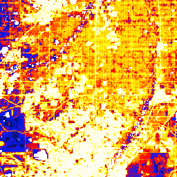
Tập dữ liệu Sửa đổi của con người trên toàn cầu phiên bản 3 đo lường các áp lực tích luỹ của con người đối với các hệ sinh thái trên đất liền trên toàn cầu (ngoại trừ Nam Cực). Tập dữ liệu này theo dõi dữ liệu từ năm 1990 đến năm 2022 và nhằm giúp định lượng tác động của con người đối với việc lập kế hoạch bảo tồn, hoạch định chính sách và nghiên cứu. Tập dữ liệu này là chuỗi "Nhất quán với sự thay đổi" (chuỗi "c") …
Tập dữ liệu Sửa đổi của con người trên toàn cầu phiên bản 3 đo lường các áp lực tích luỹ của con người đối với các hệ sinh thái trên đất liền trên toàn cầu (ngoại trừ Nam Cực). Tập dữ liệu này theo dõi dữ liệu từ năm 1990 đến năm 2022 và nhằm giúp định lượng tác động của con người đối với việc lập kế hoạch bảo tồn, hoạch định chính sách và nghiên cứu. Đây là ảnh chụp nhanh tĩnh năm 2022 (chuỗi "s") …
[[["Dễ hiểu","easyToUnderstand","thumb-up"],["Giúp tôi giải quyết được vấn đề","solvedMyProblem","thumb-up"],["Khác","otherUp","thumb-up"]],[["Thiếu thông tin tôi cần","missingTheInformationINeed","thumb-down"],["Quá phức tạp/quá nhiều bước","tooComplicatedTooManySteps","thumb-down"],["Đã lỗi thời","outOfDate","thumb-down"],["Vấn đề về bản dịch","translationIssue","thumb-down"],["Vấn đề về mẫu/mã","samplesCodeIssue","thumb-down"],["Khác","otherDown","thumb-down"]],[],[],["The Global Human Modification (gHM) dataset measures human impact on land at a 1-square-kilometer scale, with values from 0.0 to 1.0 representing the proportion and intensity of modification. The FireCCI51 dataset is a monthly, global dataset with roughly 250m resolution, providing information on burned areas using Near Infrared surface reflectance from the MODIS instrument, including additional related data. Both datasets contain information related to fragmentation.\n"]]