Page Summary
-
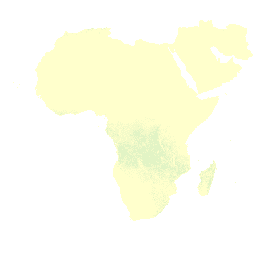
The FAO provides datasets on drained organic soils, estimating area drained for agriculture and associated carbon and nitrous oxide emissions.
-
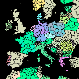
The FAO GAUL datasets offer simplified and full versions of global administrative unit layers at country, first, and second-level administrative units.
-
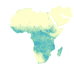
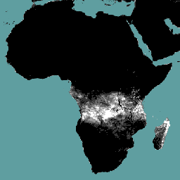
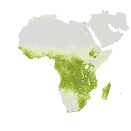
FAO datasets include information on Forest Proximate People and Tree Proximate People, contributing to indicators of forest-dependent people in extreme poverty.
-
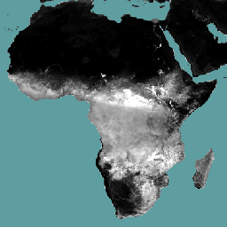
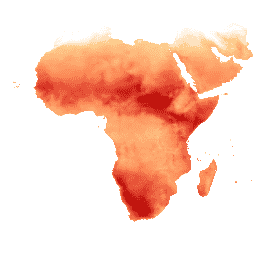
WAPOR datasets from FAO provide data on actual evapotranspiration and interception, reference evapotranspiration, evaporation, interception, transpiration, and net primary production.
-
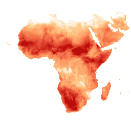
Drained Organic Soils Emissions (Annual) 1.0

The two related FAO datasets on Drained Organic Soils provide estimates of: DROSA-A: area of Organic Soils (in hectares) drained for agricultural activities (cropland and grazed grassland) DROSE-A: carbon (C) and nitrous oxide (N2O) estimates (in gigagrams) from the agricultural drainage of organic soils under … agriculture climate climate-change emissions fao ghg -
FAO GAUL 500m Simplified: Global Administrative Unit Layers 2015, Country Boundaries

This version of GAUL dataset is simplified at 500m. The Global Administrative Unit Layers (GAUL) compiles and disseminates the best available information on administrative units for all the countries in the world, providing a contribution to the standardization of the spatial dataset representing administrative units. … borders countries fao gaul infrastructure-boundaries table -
FAO GAUL 500m Simplified: Global Administrative Unit Layers 2015, First-Level Administrative Units
This version of GAUL dataset is simplified at 500m. The Global Administrative Unit Layers (GAUL) compiles and disseminates the best available information on administrative units for all the countries in the world, providing a contribution to the standardization of the spatial dataset representing administrative units. … borders departments fao gaul infrastructure-boundaries provinces -
FAO GAUL 500m Simplified: Global Administrative Unit Layers 2015, Second-Level Administrative Units
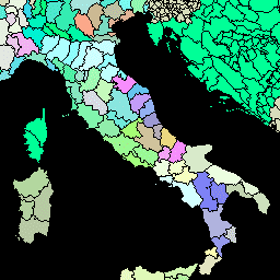
This version of GAUL dataset is simplified at 500m. The Global Administrative Unit Layers (GAUL) compiles and disseminates the best available information on administrative units for all the countries in the world, providing a contribution to the standardization of the spatial dataset representing administrative units. … borders county districts fao gaul infrastructure-boundaries -
FAO GAUL: Global Administrative Unit Layers 2015, Country Boundaries
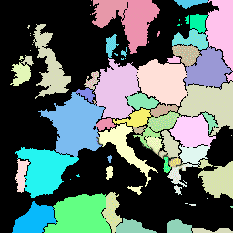
The Global Administrative Unit Layers (GAUL) compiles and disseminates the best available information on administrative units for all the countries in the world, providing a contribution to the standardization of the spatial dataset representing administrative units. The GAUL always maintains global layers with a unified … borders countries fao gaul infrastructure-boundaries table -
FAO GAUL: Global Administrative Unit Layers 2015, First-Level Administrative Units

The Global Administrative Unit Layers (GAUL) compiles and disseminates the best available information on administrative units for all the countries in the world, providing a contribution to the standardization of the spatial dataset representing administrative units. The GAUL always maintains global layers with a unified … borders departments fao gaul infrastructure-boundaries provinces -
FAO GAUL: Global Administrative Unit Layers 2015, Second-Level Administrative Units

The Global Administrative Unit Layers (GAUL) compiles and disseminates the best available information on administrative units for all the countries in the world, providing a contribution to the standardization of the spatial dataset representing administrative units. The GAUL always maintains global layers with a unified … borders county districts fao gaul infrastructure-boundaries -
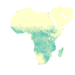
Forest proximate people (FPP) 1.0
The "Forest Proximate People" (FPP) dataset is one of the data layers contributing to the development of indicator #13, "number of forest-dependent people in extreme poverty," of the Collaborative Partnership on Forests (CPF) Global Core Set of forest-related indicators (GCS). The FPP dataset provides an … agriculture fao forest global plant-productivity population -
Tree proximate people (TPP) 1.0
The "Tree Proximate People" (TPP) is one of the datasets contributing to the development of indicator #13, number of forest-dependent people in extreme poverty, of the Collaborative Partnership on Forests (CPF) Global Core Set of forest-related indicators (GCS). The TPP dataset provides 4 different estimates … agriculture fao forest global plant-productivity population -
UN FAO Drained Organic Soils Area (Annual) 1.0
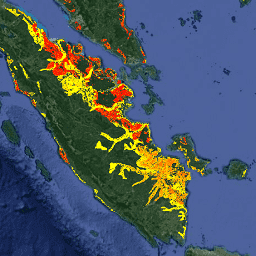
The two related FAO datasets on Drained Organic Soils provide estimates of: DROSA-A: area of Organic Soils (in hectares) drained for agricultural activities (cropland and grazed grassland) DROSE-A: carbon (C) and nitrous oxide (N2O) estimates (in gigagrams) from the agricultural drainage of organic soils under … agriculture climate climate-change emissions fao ghg -
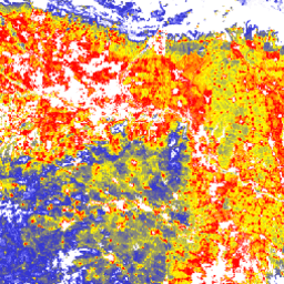
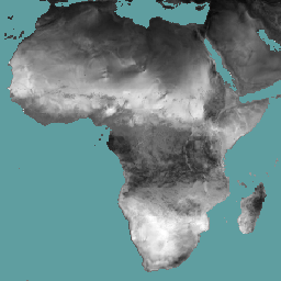
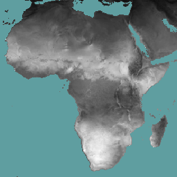
WAPOR Actual Evapotranspiration and Interception 2.0
The actual evapotranspiration and interception (ETIa) (dekadal, in mm/day) is the sum of the soil evaporation (E), canopy transpiration (T), and evaporation from rainfall intercepted by leaves (I). The value of each pixel represents the average daily ETIa in a given dekad. agriculture fao wapor water water-vapor -
WAPOR Actual Evapotranspiration and Interception 3.0
The actual evapotranspiration and interception (ETIa) (dekadal, in mm/day) is the sum of the soil evaporation (E), canopy transpiration (T), and evaporation from rainfall intercepted by leaves (I). The value of each pixel represents the average daily ETIa in a given dekad. agriculture fao wapor water water-vapor -
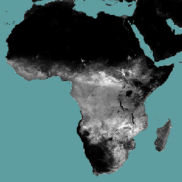
WAPOR Daily Reference Evapotranspiration 2.0
Reference evapotranspiration (RET) is defined as the evapotranspiration from a hypothetical reference crop and it simulates the behaviour of a well-watered grass surface. Each pixel represents the daily reference evapotranspiration in mm. agriculture fao wapor water water-vapor -
WAPOR Daily Reference Evapotranspiration 3.0
Reference evapotranspiration (RET) is defined as the evapotranspiration from a hypothetical reference crop and it simulates the behaviour of a well-watered grass surface. Each pixel represents the daily reference evapotranspiration in mm. agriculture fao wapor water water-vapor -
WAPOR Dekadal Evaporation 2.0
The evaporation (E) data component (dekadal, in mm/day) is the actual evaporation of the soil surface. The value of each pixel represents the average daily actual evaporation for that specific dekad. agriculture fao wapor water water-vapor -
WAPOR Dekadal Evaporation 3.0
The evaporation (E) data component (dekadal, in mm/day) is the actual evaporation of the soil surface. The value of each pixel represents the average daily actual evaporation for that specific dekad. agriculture fao wapor water water-vapor -
WAPOR Dekadal Interception 2.0
The interception (I) data component (dekadal, in mm/day) represents the evaporation of intercepted rainfall from the vegetation canopy. Interception is the process where rainfall is captured by the leaves. Part of this captured rainfall will evaporate again. The value of each pixel represents the average … agriculture fao wapor water water-vapor -
WAPOR Dekadal Interception 3.0
The interception (I) data component (dekadal, in mm/day) represents the evaporation of intercepted rainfall from the vegetation canopy. Interception is the process where rainfall is captured by the leaves. Part of this captured rainfall will evaporate again. The value of each pixel represents the average … agriculture fao wapor water water-vapor -
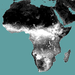
WAPOR Dekadal Net Primary Production 2.0
Net primary production (NPP) is a fundamental characteristic of an ecosystem, expressing the conversion of carbon dioxide into biomass driven by photosynthesis. The pixel value represents the mean daily NPP for that specific dekad. agriculture fao plant-productivity wapor water -
WAPOR Dekadal Reference Evapotranspiration 2.0
Reference evapotranspiration (RET) is defined as the evapotranspiration from a hypothetical reference crop and it simulates the behaviour of a well-watered grass surface. The value of each pixel represents the average of the daily reference evapotranspiration for that specific dekad. agriculture fao wapor water water-vapor -
WAPOR Dekadal Reference Evapotranspiration 3.0
Reference evapotranspiration (RET) is defined as the evapotranspiration from a hypothetical reference crop and it simulates the behaviour of a well-watered grass surface. The value of each pixel represents the average of the daily reference evapotranspiration for that specific dekad. agriculture fao wapor water water-vapor -
WAPOR Dekadal Transpiration 2.0
The transpiration (T) data component (dekadal, in mm/day) is the actual transpiration of the vegetation canopy. The value of each pixel represents the average daily actual transpiration for that specific dekad. agriculture fao wapor water water-vapor -
WAPOR Dekadal Transpiration 3.0
The transpiration (T) data component (dekadal, in mm/day) is the actual transpiration of the vegetation canopy. The value of each pixel represents the average daily actual transpiration for that specific dekad. agriculture fao global wapor water water-vapor