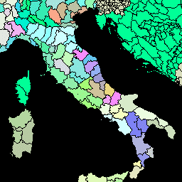
הגרסה הזו של מערך הנתונים GAUL היא פשוטה יותר ברזולוציה של 500 מ'. שכבות היחידות האדמיניסטרטיביות הגלובליות (GAUL) מרכזות ומפיצות את המידע הטוב ביותר שזמין על יחידות אדמיניסטרטיביות בכל המדינות בעולם, ובכך תורמות לסטנדרטיזציה של מערך הנתונים המרחבי שמייצג יחידות אדמיניסטרטיביות. …
שכבות היחידות האדמיניסטרטיביות הגלובליות (GAUL) מרכזות ומפיצות את המידע הטוב ביותר שזמין על יחידות אדמיניסטרטיביות בכל המדינות בעולם, ובכך תורמות לסטנדרטיזציה של מערך הנתונים המרחבי שמייצג יחידות אדמיניסטרטיביות. ה-GAUL תמיד שומר על שכבות גלובליות עם …
[[["התוכן קל להבנה","easyToUnderstand","thumb-up"],["התוכן עזר לי לפתור בעיה","solvedMyProblem","thumb-up"],["סיבה אחרת","otherUp","thumb-up"]],[["חסרים לי מידע או פרטים","missingTheInformationINeed","thumb-down"],["התוכן מורכב מדי או עם יותר מדי שלבים","tooComplicatedTooManySteps","thumb-down"],["התוכן לא עדכני","outOfDate","thumb-down"],["בעיה בתרגום","translationIssue","thumb-down"],["בעיה בדוגמאות/בקוד","samplesCodeIssue","thumb-down"],["סיבה אחרת","otherDown","thumb-down"]],[],[],["The Global Administrative Unit Layers (GAUL) dataset compiles and disseminates information on administrative units for all countries, aiding in the standardization of spatial datasets representing these units. Two versions are available: GAUL 2015 (second-level units) and a simplified 500m version. Both provide global layers and are related to administrative borders, counties, and districts. These datasets are made available by the FAO.\n"]]