Page Summary
-
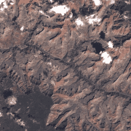
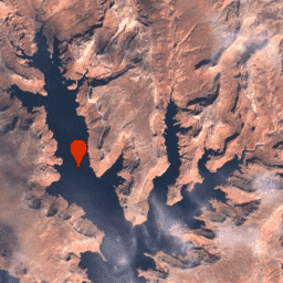
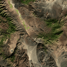
This content describes various Landsat Collection 2 datasets from USGS, including both Tier 1 and Tier 2 scenes for Landsats 1-5 (MSS/TM) and Landsats 7-9 (various instruments).
-
Tier 1 scenes represent the highest available data quality and are suitable for time-series analysis, often processed with Level-1 Precision Terrain (L1TP).
-
Tier 2 scenes are those that do not meet Tier 1 criteria and include Systematic terrain (L1GT) and Systematic (L1GS) processed data.
-
The datasets provide scaled, calibrated at-sensor radiance (DN values) or calibrated top-of-atmosphere (TOA) reflectance, with calibration details derived from image metadata and external references.
-
Some Landsat 7 and 8 datasets also include real-time (RT) data in addition to Tier 1 scenes.
-
USGS Landsat 1 MSS Collection 2 Tier 1 Raw Scenes
Landsat 1 MSS Collection 2 Tier 1 DN values, representing scaled, calibrated at-sensor radiance. Landsat scenes with the highest available data quality are placed into Tier 1 and are considered suitable for time-series processing analysis. Tier 1 includes Level-1 Precision Terrain (L1TP) processed data that … c2 global l1 landsat lm1 mss -
USGS Landsat 1 MSS Collection 2 Tier 2 Raw Scenes

Landsat 1 MSS Collection 2 Tier 2 DN values, representing scaled, calibrated at-sensor radiance. Scenes not meeting Tier 1 criteria during processing are assigned to Tier 2. This includes Systematic terrain (L1GT) and Systematic (L1GS) processed scenes, as well as any L1TP scenes that do … c2 global l1 landsat lm1 mss -
USGS Landsat 2 MSS Collection 2 Tier 1 Raw Scenes

Landsat 2 MSS Collection 2 Tier 1 DN values, representing scaled, calibrated at-sensor radiance. Landsat scenes with the highest available data quality are placed into Tier 1 and are considered suitable for time-series processing analysis. Tier 1 includes Level-1 Precision Terrain (L1TP) processed data that … c2 global l2 landsat lm2 mss -
USGS Landsat 2 MSS Collection 2 Tier 2 Raw Scenes

Landsat 2 MSS Collection 2 Tier 2 DN values, representing scaled, calibrated at-sensor radiance. Scenes not meeting Tier 1 criteria during processing are assigned to Tier 2. This includes Systematic terrain (L1GT) and Systematic (L1GS) processed scenes, as well as any L1TP scenes that do … c2 global l2 landsat lm2 mss -
USGS Landsat 3 MSS Collection 2 Tier 1 Raw Scenes

Landsat 3 MSS Collection 2 Tier 1 DN values, representing scaled, calibrated at-sensor radiance. Landsat scenes with the highest available data quality are placed into Tier 1 and are considered suitable for time-series processing analysis. Tier 1 includes Level-1 Precision Terrain (L1TP) processed data that … c2 global l3 landsat lm3 mss -
USGS Landsat 3 MSS Collection 2 Tier 2 Raw Scenes

Landsat 3 MSS Collection 2 Tier 2 DN values, representing scaled, calibrated at-sensor radiance. Scenes not meeting Tier 1 criteria during processing are assigned to Tier 2. This includes Systematic terrain (L1GT) and Systematic (L1GS) processed scenes, as well as any L1TP scenes that do … c2 global l3 landsat lm3 mss -
USGS Landsat 4 MSS Collection 2 Tier 1 Raw Scenes

Landsat 4 MSS Collection 2 Tier 1 DN values, representing scaled, calibrated at-sensor radiance. Landsat scenes with the highest available data quality are placed into Tier 1 and are considered suitable for time-series processing analysis. Tier 1 includes Level-1 Precision Terrain (L1TP) processed data that … c2 global l4 landsat lm4 mss -
USGS Landsat 4 MSS Collection 2 Tier 2 Raw Scenes

Landsat 4 MSS Collection 2 Tier 2 DN values, representing scaled, calibrated at-sensor radiance. Scenes not meeting Tier 1 criteria during processing are assigned to Tier 2. This includes Systematic terrain (L1GT) and Systematic (L1GS) processed scenes, as well as any L1TP scenes that do … c2 global l4 landsat lm4 mss -
USGS Landsat 4 TM Collection 2 Tier 1 Raw Scenes

Landsat 4 TM Collection 2 Tier 1 DN values, representing scaled, calibrated at-sensor radiance. Landsat scenes with the highest available data quality are placed into Tier 1 and are considered suitable for time-series processing analysis. Tier 1 includes Level-1 Precision Terrain (L1TP) processed data that … c2 global l4 landsat lt4 radiance -
USGS Landsat 4 TM Collection 2 Tier 2 Raw Scenes

Landsat 4 TM Collection 2 Tier 2 DN values, representing scaled, calibrated at-sensor radiance. Scenes not meeting Tier 1 criteria during processing are assigned to Tier 2. This includes Systematic terrain (L1GT) and Systematic (L1GS) processed scenes, as well as any L1TP scenes that do … c2 global l4 landsat lt4 radiance -
USGS Landsat 5 MSS Collection 2 Tier 1 Raw Scenes

Landsat 5 MSS Collection 2 Tier 1 DN values, representing scaled, calibrated at-sensor radiance. Landsat scenes with the highest available data quality are placed into Tier 1 and are considered suitable for time-series processing analysis. Tier 1 includes Level-1 Precision Terrain (L1TP) processed data that … c2 global l5 landsat lm5 mss -
USGS Landsat 5 MSS Collection 2 Tier 2 Raw Scenes

Landsat 5 MSS Collection 2 Tier 2 DN values, representing scaled, calibrated at-sensor radiance. Scenes not meeting Tier 1 criteria during processing are assigned to Tier 2. This includes Systematic terrain (L1GT) and Systematic (L1GS) processed scenes, as well as any L1TP scenes that do … c2 global l5 landsat lm5 mss -
USGS Landsat 5 TM Collection 2 Tier 1 Raw Scenes

Landsat 5 TM Collection 2 Tier 1 DN values, representing scaled, calibrated at-sensor radiance. Landsat scenes with the highest available data quality are placed into Tier 1 and are considered suitable for time-series processing analysis. Tier 1 includes Level-1 Precision Terrain (L1TP) processed data that … c2 global l5 landsat lt5 radiance -
USGS Landsat 5 TM Collection 2 Tier 2 Raw Scenes

Landsat 5 TM Collection 2 Tier 2 DN values, representing scaled, calibrated at-sensor radiance. Scenes not meeting Tier 1 criteria during processing are assigned to Tier 2. This includes Systematic terrain (L1GT) and Systematic (L1GS) processed scenes, as well as any L1TP scenes that do … c2 global l5 landsat lt5 radiance -
USGS Landsat 7 Collection 2 Tier 1 Raw Scenes

Landsat 7 Collection 2 Tier 1 DN values, representing scaled, calibrated at-sensor radiance. Landsat scenes with the highest available data quality are placed into Tier 1 and are considered suitable for time-series processing analysis. Tier 1 includes Level-1 Precision Terrain (L1TP) processed data that have … c2 etm global l7 landsat le7 -
USGS Landsat 7 Collection 2 Tier 1 TOA Reflectance

Landsat 7 Collection 2 Tier 1 calibrated top-of-atmosphere (TOA) reflectance. Calibration coefficients are extracted from the image metadata. See Chander et al. (2009) for details on the TOA computation. Note that Landsat 7's orbit has been drifting to an earlier acquisition time since 2017. c2 global landsat satellite-imagery toa usgs -
USGS Landsat 7 Collection 2 Tier 1 and Real-Time data Raw Scenes

Landsat 7 Collection 2 Tier 1 and Real-Time data DN values, representing scaled, calibrated at-sensor radiance. Landsat scenes with the highest available data quality are placed into Tier 1 and are considered suitable for time-series processing analysis. Tier 1 includes Level-1 Precision Terrain (L1TP) processed … c2 etm global l7 landsat le7 -
USGS Landsat 7 Collection 2 Tier 1 and Real-Time data TOA Reflectance
Landsat 7 Collection 2 Tier 1 and Real-Time data calibrated top-of-atmosphere (TOA) reflectance. Calibration coefficients are extracted from the image metadata. See Chander et al. (2009) for details on the TOA computation. Note that Landsat 7's orbit has been drifting to an earlier acquisition time … c2 global landsat satellite-imagery toa usgs -
USGS Landsat 7 Collection 2 Tier 2 Raw Scenes

Landsat 7 Collection 2 Tier 2 DN values, representing scaled, calibrated at-sensor radiance. Scenes not meeting Tier 1 criteria during processing are assigned to Tier 2. This includes Systematic terrain (L1GT) and Systematic (L1GS) processed scenes, as well as any L1TP scenes that do not … c2 etm global l7 landsat le7 -
USGS Landsat 7 Collection 2 Tier 2 TOA Reflectance

Landsat 7 Collection 2 Tier 2 calibrated top-of-atmosphere (TOA) reflectance. Calibration coefficients are extracted from the image metadata. See Chander et al. (2009) for details on the TOA computation. Note that Landsat 7's orbit has been drifting to an earlier acquisition time since 2017. c2 global landsat satellite-imagery toa usgs -
USGS Landsat 8 Collection 2 Tier 1 Raw Scenes

Landsat 8 Collection 2 Tier 1 DN values, representing scaled, calibrated at-sensor radiance. Landsat scenes with the highest available data quality are placed into Tier 1 and are considered suitable for time-series processing analysis. Tier 1 includes Level-1 Precision Terrain (L1TP) processed data that have … c2 global l8 landsat lc8 oli-tirs -
USGS Landsat 8 Collection 2 Tier 1 TOA Reflectance

Landsat 8 Collection 2 Tier 1 calibrated top-of-atmosphere (TOA) reflectance. Calibration coefficients are extracted from the image metadata. See Chander et al. (2009) for details on the TOA computation. Landsat scenes with the highest available data quality are placed into Tier 1 and are considered … c2 global landsat satellite-imagery toa usgs -
USGS Landsat 8 Collection 2 Tier 1 and Real-Time data Raw Scenes

Landsat 8 Collection 2 Tier 1 and Real-Time data DN values, representing scaled, calibrated at-sensor radiance. Landsat scenes with the highest available data quality are placed into Tier 1 and are considered suitable for time-series processing analysis. Tier 1 includes Level-1 Precision Terrain (L1TP) processed … c2 global l8 landsat lc8 nrt -
USGS Landsat 8 Collection 2 Tier 1 and Real-Time data TOA Reflectance

Landsat 8 Collection 2 Tier 1 and Real-Time data calibrated top-of-atmosphere (TOA) reflectance. Calibration coefficients are extracted from the image metadata. See Chander et al. (2009) for details on the TOA computation. Landsat scenes with the highest available data quality are placed into Tier 1 … c2 global l8 landsat lc8 satellite-imagery -
USGS Landsat 8 Collection 2 Tier 2 Raw Scenes

Landsat 8 Collection 2 Tier 2 DN values, representing scaled, calibrated at-sensor radiance. Scenes not meeting Tier 1 criteria during processing are assigned to Tier 2. This includes Systematic terrain (L1GT) and Systematic (L1GS) processed scenes, as well as any L1TP scenes that do not … c2 global l8 landsat lc8 oli-tirs -
USGS Landsat 8 Collection 2 Tier 2 TOA Reflectance

Landsat 8 Collection 2 Tier 2 calibrated top-of-atmosphere (TOA) reflectance. Calibration coefficients are extracted from the image metadata. See Chander et al. (2009) for details on the TOA computation. Scenes not meeting Tier 1 criteria during processing are assigned to Tier 2. This includes Systematic … c2 global landsat satellite-imagery toa usgs -
USGS Landsat 9 Collection 2 Tier 1 Raw Scenes

Landsat 9 Collection 2 Tier 1 DN values, representing scaled, calibrated at-sensor radiance. Landsat scenes with the highest available data quality are placed into Tier 1 and are considered suitable for time-series processing analysis. Tier 1 includes Level-1 Precision Terrain (L1TP) processed data that have … c2 global l9 landsat lc9 oli-tirs -
USGS Landsat 9 Collection 2 Tier 1 TOA Reflectance
Landsat 9 Collection 2 Tier 1 calibrated top-of-atmosphere (TOA) reflectance. Calibration coefficients are extracted from the image metadata. See Chander et al. (2009) for details on the TOA computation. Landsat scenes with the highest available data quality are placed into Tier 1 and are considered … c2 global landsat satellite-imagery toa usgs -
USGS Landsat 9 Collection 2 Tier 2 Raw Scenes

Landsat 9 Collection 2 Tier 2 DN values, representing scaled, calibrated at-sensor radiance. Scenes not meeting Tier 1 criteria during processing are assigned to Tier 2. This includes Systematic terrain (L1GT) and Systematic (L1GS) processed scenes, as well as any L1TP scenes that do not … c2 global l9 landsat lc9 oli-tirs -
USGS Landsat 9 Collection 2 Tier 2 TOA Reflectance

Landsat 9 Collection 2 Tier 2 calibrated top-of-atmosphere (TOA) reflectance. Calibration coefficients are extracted from the image metadata. See Chander et al. (2009) for details on the TOA computation. Scenes not meeting Tier 1 criteria during processing are assigned to Tier 2. This includes Systematic … c2 global l9 landsat lc9 satellite-imagery