Page Summary
-
The ESA WorldCereal classification system produces products within one month after the end of a growing season, using a global stratification into Agro-Ecological Zones.
-
WDOECM datasets represent geographically defined areas other than Protected Areas that conserve biodiversity and associated ecosystem functions.
-
The World Database on Protected Areas (WDPA) is a monthly updated source of information on protected areas managed by UNEP-WCMC.
-
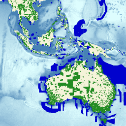
ESA WorldCereal AEZ v100
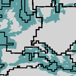
The European Space Agency (ESA) WorldCereal classification system aims for product generation within one month after the end of a particular growing season. Due to the dynamic nature of these growing seasons across the globe, a global stratification into Agro-Ecological Zones (AEZ) was performed based … agriculture boundaries crop esa global table -
WDKBA: World Database of Key Biodiversity Areas (KBAs) - March 2026
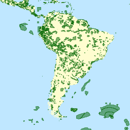
If you are interested in accessing the KBA dataset please complete the KBA data request form which will allow access directly in GEE once approved. Key Biodiversity Areas (KBAs) are 'sites contributing significantly to the global persistence of biodiversity’, in terrestrial, freshwater and marine ecosystems. … biodiversity boundaries ecosystems global iucn management -
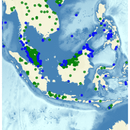
WDOECM: Other Effective Area-based Conservation Measures (points)

A geographically defined area other than a Protected Area, which is governed and managed in ways that achieve positive and sustained long-term outcomes for the in situ conservation of biodiversity, with associated ecosystem functions and services and where applicable, cultural, spiritual, socio-economic, and other locally … boundaries ecosystems iucn mpa oceans protected -
WDOECM: Other Effective Area-based Conservation Measures (polygons)
A geographically defined area other than a Protected Area, which is governed and managed in ways that achieve positive and sustained long-term outcomes for the in situ conservation of biodiversity, with associated ecosystem functions and services and where applicable, cultural, spiritual, socio-economic, and other locally … boundaries ecosystems iucn mpa oceans protected -
WDPA: World Database on Protected Areas (points)
The World Database on Protected Areas (WDPA) is the most up-to-date and complete source of information on protected areas, updated monthly with submissions from governments, non-governmental organizations, landowners, and communities. It is managed by the United Nations Environment Programme's World Conservation Monitoring Centre (UNEP-WCMC) with … boundaries ecosystems iucn mpa oceans protected -
WDPA: World Database on Protected Areas (polygons)
The World Database on Protected Areas (WDPA) is the most up-to-date and complete source of information on protected areas, updated monthly with submissions from governments, non-governmental organizations, landowners, and communities. It is managed by the United Nations Environment Programme's World Conservation Monitoring Centre (UNEP-WCMC) with … boundaries ecosystems iucn mpa oceans protected