Page Summary
-
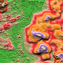
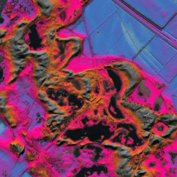
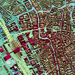
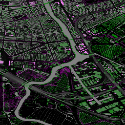
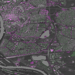
The AHN datasets provide detailed 0.5m Digital Elevation Models for the Netherlands.
-
Data was collected using LIDAR technology between 2007 and 2012 for earlier versions, and through laser technology from helicopters and aircraft for later versions (AHN3, AHN4).
-
Different versions are available, including interpolated, non-interpolated, and raw samples (which include features above ground level) for the older AHN DEMs.
-
The AHN3 and AHN4 datasets contain the Netherlands AHN 0.5m DSM with a vertical accuracy of 5 cm.
-
AHN Netherlands 0.5m DEM, Interpolated
The AHN DEM is a 0.5m DEM covering the Netherlands. It was generated from LIDAR data taken in the spring between 2007 and 2012. It contains ground level samples with all other items above ground (such as buildings, bridges, trees etc.) removed. This version is … ahn dem elevation elevation-topography geophysical lidar -
AHN Netherlands 0.5m DEM, Non-Interpolated
The AHN DEM is a 0.5m DEM covering the Netherlands. It was generated from LIDAR data taken in the spring between 2007 and 2012. It contains ground level samples with all other items above ground (such as buildings, bridges, trees etc.) removed. This version is … ahn dem elevation elevation-topography geophysical lidar -
AHN Netherlands 0.5m DEM, Raw Samples
The AHN DEM is a 0.5m DEM covering the Netherlands. It was generated from LIDAR data taken in the spring between 2007 and 2012. This version contains both ground level samples and items above ground level (such as buildings, bridges, trees etc). The point cloud … ahn dem elevation elevation-topography geophysical lidar -
AHN3: Netherlands AHN 0.5m
The Actueel Hoogtebestand Nederland (AHN) is a dataset with detailed and precise elevation data for the whole of the Netherlands. Elevation information was collected from helicopters and aircraft using laser technology with vertical accuracy of 5 cm. AHN3 Dataset contains the Netherlands AHN 0.5m DSM … ahn dem elevation elevation-topography geophysical lidar -
AHN4: Netherlands AHN 0.5m
The Actueel Hoogtebestand Nederland (AHN) is a dataset with detailed and precise elevation data for the whole of the Netherlands. Elevation information was collected from helicopters and aircraft using laser technology with vertical accuracy of 5 cm. AHN4 Dataset contains the Netherlands AHN 0.5m DSM … ahn dem elevation elevation-topography geophysical lidar