美国国家科学基金会的国家生态观测网络 (NEON) 是由 Battelle 运营的大陆级观测设施,旨在收集长期开放获取的生态数据,以便更好地了解美国生态系统的变化情况。
除了原位数据产品外,NEON 还通过高分辨率机载遥感技术,在美国和波多黎各的 81 个陆地和水生野外站点提供重复数据,用于生态研究和监测。
-
NEON 冠层高度模型 (CHM)

冠层顶部相对于裸地的海拔高度(冠层高度模型;CHM)。CHM 源自 NEON LiDAR 点云,通过在 LiDAR 调查的整个空间域内创建连续的冠层高度估计值表面来生成。… 机载 冠层 森林 森林生物质 高分辨率 激光雷达 -
NEON 冠层氮含量 (CNC)
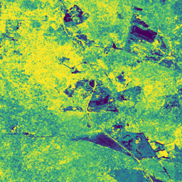
模型化的冠层氮浓度,根据 NEON 植物叶面化学观测结果进行校准,并根据从 NEON 成像光谱仪 (NIS) 获得的 L1 表面方向反射率进行预测。波段包括:1) 冠层氮百分比、2) 冠层氮模型不确定性、3) 针叶与非针叶模型的分类结果,以及… 机载 冠层 森林 高分辨率 高光谱 neon -
NEON 数字高程模型 (DEM)
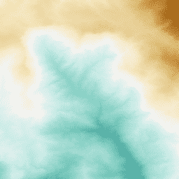
根据 NEON LiDAR 数据得出的地表 (DSM) 和地形 (DTM) 数字模型。DSM:地表特征(包含植被和人造结构的地形信息)。DTM:裸地高程(已移除植被和人造结构的地面地形信息)。图片以米为单位显示了平均海平面以上的… 机载 数字高程模型 海拔地形 森林 高分辨率 激光雷达 -
NEON RGB 相机影像

使用最近邻重采样方法将高分辨率红绿蓝 (RGB) 正射校正相机图像镶嵌并输出到固定的均匀空间网格上;空间分辨率为 0.1 米。数码相机是 NEON 机载观测平台 (AOP) 上的一套仪器的一部分,该平台还包括… airborne forest highres neon neon-prod-earthengine orthophoto -
NEON 表面双向反射率

NEON AOP 地表双向反射率是一种高光谱 VSWIR(可见光到短波红外)数据产品,包含 426 个波段,波长范围约为 380 nm 至 2510 nm。反射率按 10000 的系数进行缩放。将 1340-1445 nm 和 1790-1955 nm 之间的波长设置为… airborne forest highres hyperspectral neon neon-prod-earthengine -
NEON 地表方向性反射率

NEON AOP 地表定向反射率是一种高光谱 VSWIR(可见光到短波红外)数据产品,包含 426 个波段,波长范围约为 380 nm 到 2510 nm。反射率按 10000 的系数进行缩放。将 1340-1445 nm 和 1790-1955 nm 之间的波长设置为… 机载 森林 高光谱 neon neon-prod-earthengine publisher-dataset