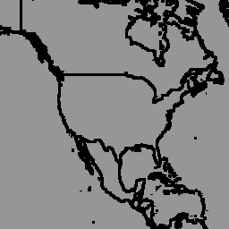
geoBoundaries Global Database of Political Administrative Boundaries Database は、世界中のすべての国境(州、郡など)に関するオンラインのオープン ライセンス リソースです。現在、国連加盟国 195 か国すべて、グリーンランド、台湾、ニウエ、コソボを含む合計 199 のエンティティが追跡されています。
geoBoundaries Global Database of Political Administrative Boundaries Database は、世界中のすべての国境(州、郡など)に関するオンラインのオープン ライセンス リソースです。現在、国連加盟国 195 か国すべて、グリーンランド、台湾、ニウエ、コソボを含む、合計 199 のエンティティが追跡されています。包括的な世界の行政区分(CGAZ)は、…
[[["わかりやすい","easyToUnderstand","thumb-up"],["問題の解決に役立った","solvedMyProblem","thumb-up"],["その他","otherUp","thumb-up"]],[["必要な情報がない","missingTheInformationINeed","thumb-down"],["複雑すぎる / 手順が多すぎる","tooComplicatedTooManySteps","thumb-down"],["最新ではない","outOfDate","thumb-down"],["翻訳に関する問題","translationIssue","thumb-down"],["サンプル / コードに問題がある","samplesCodeIssue","thumb-down"],["その他","otherDown","thumb-down"]],[],[],["The dataset provides country-level (ADM0) political administrative boundaries from the geoBoundaries Global Database, version 6.0.0, last updated on 2023-09-13. It covers 199 entities, including all UN member states, with disputed areas resolved using US Department of State definitions. Data can be accessed using Earth Engine snippets and visualized in the code editor, utilizing `ee.FeatureCollection` and `ui.Map.FeatureViewLayer`. The data is provided under the CC BY 4.0 license, supporting diverse usage.\n"]]