- 데이터 세트 제공
- 2000-02-11T00:00:00Z–2000-02-22T00:00:00Z
- 데이터 세트 출처
- NASA / USGS / JPL-Caltech
- 태그
설명
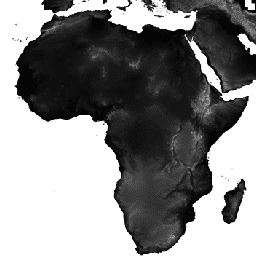
셔틀 레이더 지형 임무 (SRTM, Farr et al. 2007 참고) 디지털 고도 데이터는 전 세계에 가까운 규모로 디지털 고도 모델을 획득한 국제 연구 노력입니다. 이 SRTM V3 제품 (SRTM Plus)은 NASA JPL에서 1초 (약 30m) 해상도로 제공합니다.
이 데이터 세트는 오픈소스 데이터(ASTER GDEM2, GMTED2010, NED)를 사용하여 무효값 채우기 프로세스를 거쳤습니다. 무효값이 포함되어 있거나 상업적 소스로 무효값이 채워진 다른 버전과는 다릅니다. 다양한 버전에 대한 자세한 내용은 SRTM 빠른 가이드를 참고하세요.
문서:
대역
대역
픽셀 크기: 30미터 (모든 밴드)
| 이름 | 단위 | 최소 | 최대 | 픽셀 크기 | 설명 |
|---|---|---|---|---|---|
elevation |
m | -10* | 6500* | 30m | 고도 |
이용약관
이용약관
별도로 명시되지 않는 한 JPL 공개 웹사이트 (jpl.nasa.gov 주소로 끝나는 공개 사이트)의 이미지와 동영상은 사전 허가 없이 어떤 목적으로든 사용할 수 있습니다. 자세한 내용과 예외는 JPL 이미지 사용 정책 사이트를 참고하세요.
인용
Farr, T.G., Rosen, P.A., Caro, E., Crippen, R., Duren, R., Hensley, S., Kobrick, M., Paller, M., Rodriguez, E., Roth, L., Seal, D., Shaffer, S., Shimada, J., Umland, J., Werner, M., Oskin, M., Burbank, D., and Alsdorf, D.E., 2007, The shuttle radar topography mission: Reviews of Geophysics, v. 45, no. 2, RG2004, at https://doi.org/10.1029/2005RG000183.
Earth Engine으로 탐색
코드 편집기(JavaScript)
var dataset = ee.Image('USGS/SRTMGL1_003');
var elevation = dataset.select('elevation');
var slope = ee.Terrain.slope(elevation);
Map.setCenter(-112.8598, 36.2841, 10);
Map.addLayer(slope, {min: 0, max: 60}, 'slope');
import ee
import geemap.core as geemap
Colab(Python)
dataset = ee.Image('USGS/SRTMGL1_003')
elevation = dataset.select('elevation')
slope = ee.Terrain.slope(elevation)

m = geemap.Map()
m.set_center(-112.8598, 36.2841, 10)
m.add_layer(slope, {'min': 0, 'max': 60}, 'slope')
m