Page Summary
-
The Suomi NPP VIIRS VNP43IA1 product provides kernel weights at 500m resolution for modeling Earth's surface anisotropic effects.
-
This product is generated daily using 16 days of VIIRS data and offers three spectrally dependent kernel weights.
-
VNP43 data products are designed to ensure continuity with NASA's MODIS BRDF/Albedo data product suite.
-
The dataset is available from 2012-01-17 to 2024-06-09 with a daily cadence.
-
Data are freely accessible from LP DAAC NASA, with a request to cite the datasets when used in publications.
- Dataset Availability
- 2012-01-17T00:00:00Z–2024-06-09T00:00:00Z
- Dataset Producer
- NASA LP DAAC at the USGS EROS Center
- Cadence
- 1 Day
- Tags
Description
The Suomi National Polar-Orbiting Partnership (Suomi NPP) NASA Visible Infrared Imaging Radiometer Suite (VIIRS) Bidirectional Reflectance Distribution Function (BRDF) and Albedo Model Parameters (VNP43IA1) Version 1 product provides kernel weights (parameters) at 500 resolution. The VNP43IA1 product is produced daily using 16 days of VIIRS data, temporally weighted to the ninth day, which is reflected in the file name. The VNP43IA1 product provides three spectrally dependent kernel weights, also known as model parameters: isotropic (fiso), volumetric (fvol), and geometric (fgeo), which can be used to model anisotropic effects of the Earth's surface. All VNP43 data products are designed to promote the continuity of NASA's Moderate Resolution Imaging Spectroradiometer (MODIS) BRDF/Albedo data product suite.
Documentation:
Bands
Bands
Pixel size: 500 meters (all bands)
| Name | Pixel Size | Description |
|---|---|---|
BRDF_Albedo_Band_Mandatory_Quality_I1 |
500 meters | BRDF/Albedo mandatory quality for band I1 |
BRDF_Albedo_Band_Mandatory_Quality_I2 |
500 meters | BRDF/Albedo mandatory quality for band I2 |
BRDF_Albedo_Band_Mandatory_Quality_I3 |
500 meters | BRDF/Albedo mandatory quality for band I3 |
BRDF_Albedo_Parameters_fiso_I1 |
500 meters | Isotropic parameter for band I1 |
BRDF_Albedo_Parameters_fvol_I1 |
500 meters | Volumetric parameter for band I1 |
BRDF_Albedo_Parameters_fgeo_I1 |
500 meters | Geometric parameter for band I1 |
BRDF_Albedo_Parameters_fiso_I2 |
500 meters | Isotropic parameter for band I2 |
BRDF_Albedo_Parameters_fvol_I2 |
500 meters | Volumetric parameter for band I2 |
BRDF_Albedo_Parameters_fgeo_I2 |
500 meters | Geometric parameter for band I2 |
BRDF_Albedo_Parameters_fiso_I3 |
500 meters | Isotropic parameter for band I3 |
BRDF_Albedo_Parameters_fvol_I3 |
500 meters | Volumetric parameter for band I3 |
BRDF_Albedo_Parameters_fgeo_I3 |
500 meters | Geometric parameter for band I3 |
BRDF_Albedo_Band_Mandatory_Quality_I1 Class Table
| Value | Color | Description |
|---|---|---|
| 0 | None | Full BRDF inversions |
| 1 | None | Magnitude BRDF inversions |
BRDF_Albedo_Band_Mandatory_Quality_I2 Class Table
| Value | Color | Description |
|---|---|---|
| 0 | None | Full BRDF inversions |
| 1 | None | Magnitude BRDF inversions |
BRDF_Albedo_Band_Mandatory_Quality_I3 Class Table
| Value | Color | Description |
|---|---|---|
| 0 | None | Full BRDF inversions |
| 1 | None | Magnitude BRDF inversions |
Terms of Use
Terms of Use
LP DAAC NASA data are freely accessible; however, when an author publishes these data or works based on the data, it is requested that the author cite the datasets within the text of the publication and include a reference to them in the reference list.
Citations
Please visit LP DAAC 'Citing Our Data' page for information on citing LP DAAC datasets.
DOIs
Explore with Earth Engine
Code Editor (JavaScript)
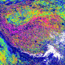
var dataset = ee.ImageCollection('NOAA/VIIRS/001/VNP43IA1')
                .filter(ee.Filter.date('2017-03-10', '2017-03-11'));

var visualization = {
  bands: ['BRDF_Albedo_Parameters_fiso_I1'],
  min: 0,
  max: 1,
  palette: [
    '000080','0000d9','4000ff','8000ff','0080ff','00ffff',
    '00ff80','80ff00','daff00','ffff00','fff500','FFda00',
    'ffb000','ffa400','ff4f00','ff2500','ff0a00','ff00ff',
  ]
};

Map.setCenter(89, 58, 3);

Map.addLayer(dataset, visualization, 'Isotropic parameter for band I1');