Page Summary
-
The GIMMS NDVI dataset, version NDVI3g, is generated from NOAA's AVHRR sensors and provides global NDVI data on a 1/12-degree grid from 1981 to 2013.
-
The dataset includes 'ndvi' and 'qa' bands with a pixel size of 9277 meters.
-
This dataset is in the public domain and available without restriction on use and distribution.
- Dataset Availability
- 1981-07-01T00:00:00Z–2013-12-16T00:00:00Z
- Dataset Producer
- NASA/NOAA
- Cadence
- 15 Days
- Tags
Description
GIMMS NDVI is generated from several NOAA's AVHRR sensors for a global 1/12-degree lat/lon grid. The latest version of the GIMMS NDVI dataset is named NDVI3g (third generation GIMMS NDVI from AVHRR sensors).
Bands
Bands
Pixel size: 9277 meters (all bands)
| Name | Min | Max | Pixel Size | Description | |||||||||||||||||||||||||||||||||||||||||||||||||||||||||||||||||||||||||||||||||||||||||||||||
|---|---|---|---|---|---|---|---|---|---|---|---|---|---|---|---|---|---|---|---|---|---|---|---|---|---|---|---|---|---|---|---|---|---|---|---|---|---|---|---|---|---|---|---|---|---|---|---|---|---|---|---|---|---|---|---|---|---|---|---|---|---|---|---|---|---|---|---|---|---|---|---|---|---|---|---|---|---|---|---|---|---|---|---|---|---|---|---|---|---|---|---|---|---|---|---|---|---|---|---|
ndvi |
-1 | 1 | 9277 meters | NDVI |
|||||||||||||||||||||||||||||||||||||||||||||||||||||||||||||||||||||||||||||||||||||||||||||||
qa |
9277 meters | QA flag |
|||||||||||||||||||||||||||||||||||||||||||||||||||||||||||||||||||||||||||||||||||||||||||||||||
Terms of Use
Terms of Use
This dataset is in the public domain and is available without restriction on use and distribution. See NASA's Earth Science Data & Information Policy for additional information.
Explore with Earth Engine
Code Editor (JavaScript)
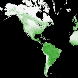
var dataset = ee.ImageCollection('NASA/GIMMS/3GV0')
                  .filter(ee.Filter.date('2013-06-01', '2013-12-31'));
var ndvi = dataset.select('ndvi');
var ndviVis = {
  min: -1.0,
  max: 1.0,
  palette: ['000000', 'f5f5f5', '119701'],
};
Map.setCenter(-88.6, 26.4, 1);
Map.addLayer(ndvi, ndviVis, 'NDVI');