Page Summary
-
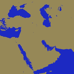
The Global Water Mask dataset provides a global map of surface water at 250m resolution, circa 2000-2002, created by combining SWBD and MODIS 250m data.
-
This dataset is designed for use in processing and masking out water in raster data products.
-
It includes bands for 'water_mask' indicating land or water and 'water_mask_qa' showing the data source for water pixels.
-
MODIS data and products from LP DAAC have no restrictions on subsequent use, sale, or redistribution.
- Dataset Availability
- 2000-02-24T00:00:00Z–2000-02-24T00:00:00Z
- Dataset Producer
- NASA LP DAAC at the USGS EROS Center
- Tags
Description
The Global Water Mask uses the SWBD (SRTM Water Body Data) in combination with MODIS 250m data to create a complete global map of surface water at 250m spatial resolution, circa 2000-2002. This dataset is intended for use in processing of raster data and for masking out water in final raster data products.
Bands
Bands
Pixel size: 250 meters (all bands)
| Name | Pixel Size | Description | |||||||||||||||||||||||||||||||||||||||||||||||||||||||||||||||||||||||||||||||||||||||||||||||||
|---|---|---|---|---|---|---|---|---|---|---|---|---|---|---|---|---|---|---|---|---|---|---|---|---|---|---|---|---|---|---|---|---|---|---|---|---|---|---|---|---|---|---|---|---|---|---|---|---|---|---|---|---|---|---|---|---|---|---|---|---|---|---|---|---|---|---|---|---|---|---|---|---|---|---|---|---|---|---|---|---|---|---|---|---|---|---|---|---|---|---|---|---|---|---|---|---|---|---|---|
water_mask |
250 meters | Land-water mask |
|||||||||||||||||||||||||||||||||||||||||||||||||||||||||||||||||||||||||||||||||||||||||||||||||
water_mask_qa |
250 meters | Shows which data source provided the water pixel. |
|||||||||||||||||||||||||||||||||||||||||||||||||||||||||||||||||||||||||||||||||||||||||||||||||
Terms of Use
Terms of Use
MODIS data and products acquired through the LP DAAC have no restrictions on subsequent use, sale, or redistribution.
Citations
Please visit LP DAAC 'Citing Our Data' page for information on citing LP DAAC datasets.
Explore with Earth Engine
Code Editor (JavaScript)
var dataset = ee.Image('MODIS/MOD44W/MOD44W_005_2000_02_24');
var waterMask = dataset.select('water_mask');
var waterMaskVis = {
  min: 0.0,
  max: 1,
};
Map.setCenter(6.746, 46.529, 2);
Map.addLayer(waterMask, waterMaskVis, 'Water Mask');