Page Summary
-
This dataset contains global daily snow cover, snow albedo, fractional snow cover, and quality assessment data at 500m resolution.
-
The snow cover data is derived using a snow mapping algorithm based on the Normalized Difference Snow Index (NDSI).
-
The dataset is available from February 24, 2000 to December 26, 2016.
-
This dataset has been superseded by MODIS/061/MOD10A1.
- Dataset Availability
- 2000-02-24T00:00:00Z–2016-12-26T00:00:00Z
- Dataset Producer
- NSIDC
- Cadence
- 1 Day
- Tags
Description
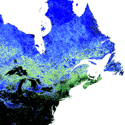
The MOD10A1 V5 Snow Cover Daily Global 500m product contains snow cover, snow albedo, fractional snow cover, and quality assessment (QA) data. Snow cover data are based on a snow mapping algorithm that employs a Normalized Difference Snow Index (NDSI) and other criteria tests.
Bands
Bands
Pixel size: 500 meters (all bands)
| Name | Min | Max | Pixel Size | Description | |||||||||||||||||||||||||||||||||||||||||||||||||||||||||||||||||||||||||||||||||||||||||||||||
|---|---|---|---|---|---|---|---|---|---|---|---|---|---|---|---|---|---|---|---|---|---|---|---|---|---|---|---|---|---|---|---|---|---|---|---|---|---|---|---|---|---|---|---|---|---|---|---|---|---|---|---|---|---|---|---|---|---|---|---|---|---|---|---|---|---|---|---|---|---|---|---|---|---|---|---|---|---|---|---|---|---|---|---|---|---|---|---|---|---|---|---|---|---|---|---|---|---|---|---|
Snow_Cover_Daily_Tile |
500 meters | NDSI snow cover plus other results. This value is computed for MOD10_L2 and retrieved when the observation of the day is selected. Possible values are: 0-100 (NDSI snow cover). |
|||||||||||||||||||||||||||||||||||||||||||||||||||||||||||||||||||||||||||||||||||||||||||||||||
Snow_Spatial_QA |
500 meters | A basic estimate of the quality of the algorithm result. This value is computed for MOD10_L2 and retrieved with the corresponding observation of the day. |
|||||||||||||||||||||||||||||||||||||||||||||||||||||||||||||||||||||||||||||||||||||||||||||||||
Snow_Albedo_Daily_Tile |
1 | 254 | 500 meters | Snow albedo percentage plus other results. |
|||||||||||||||||||||||||||||||||||||||||||||||||||||||||||||||||||||||||||||||||||||||||||||||
Fractional_Snow_Cover |
0 | 254 | 500 meters | Snow cover percentage plus other results. |
|||||||||||||||||||||||||||||||||||||||||||||||||||||||||||||||||||||||||||||||||||||||||||||||
Terms of Use
Terms of Use
You may download and use photographs, imagery, or text from the NSIDC web site, unless limitations for its use are specifically stated. For more information on usage and citing NSIDC datasets, please visit the NSIDC 'Use and Copyright' page.
Citations
Hall, D. K., V. V. Salomonson, and G. A. Riggs. 2006. MODIS/Terra Snow Cover Daily L3 Global 500m Grid. Version 5. Boulder, Colorado USA: NASA National Snow and Ice Data Center Distributed Active Archive Center.
DOIs
Explore with Earth Engine
Code Editor (JavaScript)
var dataset = ee.ImageCollection('MODIS/MOD10A1')
    .filterDate('2015-01-01', '2016-01-01');

var visualization = {
  bands: ['Snow_Cover_Daily_Tile'],
  min: 0.0,
  max: 100.0,
  palette: ['black', '0dffff', '0524ff', 'ffffff']
};

Map.setCenter(-41.13, 76.35, 3);

Map.addLayer(dataset, visualization, 'Snow Cover');