Page Summary
-
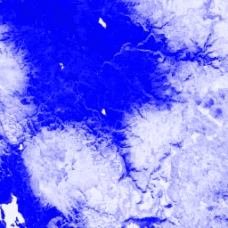
The Normalized Difference Snow Index (NDSI) is used to identify snow based on its reflectance in the visible and mid-IR spectrum.
-
NDSI is calculated using Green and Mid-IR bands and ranges from -1.0 to 1.0.
-
This dataset is available daily from 2000-02-24 to 2023-02-17 and has no restrictions on use, sale, or redistribution.
- Dataset Availability
- 2000-02-24T00:00:00Z–2023-02-17T00:00:00Z
- Dataset Producer
- Cadence
- 1 Day
- Tags
Description
The Normalized Difference Snow Index is used to identify snow, based on its characteristically higher reflectance in the visible portion of the spectrum compared to the mid-IR. NDSI is computed using the Green and Mid-IR bands, and has a range of -1.0 to 1.0. See Riggs et al. (1994) for details. This product is generated from the MODIS/006/MOD09GA surface reflectance composites.
Bands
Bands
Pixel size: 463.313 meters (all bands)
| Name | Pixel Size | Description |
|---|---|---|
NDSI |
463.313 meters | Normalized Difference Snow Index |
Terms of Use
Terms of Use
MODIS data and products acquired through the LP DAAC have no restrictions on subsequent use, sale, or redistribution.
Explore with Earth Engine
Code Editor (JavaScript)
var dataset = ee.ImageCollection('MODIS/MOD09GA_006_NDSI')
                  .filter(ee.Filter.date('2018-04-01', '2018-06-01'));
var colorized = dataset.select('NDSI');
var colorizedVis = {
  palette: ['000088', '0000ff', '8888ff', 'ffffff'],
};
Map.setCenter(-7.03125, 31.0529339857, 2);
Map.addLayer(colorized, colorizedVis, 'Colorized');