- Phạm vi cung cấp tập dữ liệu
- 2002-07-04T00:00:00Z–2026-01-01T00:00:00Z
- Nhà cung cấp tập dữ liệu
- NASA LP DAAC tại Trung tâm EROS của USGS
- Tần suất
- 8 ngày
- Thẻ
Mô tả
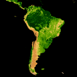
Sản phẩm MYD15A2H V6.1 MODIS kết hợp Chỉ số diện tích lá (LAI) và Tỷ lệ bức xạ quang hợp (FPAR) là một tập dữ liệu tổng hợp 8 ngày ở độ phân giải 500 m. Thuật toán này sẽ chọn pixel "tốt nhất" có sẵn trong tất cả các lần thu thập dữ liệu của cảm biến Aqua trong khoảng thời gian 8 ngày.
Tài liệu:
Dải
Kích thước pixel
500 mét
Dải
| Tên | Đơn vị | Tối thiểu | Tối đa | Tỷ lệ | Kích thước pixel | Mô tả |
|---|---|---|---|---|---|---|
Fpar_500m |
% | 0 | 100 | 0,01 | mét | Tỷ lệ bức xạ quang hợp |
Lai_500m |
Tỷ lệ diện tích | 0 | 100 | 0,1 | mét | Chỉ số diện tích lá |
FparLai_QC |
0 | 254 | mét | Chất lượng cho LAI và FPAR |
||
FparExtra_QC |
0 | 254 | mét | Chất lượng chi tiết bổ sung cho LAI và FPAR |
||
FparStdDev_500m |
% | 0 | 100 | 0,01 | mét | Độ lệch chuẩn của FPAR |
LaiStdDev_500m |
Tỷ lệ diện tích | 0 | 100 | 0,1 | mét | Độ lệch chuẩn của LAI |
Điều khoản sử dụng
Điều khoản sử dụng
Dữ liệu và sản phẩm MODIS thu được thông qua LP DAAC không có hạn chế đối với việc sử dụng, bán hoặc phân phối lại sau này.
Trích dẫn
Vui lòng truy cập vào trang "Trích dẫn dữ liệu của chúng tôi" của LP DAAC để biết thông tin về cách trích dẫn các tập dữ liệu của LP DAAC.
DOI
Khám phá bằng Earth Engine
Trình soạn thảo mã (JavaScript)
var collection = ee.ImageCollection('MODIS/061/MYD15A2H')
                  .filterDate('2019-01-01', '2019-10-01');

var colorizedVis = {
  min: 0,
  max: 100,
  palette: [
    'ffffff', 'ce7e45', 'df923d', 'f1b555', 'fcd163', '99b718', '74a901',
    '66a000', '529400', '3e8601', '207401', '056201', '004c00', '023b01',
    '012e01', '011d01', '011301'
  ],
};

Map.setCenter(-10.88, 40.94, 2);
Map.addLayer(collection.select('Lai_500m'), colorizedVis, 'Lai');
Map.addLayer(collection.select('Fpar_500m'), colorizedVis, 'Fpar');