Page Summary
-
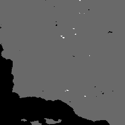
The MYD14A2 V6.1 dataset provides 8-day fire mask composites at 1km resolution.
-
The dataset includes a fire mask layer indicating fire confidence and a QA layer for pixel quality.
-
This dataset is available from 2002-07-04 to 2025-09-30 and is updated every 8 days.
-
MODIS data acquired through LP DAAC have no restrictions on subsequent use.
-
This dataset can be explored and analyzed using the Google Earth Engine platform.
- Dataset Availability
- 2002-07-04T00:00:00Z–2026-06-10T00:00:00Z
- Dataset Producer
- NASA LP DAAC at the USGS EROS Center
- Cadence
- 8 Days
- Tags
Description
The MYD14A2 V6.1 dataset provides 8-day fire mask composites at 1km resolution. It contains the maximum value of the individual pixel classes over the compositing period. Along with the fire mask, an associated quality information layer is also provided.
Documentation:
Bands
Bands
Pixel size: 1000 meters (all bands)
| Name | Pixel Size | Description | |||||||||||||||||||||||||||||||||||||||||||||||||||||||||||||||||||||||||||||||||||||||||||||||||
|---|---|---|---|---|---|---|---|---|---|---|---|---|---|---|---|---|---|---|---|---|---|---|---|---|---|---|---|---|---|---|---|---|---|---|---|---|---|---|---|---|---|---|---|---|---|---|---|---|---|---|---|---|---|---|---|---|---|---|---|---|---|---|---|---|---|---|---|---|---|---|---|---|---|---|---|---|---|---|---|---|---|---|---|---|---|---|---|---|---|---|---|---|---|---|---|---|---|---|---|
FireMask |
1000 meters | Confidence of fire |
|||||||||||||||||||||||||||||||||||||||||||||||||||||||||||||||||||||||||||||||||||||||||||||||||
QA |
1000 meters | Pixel quality indicators |
|||||||||||||||||||||||||||||||||||||||||||||||||||||||||||||||||||||||||||||||||||||||||||||||||
Terms of Use
Terms of Use
MODIS data and products acquired through the LP DAAC have no restrictions on subsequent use, sale, or redistribution.
Citations
Please visit LP DAAC 'Citing Our Data' page for information on citing LP DAAC datasets.
DOIs
Explore with Earth Engine
Code Editor (JavaScript)
var dataset = ee.ImageCollection('MODIS/061/MYD14A2')
                  .filter(ee.Filter.date('2018-01-01', '2018-05-01'));
var fireMask = dataset.select('FireMask');
var fireMaskVis = {
  min: 3.0,
  max: 8.0,
};
Map.setCenter(6.746, 46.529, 2);
Map.addLayer(fireMask, fireMaskVis, 'Fire Mask');