- Disponibilidad del conjunto de datos
- 1982-08-22T14:18:20Z–1993-11-18T14:54:14Z
- Productor del conjunto de datos
- USGS
- Etiquetas
Descripción
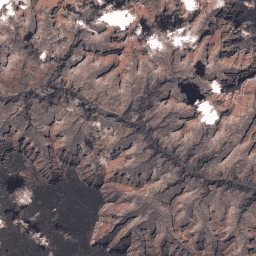
Son los valores de DN de la colección 1, nivel 2, del sensor TM de Landsat 4, que representan la radiancia escalada y calibrada en el sensor. Las escenas que no cumplen con los criterios del nivel 1 durante el procesamiento se asignan al nivel 2. Esto incluye las escenas procesadas de terreno sistemático (L1GT) y sistemático (L1GS), así como las escenas L1TP que no cumplen con las especificaciones de nivel 1 debido a una cobertura de nubes significativa, un control de tierra insuficiente y otros factores. Los usuarios interesados en las escenas de nivel 2 pueden analizar el RMSE y otras propiedades para determinar si son adecuadas para su uso en aplicaciones y estudios individuales. Obtén más información en los documentos del USGS.
Bandas
Resolución
30 metros
Bandas
| Nombre | Longitud de onda | Descripción | |||||||||||||||||||||||||||||||||||||||||||||||||||||||||||||||||||||||||||||||||||||||||||||||||
|---|---|---|---|---|---|---|---|---|---|---|---|---|---|---|---|---|---|---|---|---|---|---|---|---|---|---|---|---|---|---|---|---|---|---|---|---|---|---|---|---|---|---|---|---|---|---|---|---|---|---|---|---|---|---|---|---|---|---|---|---|---|---|---|---|---|---|---|---|---|---|---|---|---|---|---|---|---|---|---|---|---|---|---|---|---|---|---|---|---|---|---|---|---|---|---|---|---|---|---|
B1 |
0.45 a 0.52 µm | Azul |
|||||||||||||||||||||||||||||||||||||||||||||||||||||||||||||||||||||||||||||||||||||||||||||||||
B2 |
0.52 a 0.60 μm | Verde |
|||||||||||||||||||||||||||||||||||||||||||||||||||||||||||||||||||||||||||||||||||||||||||||||||
B3 |
0.63 a 0.69 μm | Rojo |
|||||||||||||||||||||||||||||||||||||||||||||||||||||||||||||||||||||||||||||||||||||||||||||||||
B4 |
0.76 a 0.90 μm | Infrarrojo cercano |
|||||||||||||||||||||||||||||||||||||||||||||||||||||||||||||||||||||||||||||||||||||||||||||||||
B5 |
1.55 a 1.75 μm | Infrarrojo de onda corta 1 |
|||||||||||||||||||||||||||||||||||||||||||||||||||||||||||||||||||||||||||||||||||||||||||||||||
B6 |
10.40 a 12.50 μm | Infrarrojo térmico 1: Se volvió a muestrear de 60 m a 30 m. |
|||||||||||||||||||||||||||||||||||||||||||||||||||||||||||||||||||||||||||||||||||||||||||||||||
B7 |
2.08 a 2.35 μm | Infrarrojo de onda corta 2 |
|||||||||||||||||||||||||||||||||||||||||||||||||||||||||||||||||||||||||||||||||||||||||||||||||
BQA |
Máscara de bits de QA de Landsat Collection 1 (consulta la página de QA de Landsat) |
||||||||||||||||||||||||||||||||||||||||||||||||||||||||||||||||||||||||||||||||||||||||||||||||||
Propiedades de imágenes
Propiedades de la imagen
| Nombre | Tipo | Descripción |
|---|---|---|
| CLOUD_COVER | DOBLE | Porcentaje de cobertura de nubes (0-100), -1 = no calculado. |
| CLOUD_COVER_LAND | DOBLE | Porcentaje de cobertura de nubes sobre la tierra (0-100), -1 = no calculado. |
| COLLECTION_CATEGORY | STRING | Es el nivel de la escena. (T1 o T2) |
| COLLECTION_NUMBER | DOUBLE | Número de la colección. |
| CORRECTION_BIAS_BAND_1 | STRING | Es el método interno de sesgo de calibración para la banda 1. |
| CORRECTION_BIAS_BAND_2 | STRING | Es el método interno de sesgo de calibración para la banda 2. |
| CORRECTION_BIAS_BAND_3 | STRING | Es el método interno de sesgo de calibración para la banda 3. |
| CORRECTION_BIAS_BAND_4 | STRING | Es el método interno de sesgo de calibración para la banda 4. |
| CORRECTION_BIAS_BAND_5 | STRING | Es el método interno de sesgo de calibración para la banda 5. |
| CORRECTION_BIAS_BAND_6 | STRING | Es el método interno de sesgo de calibración para la banda 6. |
| CORRECTION_BIAS_BAND_7 | STRING | Es el método interno de sesgo de calibración para la banda 7. |
| CORRECTION_GAIN_BAND_1 | STRING | Es el método interno de ganancia de calibración para la banda 1. |
| CORRECTION_GAIN_BAND_2 | STRING | Es el método interno de ganancia de calibración para la banda 2. |
| CORRECTION_GAIN_BAND_3 | STRING | Es el método interno de ganancia de calibración para la banda 3. |
| CORRECTION_GAIN_BAND_4 | STRING | Es el método interno de ganancia de calibración para la banda 4. |
| CORRECTION_GAIN_BAND_5 | STRING | Es el método interno de ganancia de calibración para la banda 5. |
| CORRECTION_GAIN_BAND_6 | STRING | Es el método interno de ganancia de calibración para la banda 6. |
| CORRECTION_GAIN_BAND_7 | STRING | Es el método interno de ganancia de calibración para la banda 7. |
| CPF_NAME | STRING | Es el nombre del archivo de parámetros de calibración. |
| DATA_CATEGORY | STRING | Es la categoría de datos actual asignada a los datos. Valores posibles: ("NOMINAL", "VALIDATION", "EXCHANGE", "TEST", "ENGINEERING") |
| DATA_TYPE | STRING | Es el identificador del tipo de datos. (L1T o L1G) |
| DATA_TYPE_L0RP | STRING | Es la cadena del identificador del tipo de datos que se usa para crear el producto L0RP. |
| DATE_ACQUIRED | STRING | Fecha de adquisición de la imagen. "AAAA-MM-DD" |
| DATUM | STRING | Es el datum que se usa en la creación de imágenes. |
| EARTH_SUN_DISTANCE | DOUBLE | Distancia entre la Tierra y el Sol en unidades astronómicas (AU). |
| ELEVATION_SOURCE | STRING | Es la fuente del modelo de elevación que se usa para los productos estándar corregidos por el terreno (L1T). |
| ELLIPSOID | STRING | Es el elipsoide que se usa en la creación de imágenes. |
| EPHEMERIS_TYPE | STRING | Es el tipo de datos de efemérides que se usa para realizar la corrección geométrica. (Definitiva o predictiva) |
| FILE_DATE | DOUBLE | Fecha del archivo en milisegundos desde la época. |
| GEOMETRIC_RMSE_MODEL | DOUBLE | Error cuadrático medio combinado (RMSE) de los residuos geométricos (metros) en las direcciones transversal y longitudinal a la trayectoria, medido en los GCP utilizados en la corrección de precisión geométrica. No está presente en los productos de L1G. |
| GEOMETRIC_RMSE_MODEL_X | DOUBLE | RMSE de los residuos geométricos en la dirección X (en metros) medidos en los GCP utilizados en la corrección de precisión geométrica. No está presente en los productos de L1G. |
| GEOMETRIC_RMSE_MODEL_Y | DOUBLE | RMSE de los residuos geométricos en la dirección Y (en metros) medidos en los GCP que se usan en la corrección de precisión geométrica. No está presente en los productos de L1G. |
| GEOMETRIC_RMSE_VERIFY | DOUBLE | RMSE de los residuos geométricos (píxeles) en las direcciones de línea y muestra medidos en el producto corregido por el terreno de forma independiente con GLS2000. |
| GEOMETRIC_RMSE_VERIFY_QUAD_LL | DOUBLE | RMSE de los residuos geométricos (píxeles) del cuadrante inferior izquierdo medidos en el producto corregido por el terreno de forma independiente con GLS2000. |
| GEOMETRIC_RMSE_VERIFY_QUAD_LR | DOUBLE | RMSE de los residuos geométricos (píxeles) del cuadrante inferior derecho medidos en el producto corregido por el terreno de forma independiente con GLS2000. |
| GEOMETRIC_RMSE_VERIFY_QUAD_UL | DOUBLE | RMSE de los residuos geométricos (píxeles) del cuadrante superior izquierdo medidos en el producto corregido por el terreno de forma independiente con GLS2000. |
| GEOMETRIC_RMSE_VERIFY_QUAD_UR | DOUBLE | RMSE de los residuos geométricos (píxeles) del cuadrante superior derecho medidos en el producto corregido por el terreno de forma independiente con GLS2000. |
| GRID_CELL_SIZE_REFLECTIVE | DOUBLE | Es el tamaño de la celda de cuadrícula que se usa para crear la imagen de la banda reflectiva. |
| GRID_CELL_SIZE_THERMAL | DOUBLE | Tamaño de la celda de la cuadrícula que se usa para crear la imagen de la banda térmica. |
| GROUND_CONTROL_POINTS_MODEL | DOUBLE | Es la cantidad de puntos de control terrestres utilizados. No se usa en los productos de L1GT. Valores: 0 a 999 (el 0 se usa para los productos L1T que utilizaron el perfeccionamiento multiescena). |
| GROUND_CONTROL_POINTS_VERIFY | DOUBLE | Es la cantidad de puntos de control terrestres que se usaron en la verificación del producto corregido por terreno. Valores: de -1 a 1615 (-1 = no disponible) |
| GROUND_CONTROL_POINTS_VERSION | DOUBLE | Es la cantidad de puntos de control terrestres que se usaron en la verificación del producto corregido por terreno. Valores: de -1 a 1615 (-1 = no disponible) |
| IMAGE_QUALITY | DOUBLE | Calidad de la imagen, 0 = peor, 9 = mejor, -1 = calidad no calculada |
| K1_CONSTANT_BAND_6 | DOUBLE | Constante de calibración K1 para la conversión de radiancia a temperatura de la banda 6. |
| K2_CONSTANT_BAND_6 | DOUBLE | Constante de calibración K2 para la conversión de radiancia a temperatura de la banda 6. |
| LANDSAT_PRODUCT_ID | STRING | Convención de nomenclatura de cada imagen de nivel 1 de la colección 1 de Landsat basada en parámetros de adquisición y procesamiento. Formato: LXSS_LLLL_PPPRRR_AAAAMMDD_aaaammdd_CC_TX
|
| LANDSAT_SCENE_ID | STRING | La convención de nombres previa a la recopilación de cada imagen se basa en los parámetros de adquisición. Esta era la convención de nomenclatura que se usaba antes de la Colección 1. Formato: LXSPPPRRRYYYYDDDGSIVV
|
| MAP_PROJECTION | STRING | Proyección que se usa para representar la superficie tridimensional de la Tierra para el producto de nivel 1. |
| MAP_PROJECTION_L0RA | STRING | Proyección del mapa L0RA aplicada de forma selectiva a los HDT según la ubicación geográfica. Se usa para los datos de archivo procesados. |
| ORIENTACIÓN | STRING | Es la orientación que se usó para crear la imagen. Valores: NOMINAL = Nominal Path, NORTH_UP = North Up, TRUE_NORTH = True North, USER = User |
| PROCESSING_SOFTWARE_VERSION | STRING | Nombre y versión del software de procesamiento que se usó para generar el producto de nivel 1. |
| RADIANCE_ADD_BAND_1 | DOUBLE | Factor de reescalado aditivo que se usa para convertir el DN calibrado en radiancia para la banda 1. |
| RADIANCE_ADD_BAND_2 | DOUBLE | Es el factor de reescalado aditivo que se usa para convertir el DN calibrado en radiancia para la banda 2. |
| RADIANCE_ADD_BAND_3 | DOUBLE | Es el factor de reescalado aditivo que se usa para convertir el DN calibrado en radiancia para la banda 3. |
| RADIANCE_ADD_BAND_4 | DOUBLE | Es el factor de reescalado aditivo que se usa para convertir el DN calibrado en radiancia para la banda 4. |
| RADIANCE_ADD_BAND_5 | DOUBLE | Es el factor de reescalado aditivo que se usa para convertir el DN calibrado en radiancia para la banda 5. |
| RADIANCE_ADD_BAND_6 | DOUBLE | Es el factor de reescalado aditivo que se usa para convertir el DN calibrado en radiancia para la banda 6. |
| RADIANCE_ADD_BAND_7 | DOUBLE | Es el factor de reescalado aditivo que se usa para convertir el DN calibrado en radiancia para la banda 7. |
| RADIANCE_MULT_BAND_1 | DOUBLE | Es el factor de cambio de escala multiplicativo que se usa para convertir el valor DN calibrado de la banda 1 en radiancia. |
| RADIANCE_MULT_BAND_2 | DOUBLE | Es el factor de reescalado multiplicativo que se usa para convertir los DN calibrados de la banda 2 en radiancia. |
| RADIANCE_MULT_BAND_3 | DOUBLE | Es el factor de reescalado multiplicativo que se usa para convertir los DN calibrados de la banda 3 en radiancia. |
| RADIANCE_MULT_BAND_4 | DOUBLE | Es el factor de cambio de escala multiplicativo que se usa para convertir los DN calibrados de la banda 4 en radiancia. |
| RADIANCE_MULT_BAND_5 | DOUBLE | Es el factor de cambio de escala multiplicativo que se usa para convertir los DN calibrados de la banda 5 en radiancia. |
| RADIANCE_MULT_BAND_6 | DOUBLE | Es el factor de reescalado multiplicativo que se usa para convertir los DN calibrados de la banda 6 en radiancia. |
| RADIANCE_MULT_BAND_7 | DOUBLE | Es el factor de reescalado multiplicativo que se usa para convertir el DN calibrado de la banda 7 en radiancia. |
| REFLECTANCE_ADD_BAND_1 | DOUBLE | Es el factor de reescalado aditivo que se usa para convertir el DN calibrado de la banda 1 en reflectancia. |
| REFLECTANCE_ADD_BAND_2 | DOUBLE | Es el factor de reescalado aditivo que se usa para convertir el DN calibrado de la banda 2 en reflectancia. |
| REFLECTANCE_ADD_BAND_3 | DOUBLE | Factor de reescalado aditivo que se usa para convertir el DN calibrado de la banda 3 en reflectancia. |
| REFLECTANCE_ADD_BAND_4 | DOUBLE | Es el factor de reescalado aditivo que se usa para convertir el DN calibrado de la banda 4 en reflectancia. |
| REFLECTANCE_ADD_BAND_5 | DOUBLE | Factor de reescalado aditivo que se usa para convertir el DN calibrado de la banda 5 en reflectancia. |
| REFLECTANCE_ADD_BAND_7 | DOUBLE | Es el factor multiplicativo que se usa para convertir los DN calibrados de la banda 7 en reflectancia. |
| REFLECTANCE_MULT_BAND_1 | DOUBLE | Es el factor multiplicativo que se usa para convertir los DN calibrados de la banda 1 en reflectancia. |
| REFLECTANCE_MULT_BAND_2 | DOUBLE | Es el factor multiplicativo que se usa para convertir los DN calibrados de la banda 2 en reflectancia. |
| REFLECTANCE_MULT_BAND_3 | DOUBLE | Es el factor multiplicativo que se usa para convertir los DN calibrados de la banda 3 en reflectancia. |
| REFLECTANCE_MULT_BAND_4 | DOUBLE | Es el factor multiplicativo que se usa para convertir los DN calibrados de la banda 4 en reflectancia. |
| REFLECTANCE_MULT_BAND_5 | DOUBLE | Es el factor multiplicativo que se usa para convertir el valor de DN calibrado de la banda 5 en reflectancia. |
| REFLECTANCE_MULT_BAND_7 | DOUBLE | Es el factor multiplicativo que se usa para convertir los DN calibrados de la banda 7 en reflectancia. |
| REFLECTIVE_LINES | DOUBLE | Cantidad de líneas de productos para las bandas reflectivas. |
| REFLECTIVE_SAMPLES | DOUBLE | Cantidad de muestras de productos para las bandas reflectivas. |
| REQUEST_ID | STRING | ID de solicitud, nnnyymmdd0000_0000
|
| RESAMPLING_OPTION | STRING | Opción de cambio de muestreo que se usó para crear la imagen. |
| SATURATION_BAND_1 | STRING | Es un indicador que señala si los píxeles de la banda 1 están saturados ("Y"/"N"). |
| SATURATION_BAND_2 | STRING | Es una marca que indica si los píxeles están saturados para la banda 2 (“Y”/“N”). |
| SATURATION_BAND_3 | STRING | Es un indicador que señala si los píxeles están saturados para la banda 3 (“Y”/“N”). |
| SATURATION_BAND_4 | STRING | Marca que indica los píxeles saturados para la banda 4 ("Y"/"N") |
| SATURATION_BAND_5 | STRING | Es una marca que indica si hay píxeles saturados para la banda 5 (“Y”/“N”). |
| SATURATION_BAND_6 | STRING | Marca que indica píxeles saturados para la banda 6 (“Y”/“N”) |
| SATURATION_BAND_7 | STRING | Marca que indica píxeles saturados para la banda 7 (“Y”/“N”) |
| SCENE_CENTER_TIME | STRING | Es la hora central de la escena de la imagen adquirida. HH:MM:SS.SSSSSSSZ
|
| SENSOR_ID | STRING | Sensor que se usa para capturar datos. |
| SENSOR_MODE | STRING | Modo operativo. Monitor de ángulo de escaneo (SAM) o BUMPER. |
| SPACECRAFT_ID | STRING | Identificación de la nave espacial. |
| STATION_ID | STRING | Estación terrestre o organización que recibió los datos. |
| SUN_AZIMUTH | DOUBLE | Ángulo azimutal del sol en grados para la ubicación del centro de la imagen en el momento de adquisición del centro de la imagen. |
| SUN_ELEVATION | DOUBLE | Ángulo de elevación del sol en grados para la ubicación del centro de la imagen en el momento de adquisición del centro de la imagen. |
| THERMAL_LINES | DOUBLE | Es la cantidad de líneas de productos para la banda térmica. |
| THERMAL_SAMPLES | DOUBLE | Es la cantidad de muestras de productos para la banda térmica. |
| UTM_ZONE | DOUBLE | Número de zona UTM que se usa en la proyección del mapa del producto. |
| WRS_PATH | DOUBLE | Número de ruta orbital del WRS (de 001 a 251). |
| WRS_ROW | DOUBLE | Fila de WRS del satélite Landsat (001-248). |
Condiciones de Uso
Condiciones de Uso
Los conjuntos de datos de Landsat son datos creados a nivel federal y, por lo tanto, son de dominio público y se pueden usar, transferir o reproducir sin restricciones de derechos de autor.
Se debe proporcionar el reconocimiento o crédito del USGS como fuente de datos, para lo cual se debe incluir una línea de texto de cita, como el ejemplo que se muestra a continuación.
(Nombre del producto, la imagen, la fotografía o el conjunto de datos) cortesía del Servicio Geológico de EE.UU.
Ejemplo: Imagen de Landsat-7 cortesía del Servicio Geológico de EE.UU.
Consulta la Guía del sistema de identidad visual del USGS para obtener más detalles sobre la cita y el reconocimiento adecuados de los productos del USGS.