- 利用可能なデータセットの期間
- 1984-01-01T00:00:00Z–2026-01-01T00:00:00Z
- データセット プロデューサー
- USGS
- ケイデンス
- 1 年
- タグ
説明
これらの Landsat Collection 2 Tier 1 Level 2 合成画像は、Tier 1 Level 2 のオルソ補正済みシーンから作成されています。
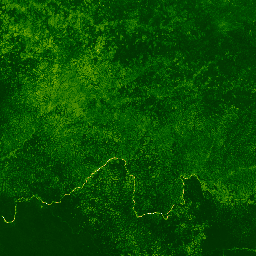
正規化植生指数は、各シーンの近赤外帯と赤色帯から(NIR - Red)/(NIR + Red)として生成され、値の範囲は -1.0 ~ 1.0 です。
これらのコンポジットは、各年間のすべてのシーンから作成されます。各年間の期間は、その年の 1 月 1 日から 12 月 31 日までです。各年のすべての画像が合成に含まれ、最新のピクセルが合成値になります。
注:
複合の作成に使用されるコードはこちらで確認できます。
WRS_ROW < 122 の昼間の画像のみが含まれます。
Landsat 7 の場合、軌道ドリフトのため、2017 年 1 月 1 日以降の画像は除外されます。
Landsat 8 の場合、ポインティングの問題により 2013 年 5 月 1 日より前の画像は除外されます。
注意: これらの複合はオンザフライで計算され、リクエストしているプロジェクトの EECU 使用量にカウントされます。
バンド
バンド
ピクセルサイズ: 30 メートル(すべてのバンド)
| 名前 | 最小 | 最大 | ピクセルサイズ | 説明 |
|---|---|---|---|---|
NDVI |
-1* | 1* | 30 メートル | 正規化植生指数 |
利用規約
利用規約
Landsat データセットは連邦政府が作成したデータであるため、パブリック ドメインに属し、著作権の制限なしで使用、転送、複製できます。
データソースとしての USGS の謝辞またはクレジットは、以下の例に示すようなテキスト引用の行を含めることで提供する必要があります。
(商品、画像、写真、データセットの名前)提供: 米国地質調査所
例: Landsat-7 画像(米国地質調査所提供)
USGS 製品の適切な引用と謝辞について詳しくは、USGS Visual Identity System Guidance をご覧ください。
Earth Engine で探索する
コードエディタ(JavaScript)
var dataset = ee.ImageCollection('LANDSAT/COMPOSITES/C02/T1_L2_ANNUAL_NDVI')
                  .filterDate('2017-01-01', '2017-12-31');
var colorized = dataset.select('NDVI');
var colorizedVis = {
  min: 0,
  max: 1,
  palette: [
    'ffffff', 'ce7e45', 'df923d', 'f1b555', 'fcd163', '99b718', '74a901',
    '66a000', '529400', '3e8601', '207401', '056201', '004c00', '023b01',
    '012e01', '011d01', '011301'
  ],
};
Map.setCenter(6.746, 46.529, 6);
Map.addLayer(colorized, colorizedVis, 'Colorized');